Cudillero Municipality
Located in Asturias, Principality of Asturias Coordinates: 43°33′41″ N 6°13′57″ W

- Population
- 5,691
- 5.7K
- Elevation
- 34 m
- above sea level
- Local time
- UTC+01:00
- Europe/Madrid · UTC+01:00
- Places inside
- 55
- listed under Cudillero Municipality
- Airports
- OVD Asturias Airport16 km
- LEN León Airport118 km
About Cudillero Municipality
Cudillero Municipality is a municipality. Location: Asturias, Principality of Asturias. Population: 5,691. Elevation: 34 m.
Cudillero (Asturian: Cuideiru) is a municipality in the Principality of Asturias, Spain. Nowadays, Cudillero's main economic activities are related to tourism, but it is also known for its fishing industry. A legend says that it was founded by the Vikings. In addition to Castilian some locals still speak a dialect called Pixueto. Cudillero is often described in the Spanish media as one of the country's most beautiful villages.
Source: Wikipedia · CC BY-SA 4.0
Photos of Cudillero Municipality
-

84nayuri · CC BY-SA 4.0 -

Wamba Wambez · CC BY-SA 3.0 -

Wamba Wambez · CC BY-SA 3.0 -

Robot8A · CC BY-SA 4.0 -

Einaz80 · CC BY-SA 4.0


Places bordering Cudillero Municipality
- Pravia
Population of Cudillero Municipality over time
| 2014 | 5,369 | |
|---|---|---|
| 2015 | 5,210 | |
| 2016 | 5,248 | |
| 2017 | 5,183 | |
| 2018 | 5,078 | |
| 2019 | 4,987 | |
| 2020 | 4,922 | |
| 2021 | 4,968 | |
| 2022 | 4,928 | |
| 2023 | 4,909 | |
| 2024 | 4,896 | |
| 2025 | 4,867 |
Censuses and official estimates; source: Wikidata.
Climate of Cudillero Municipality
Best months for sightseeingBest months for sightseeing: June–September.
This month · November
A wet month
Day 16° · Night 9° · Rain 118 mm
- Hottest month
- August (day 24°)
- Coldest month
- January (night 6°)
- Wettest month
- November (118 mm)
- Driest month
- July (47 mm)
Bars: average monthly low and high temperature. Below: precipitation. Monthly averages for 1970–2000 at about 18 km resolution, adjusted for elevation. Highlighted months are mild and relatively dry. Source: WorldClim 2.1 (CC BY 4.0).
Show values as a table
| Month | Jan | Feb | Mar | Apr | May | Jun | Jul | Aug | Sep | Oct | Nov | Dec |
|---|---|---|---|---|---|---|---|---|---|---|---|---|
| Average high (°C) | 13° | 14° | 15° | 16° | 18° | 21° | 23° | 24° | 22° | 19° | 16° | 14° |
| Average low (°C) | 6° | 6° | 7° | 8° | 11° | 13° | 15° | 16° | 14° | 12° | 9° | 7° |
| Precipitation (mm) | 106 | 93 | 86 | 110 | 92 | 54 | 47 | 49 | 64 | 114 | 118 | 114 |
Other places to visit in this season: June July August September
How to get to Cudillero Municipality
The nearest airport is Asturias Airport (OVD), 16 km to the east as the crow flies. The nearest large city is Oviedo, 39 km to the southeast.
Airports
- Asturias Airport (OVD) Ranón 16 kmeast
- León Airport (LEN) La Virgen del Camino 118 kmsoutheast
- A Coruña Airport (LCG) Culleredo 176 kmwest
Nearby large cities
- Oviedo Population: 220K 39 kmsoutheast
- Gijón Population: 271.8K 46 kmeast
- León Population: 124.8K 120 kmsoutheast
- A Coruña Population: 250.4K 176 kmwest
- Ourense Population: 105.2K 190 kmsouthwest
Straight-line distances; road distances are longer. Airport data: OurAirports.
Day trips from Cudillero Municipality
Within 100 km: 126 historic and cultural sites, 79 natural sites, 105 lakes, rivers and coasts.
0–25 km42 places
- Playa de Santa Ana Beach 15 kmW
- Playón de Bayas Beach 15 kmE
- Playa de Aguilar Beach 9 kmE
- Playa de San Pedro Beach 2 kmNE
25–60 km168 places
- Playa de Represas Beach 57 kmW
- Playa de la Ñora Beach 52 kmE
- Playa Cervigón Beach 48 kmE
- Playa de San Lorenzo Beach 47 kmE
60–100 km100 places
- Praia de Paixás Beach 82 kmW
- Praia de Lobás Beach 81 kmW
- Praia da Rapadoira Beach 82 kmW
- Playa Llanas Beach 83 kmW
Straight-line distances.
Places in Cudillero Municipality
55 placesBar: population relative to the most populous place in this list.
Cities & villages43
- Armayor · Village
- Artedo · Village
- Atalaya · Village
- Ballota · Village
- Baos · Village
- Brañaseca · Village
- Busfrío · Village
- Cándano · Village
- Carceda · Village
- Castañedo · Village
- Castañeras · Village
- Corollos · Village
- El Manto · Village
- Escalada · Village
- Faedo · Village
- Gallinero · Village
- La Fenosa · Village
- La Magdalena · Village
- Lamuño · Village
- La Rondiella · Village
- La Tabla · Village
- Longa · Village
- Mumayor · Village
- Novellana · Village
- Orderías · Village
- Otero · Village
- Pepín · Village
- Piñera · Village
- Prámaro · Village
- Reguerina · Village
- Riegoabajo · Village
- Riegoarriba · Village
- Salamir · Village
- San Cosme · Village
- San Cristóbal · Village
- San Juan · Village
- San Martín de Luiña · Village
- San Pedro de la Ribera · Village
- Santa Marina · Village
- Soto de Luiña · Village
- Valdredo · Village
- Villeirín · Village
- Vivigo · Village
Mountains & nature3
- Monte Gamonedo · Mountain
- Monte Montarés · Mountain
- Palancas · Mountain
Lakes, rivers & coasts4
- Islote Chouzano · Island
- Islote de Rabión de Artedo · Island
- Playa de San Pedro · Beach
- Río Uncín · River
Nearby attractions & nature
Everything nearby-
Cabo Vidio Natural site, Principality of Asturias3.8 km N
-
La Casa de la Torre o Casa Amarilla Historic site, Pravia9.6 km E
-
Chalet de Solís Historic site, Pravia9.6 km E
-
Palacio de Valdecarzana y Vallehermoso Historic site, Muros de Nalón10 km E
-
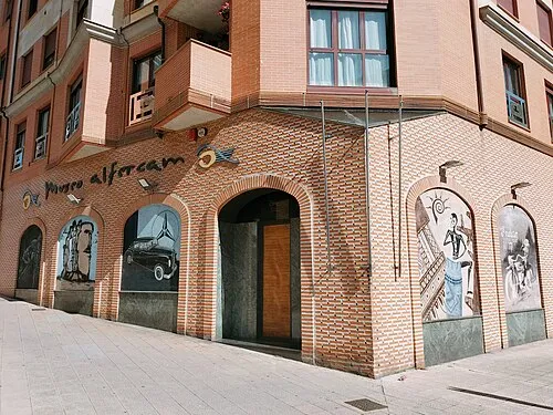 Alfercam Museum Museum, Avilés24 km E
-
Playa de Aguilar Beach, Muros de Nalón9.3 km E
-
Monte Agudo Mountain, Pravia11 km E
-
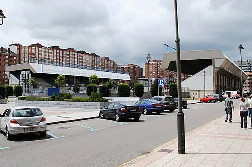 Estadio Román Suárez Puerta Landmark, Avilés24 km E
Other cities and towns in Asturias
-
 Soto del Barco Municipality Municipality, Asturias14 km E
-
 Illas Municipality, Asturias22 km E
-
Muros de Nalón Municipality, Asturias11 km E
-
 Corvera de Asturias Municipality, Asturias30 km E
-
 Oviedo Municipality, Asturias37 km SE
-
 Llanera Municipality, Asturias33 km SE
Sources & licences
Data last updated: · 2 independent sources