Langreo Municipality
Located in Asturias, Principality of Asturias Coordinates: 43°17′30″ N 5°41′58″ W

- Population
- 43,647
- 43.6K
- Elevation
- 373 m
- above sea level
- Local time
- UTC+01:00
- Europe/Madrid · UTC+01:00
- Places inside
- 46
- listed under Langreo Municipality
- Airports
- OVD Asturias Airport41 km
- LEN León Airport78 km
About Langreo Municipality
Langreo Municipality is a municipality. Location: Asturias, Principality of Asturias. Population: 43,647. Elevation: 373 m.
Langreo (Spanish pronunciation: [laŋˈɡɾeo]) or Llangréu (Asturian pronunciation: [ʎaŋˈɣɾew], locally [ʎaŋˈɣɾeo]) (Asturian) is a town and municipality in the Principality of Asturias in Spain. With a population of 38,265 as of 2024, it is the 4th-largest municipality of Asturias. Langreo is located in the centre of Asturias, approximately 20 kilometres (12 miles) south-east of Oviedo. It was an important mining and metallurgical center.
Source: Wikipedia · CC BY-SA 4.0
Places bordering Langreo Municipality
- Siero
- Mieres
- Oviedo
Population of Langreo Municipality over time
| 2014 | 42,403 | |
|---|---|---|
| 2015 | 41,738 | |
| 2016 | 41,199 | |
| 2017 | 40,529 | |
| 2018 | 39,984 | |
| 2019 | 39,420 | |
| 2020 | 39,183 | |
| 2021 | 38,683 | |
| 2022 | 38,262 | |
| 2023 | 37,978 | |
| 2024 | 38,282 | |
| 2025 | 38,612 |
Censuses and official estimates; source: Wikidata.
Climate of Langreo Municipality
Best months for sightseeingBest months for sightseeing: June–September.
This month · November
Outside the best season
Day 14° · Night 6° · Rain 94 mm
- Hottest month
- August (day 24°)
- Coldest month
- January (night 3°)
- Wettest month
- April (101 mm)
- Driest month
- August (47 mm)
Bars: average monthly low and high temperature. Below: precipitation. Monthly averages for 1970–2000 at about 18 km resolution, adjusted for elevation. Highlighted months are mild and relatively dry. Source: WorldClim 2.1 (CC BY 4.0).
Show values as a table
| Month | Jan | Feb | Mar | Apr | May | Jun | Jul | Aug | Sep | Oct | Nov | Dec |
|---|---|---|---|---|---|---|---|---|---|---|---|---|
| Average high (°C) | 11° | 12° | 14° | 15° | 18° | 21° | 24° | 24° | 22° | 18° | 14° | 11° |
| Average low (°C) | 3° | 4° | 5° | 6° | 9° | 12° | 15° | 15° | 13° | 10° | 6° | 4° |
| Precipitation (mm) | 90 | 85 | 77 | 101 | 93 | 55 | 52 | 47 | 54 | 92 | 94 | 93 |
Other places to visit in this season: June July August September
How to get to Langreo Municipality
The nearest airport is Asturias Airport (OVD), 41 km to the northwest as the crow flies. The nearest large city is Oviedo, 14 km to the northwest.
Airports
- Asturias Airport (OVD) Ranón 41 kmnorthwest
- León Airport (LEN) La Virgen del Camino 78 kmsouth
- Seve Ballesteros-Santander Airport (SDR) Santander 153 kmeast
Nearby large cities
- Oviedo Population: 220K 14 kmnorthwest
- Gijón Population: 271.8K 27 kmnorth
- León Population: 124.8K 78 kmsouth
- Santander Population: 173.6K 155 kmeast
- Burgos Population: 176.4K 195 kmsoutheast
Straight-line distances; road distances are longer. Airport data: OurAirports.
Day trips from Langreo Municipality
Within 100 km: 148 historic and cultural sites, 149 natural sites, 135 lakes, rivers and coasts.
0–25 km64 places
- Peña Mea Mountain 17 kmSE
- Gamoniteiru Mountain 22 kmSW
- Campo de San Francisco Natural site 15 kmNW
- Parque de Invierno Natural site 14 kmNW
25–60 km162 places
- Playa de la Ñora Beach 30 kmN
- Playa Cervigón Beach 29 kmN
- Playón de Bayas Beach 42 kmNW
- Playa de San Lorenzo Beach 28 kmN
60–100 km206 places
- Playa de Santa Ana Beach 66 kmNW
- Playa de San Antonio del Mar Beach 65 kmE
- Playa de San Antolín Beach 70 kmE
- Playa de Pechón Beach 98 kmE
Straight-line distances.
Places in Langreo Municipality
46 placesBar: population relative to the most populous place in this list.
Cities & villages33
- Acebal · Village
- Braña del Río · Village
- Ceacal · Village
- Ciañu · Village
- Cimalavilla · Village
- Coto · Village
- Cotorraso · Village
- El Carbayo · Village
- El Carmen · Village
- El Pontico · Village
- El Trichuru · Village
- El Viso · Village
- Entrepeñas · Village
- Faedo · Village
- Frieres · Village
- La Canga · Village
- La Cueva · Village
- La Moral · Village
- La Mosquitera · Village
- La Nava · Village
- La Nisal · Village
- La Vega · Village
- Meriñán · Village
- Pampiedra · Village
- Pando · Village
- Peña Rubia · Village
- Pozobal · Village
- Riparape · Village
- San Miguel · Village
- Santa Ana · Village
- Santianes · Village
- Tiuya/Tuilla · Village
- Turiellos · Village
Lakes, rivers & coasts1
- Río Candín · River
Heritage & sights6
- Colección Cámaras de Colores del Cine Felgueroso · Museum
- Ecomuseo Minero Valle de Samuño · Museum
- Iglesia de Santiago Apóstol · Attraction
- Museo de la Siderurgia · Museum
- Pinacoteca Eduardo Urculo · Museum
- Sala Cultural Cajastur Gervasio Ramos · Attraction
Nearby attractions & nature
Everything nearby-
Museo de la Minería y de la Industria Museum, San Martín del Rey Aurelio3.8 km E
-
Jardines del Ayuntamiento Attraction, Mieres7.6 km SW
-
Hermanos Antuña Landmark, Mieres7.6 km SW
-
Iglesia de los Padres Pasionistas Attraction, Mieres7.9 km SW
-
I.E.S. Bernaldo de Quirós Museum, Mieres8 km SW
-
Iglesia de Santa Marina Attraction, Mieres8 km SW
-
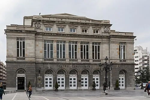 Teatro Campoamor Attraction, Oviedo14 km NW
-
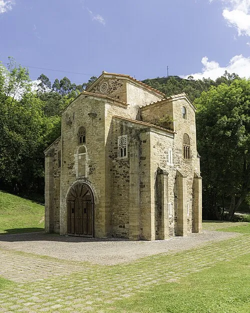 San Miguel de Lillo Attraction, Oviedo17 km NW
Other cities and towns in Asturias


Sources & licences
Data last updated: · 2 independent sources