- Elevation
- 436 m
- above sea level
- Local time
- UTC+01:00
- Europe/Madrid · UTC+01:00
- Airports
- OVD Asturias Airport33 km
- LEN León Airport79 km
About El Ablanedo
El Ablanedo is a village. Location: Morcín Municipality, Asturias. Elevation: 436 m. The best months to visit are June–September. The nearest airport is Asturias Airport (33 km). Nearby sights include Museo etnográfico de la Lecheria and Río Caudal.
Climate of El Ablanedo
Best months for sightseeingBest months for sightseeing: June–September.
This month · November
A wet month
Day 13° · Night 6° · Rain 108 mm
- Hottest month
- August (day 24°)
- Coldest month
- January (night 3°)
- Wettest month
- April (108 mm)
- Driest month
- August (49 mm)
Bars: average monthly low and high temperature. Below: precipitation. Monthly averages for 1970–2000 at about 18 km resolution, adjusted for elevation. Highlighted months are mild and relatively dry. Source: WorldClim 2.1 (CC BY 4.0).
Show values as a table
| Month | Jan | Feb | Mar | Apr | May | Jun | Jul | Aug | Sep | Oct | Nov | Dec |
|---|---|---|---|---|---|---|---|---|---|---|---|---|
| Average high (°C) | 10° | 12° | 14° | 15° | 18° | 21° | 24° | 24° | 22° | 18° | 13° | 11° |
| Average low (°C) | 3° | 4° | 5° | 6° | 9° | 12° | 14° | 14° | 13° | 9° | 6° | 4° |
| Precipitation (mm) | 102 | 93 | 84 | 108 | 101 | 60 | 54 | 49 | 60 | 101 | 108 | 107 |
Other places to visit in this season: June July August September
How to get to El Ablanedo
The nearest airport is Asturias Airport (OVD), 33 km to the north as the crow flies. The nearest large city is Oviedo, 11 km to the northeast.
Airports
- Asturias Airport (OVD) Ranón 33 kmnorth
- León Airport (LEN) La Virgen del Camino 79 kmsouth
- Bragança Airport (BGC) Bragança 171 kmsouthwest
Nearby large cities
- Oviedo Population: 220K 11 kmnortheast
- Gijón Population: 271.8K 35 kmnortheast
- León Population: 124.8K 81 kmsouth
- Santander Population: 173.6K 172 kmeast
- Ourense Population: 105.2K 191 kmsouthwest
Straight-line distances; road distances are longer. Airport data: OurAirports.
Day trips from El Ablanedo
Within 100 km: 161 historic and cultural sites, 136 natural sites, 126 lakes, rivers and coasts.
0–25 km64 places
- Gamoniteiru Mountain 10 kmS
- Campo de San Francisco Natural site 11 kmNE
- Parque de Invierno Natural site 10 kmNE
- Parque de la Música Natural site 25 kmNE
25–60 km158 places
- Playa de Santa Ana Beach 52 kmNW
- Playa de la Ñora Beach 40 kmNE
- Playa Cervigón Beach 38 kmNE
- Playón de Bayas Beach 34 kmN
60–100 km201 places
- Playa de San Antonio del Mar Beach 83 kmE
- Playa de San Antolín Beach 87 kmE
- Playa de Represas Beach 88 kmW
- Playa de Gulpiyuri Beach 86 kmE
Straight-line distances.
Nearby attractions & nature
Everything nearby-
Museo etnográfico de la Lecheria Museum, Morcín Municipality4.8 km SE
-
Río Caudal River, Oviedo5.1 km NE
-
 Estadio Carlos Tartiere Landmark, Oviedo9.9 km NE
-
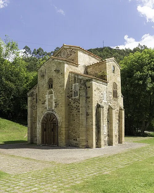 San Miguel de Lillo Attraction, Oviedo12 km N
-
 Teatro Campoamor Attraction, Oviedo11 km NE
-
Museo Etnográfico de Gallegos Museum, Mieres9.7 km SE
Sources & licences
Data last updated: