Ribadedeva Municipality
Located in Asturias, Principality of Asturias Coordinates: 43°22′53″ N 4°33′27″ W

- Population
- 1,904
- 1.9K
- Elevation
- 66 m
- above sea level
- Local time
- UTC+01:00
- Europe/Madrid · UTC+01:00
- Places inside
- 17
- listed under Ribadedeva Municipality
- Airports
- SDR Seve Ballesteros-Santander Airport60 km
- OVD Asturias Airport121 km
About Ribadedeva Municipality
Ribadedeva Municipality is a municipality. Location: Asturias, Principality of Asturias. Population: 1,904. Elevation: 66 m.
Ribadedeva (Spanish pronunciation: [riβaðeˈðeβa]; Asturian and Cantabrian: Ribadeva) is a municipality in the Autonomous Community of the Principality of Asturias, Spain. To the north is the Cantabrian Sea, while to the south lies Peñamellera Baja, to the west Llanes and to the east, across the Deva River, the Autonomous Community of Cantabria.
Source: Wikipedia · CC BY-SA 4.0
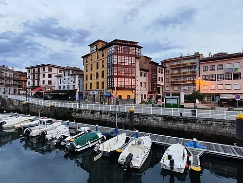
Photos of Ribadedeva Municipality
-

Almostred · CC BY-SA 4.0 -

Joergsam · CC BY-SA 3.0 -

LBM1948 · CC BY-SA 4.0 -

David Perez · CC BY 3.0 -

Luis Fermín TURIEL PEREDO · CC BY-SA 4.0
.jpg)


Places bordering Ribadedeva Municipality
- Llanes Municipality
- Val de San Vicente
Population of Ribadedeva Municipality over time
| 2014 | 1,862 | |
|---|---|---|
| 2015 | 1,836 | |
| 2016 | 1,791 | |
| 2017 | 1,753 | |
| 2018 | 1,758 | |
| 2019 | 1,756 | |
| 2020 | 1,741 | |
| 2021 | 1,724 | |
| 2022 | 1,724 | |
| 2023 | 1,731 | |
| 2024 | 1,693 | |
| 2025 | 1,693 |
Censuses and official estimates; source: Wikidata.
Climate of Ribadedeva Municipality
Best months for sightseeingBest months for sightseeing: June–September.
This month · November
Outside the best season
Day 15° · Night 7° · Rain 98 mm
- Hottest month
- August (day 24°)
- Coldest month
- January (night 4°)
- Wettest month
- November (98 mm)
- Driest month
- June (47 mm)
Bars: average monthly low and high temperature. Below: precipitation. Monthly averages for 1970–2000 at about 18 km resolution, adjusted for elevation. Highlighted months are mild and relatively dry. Source: WorldClim 2.1 (CC BY 4.0).
Show values as a table
| Month | Jan | Feb | Mar | Apr | May | Jun | Jul | Aug | Sep | Oct | Nov | Dec |
|---|---|---|---|---|---|---|---|---|---|---|---|---|
| Average high (°C) | 12° | 13° | 16° | 17° | 19° | 22° | 24° | 24° | 23° | 19° | 15° | 13° |
| Average low (°C) | 4° | 5° | 6° | 7° | 10° | 13° | 15° | 15° | 13° | 10° | 7° | 5° |
| Precipitation (mm) | 82 | 75 | 65 | 91 | 79 | 47 | 47 | 48 | 59 | 91 | 98 | 92 |
Other places to visit in this season: June July August September
How to get to Ribadedeva Municipality
The nearest airport is Seve Ballesteros-Santander Airport (SDR), 60 km to the east as the crow flies. For international flights: Asturias Airport (OVD) (121 km). The nearest large city is Santander, 62 km to the east.
Airports
- Seve Ballesteros-Santander Airport (SDR) Santander 60 kmeast
- Asturias Airport (OVD) Ranón 121 kmwest
- León Airport (LEN) La Virgen del Camino 125 kmsouthwest
Nearby large cities
- Santander Population: 173.6K 62 kmeast
- Gijón Population: 271.8K 91 kmwest
- Oviedo Population: 220K 104 kmwest
- León Population: 124.8K 120 kmsouthwest
- Barakaldo Population: 100.4K 128 kmeast
Straight-line distances; road distances are longer. Airport data: OurAirports.
Day trips from Ribadedeva Municipality
Within 100 km: 112 historic and cultural sites, 185 natural sites, 166 lakes, rivers and coasts.
0–25 km79 places
- Playa de la Rabia Beach 18 kmE
- Playa de Pechón Beach 5 kmE
- Playa de Comillas Beach 22 kmE
- Playa de Merón Beach 15 kmE
25–60 km141 places
- Playa de San Antonio del Mar Beach 31 kmW
- Playa de San Antolín Beach 26 kmW
- Playa de Gulpiyuri Beach 28 kmW
- Playa de Cuevas del Mar Beach 32 kmW
60–100 km243 places
- Playa de San Julián Beach 97 kmE
- Playa de la Ñora Beach 86 kmW
- Playa Cervigón Beach 89 kmW
- Playa de San Lorenzo Beach 91 kmW
Straight-line distances.
Places in Ribadedeva Municipality
17 placesCities & villages12
Mountains & nature2
- Peña de la Espina · Mountain
- Pico las Torres · Mountain
Lakes, rivers & coasts2
- Playa de la Franca · Beach
- Playas de Mendia · Beach
Heritage & sights1
Nearby attractions & nature
Everything nearby-
Pico Jana Mountain, Peñamellera Baja Municipality4.6 km S
-
Playa de Buelna Beach, Asturias5.2 km W
-
Deva River River, Spain3.9 km E
-
Playa de Pechón Beach, Val de San Vicente4.9 km E
-
Pico Llueres Mountain, Peñamellera Baja Municipality5.6 km SW
-
Cueto de la Hoya de Antón Mountain, Peñamellera Baja Municipality5.9 km SW
-
Río Nansa River, Val de San Vicente5.4 km SE
-
Cueto de Tabladillo Mountain, Llanes Municipality6.5 km SW
Other cities and towns in Asturias
-
 Llanes Municipality Municipality, Asturias19 km W
-
 Cabrales Municipality, Asturias22 km SW
-
Peñamellera Baja Municipality Municipality, Asturias10 km SW
-
Peñamellera Alta Municipality Municipality, Asturias13 km SW
-
 Ribadesella Municipality Municipality, Asturias42 km W
-
 Llanes Town, Llanes Municipality17 km W
Sources & licences
Data last updated: · 2 independent sources