Puig de la Llorença
Located in Benitachell/Poble Nou de Benitatxell, el, Alicante Coordinates: 38°43′13″ N 0°09′37″ E
- Elevation
- 445 m
- above sea level
- Local time
- UTC+01:00
- Europe/Madrid · UTC+01:00
- Airports
- ALC Alicante-Elche Miguel Hernández Airport79 km
- VLC Valencia Airport102 km
About Puig de la Llorença
Puig de la Llorença is a mountain. Location: Benitachell/Poble Nou de Benitatxell, el, Alicante. Elevation: 445 m. The best months to visit are April–June, September–October. The nearest airport is Alicante-Elche Miguel Hernández Airport (79 km). Nearby sights include Cala Moraig and Playa Moraira.
Photos of Puig de la Llorença
-
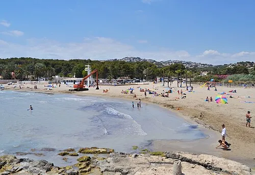
Playa Moraira Joanbanjo · CC BY-SA 3.0 -
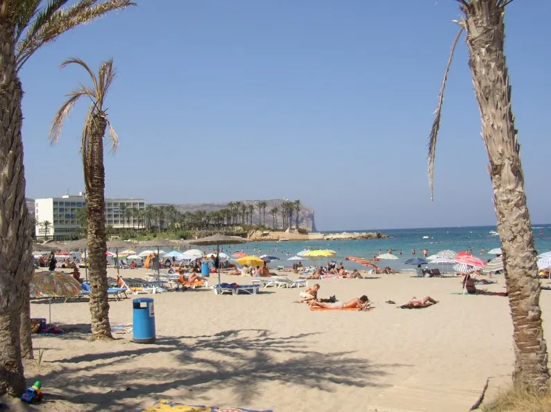
Playa del Arenal Wikimedia Commons · CC BY-SA 3.0 -
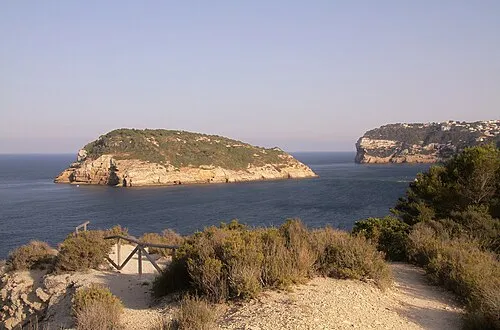
Isla del Portichol Adrian Scottow · CC BY-SA 2.0


Climate of Puig de la Llorença
Best months for sightseeingBest months for sightseeing: April–June, September–October.
This month · November
Outside the best season
Day 17° · Night 6° · Rain 38 mm
Better nearby cities in November
- Alicante · 70 km southwest20°
- Elche · 91 km southwest20°
- Orihuela · 119 km southwest20°
- Hottest month
- August (day 30°)
- Coldest month
- January (night 2°)
- Wettest month
- October (54 mm)
- Driest month
- July (8 mm)
Bars: average monthly low and high temperature. Below: precipitation. Monthly averages for 1970–2000 at about 18 km resolution, adjusted for elevation. Highlighted months are mild and relatively dry. Source: WorldClim 2.1 (CC BY 4.0).
Show values as a table
| Month | Jan | Feb | Mar | Apr | May | Jun | Jul | Aug | Sep | Oct | Nov | Dec |
|---|---|---|---|---|---|---|---|---|---|---|---|---|
| Average high (°C) | 13° | 15° | 17° | 19° | 22° | 27° | 30° | 30° | 27° | 22° | 17° | 13° |
| Average low (°C) | 2° | 3° | 5° | 7° | 10° | 14° | 17° | 17° | 14° | 10° | 6° | 3° |
| Precipitation (mm) | 23 | 24 | 25 | 33 | 34 | 19 | 8 | 10 | 37 | 54 | 38 | 31 |
Other places to visit in this season: April May June September October
How to get to Puig de la Llorença
The nearest airport is Alicante-Elche Miguel Hernández Airport (ALC), 79 km to the southwest as the crow flies. The nearest large city is Alicante, 70 km to the southwest.
Airports
- Alicante-Elche Miguel Hernández Airport (ALC) Alicante 79 kmsouthwest
- Valencia Airport (VLC) Valencia 102 kmnorthwest
- Ibiza Airport (IBZ) Ibiza (Eivissa) 107 kmeast
Nearby large cities
- Alicante Population: 348.9K 70 kmsouthwest
- Elche Population: 234.8K 91 kmsouthwest
- Valencia Population: 824.3K 96 kmnorthwest
- Orihuela Population: 101.3K 119 kmsouthwest
- Murcia Population: 472K 139 kmsouthwest
Straight-line distances; road distances are longer. Airport data: OurAirports.
Day trips from Puig de la Llorença
Within 100 km: 309 historic and cultural sites, 168 natural sites, 141 lakes, rivers and coasts.
0–25 km87 places
- Platja d'Altea Beach 23 kmSW
- Playa de la Granadella Beach 3 kmE
- Playa De La Fossa Beach 11 kmSW
- Playas De Calpe Beach 13 kmSW
25–60 km152 places
- Playa Nort de Gandía Beach 44 kmNW
- Platja de l'Albir Beach 25 kmSW
- Playa de Levante Beach 32 kmSW
- Playa de Poniente Beach 34 kmSW
60–100 km379 places
- Museo de La Asegurada Museum 70 kmSW
- MUBAG Museum 70 kmSW
- MARQ - Museo Arqueológico Museum 69 kmSW
- Playa del Postiguet Beach 70 kmSW
Straight-line distances.
Nearest towns and villages

Nearby attractions & nature
Everything nearby-
Cala Moraig Beach, Alicante1.3 km SE
-
Playa Moraira Beach, Teulada4.5 km SW
-
Cala del Portitxolet Natural site, Teulada4.1 km SW
-
Les Sort Natural site, Teulada4.1 km SW
-
Punta de Moraira Natural site, Teulada4.2 km S
-
Playa de la Granadella Beach, Alicante3.4 km E
-
Marjal del Senillar Natural site, Teulada4.4 km SW
-
Playa del Arenal Beach, Javea6.4 km NE
Sources & licences
Data last updated: