Palmeral of Elche
Local name: Palmeral de Elche
Located in Elche, Alicante Coordinates: 38°16′09″ N 0°41′56″ W
- Local time
- UTC+01:00
- Europe/Madrid · UTC+01:00
- Elevation
- 80 m
- above sea level
- Airports
- ALC Alicante-Elche Miguel Hernández Airport12 km
- RMU Region of Murcia International Airport64 km
About Palmeral of Elche
Palmeral of Elche is a tourist attraction. Location: Elche, Alicante.
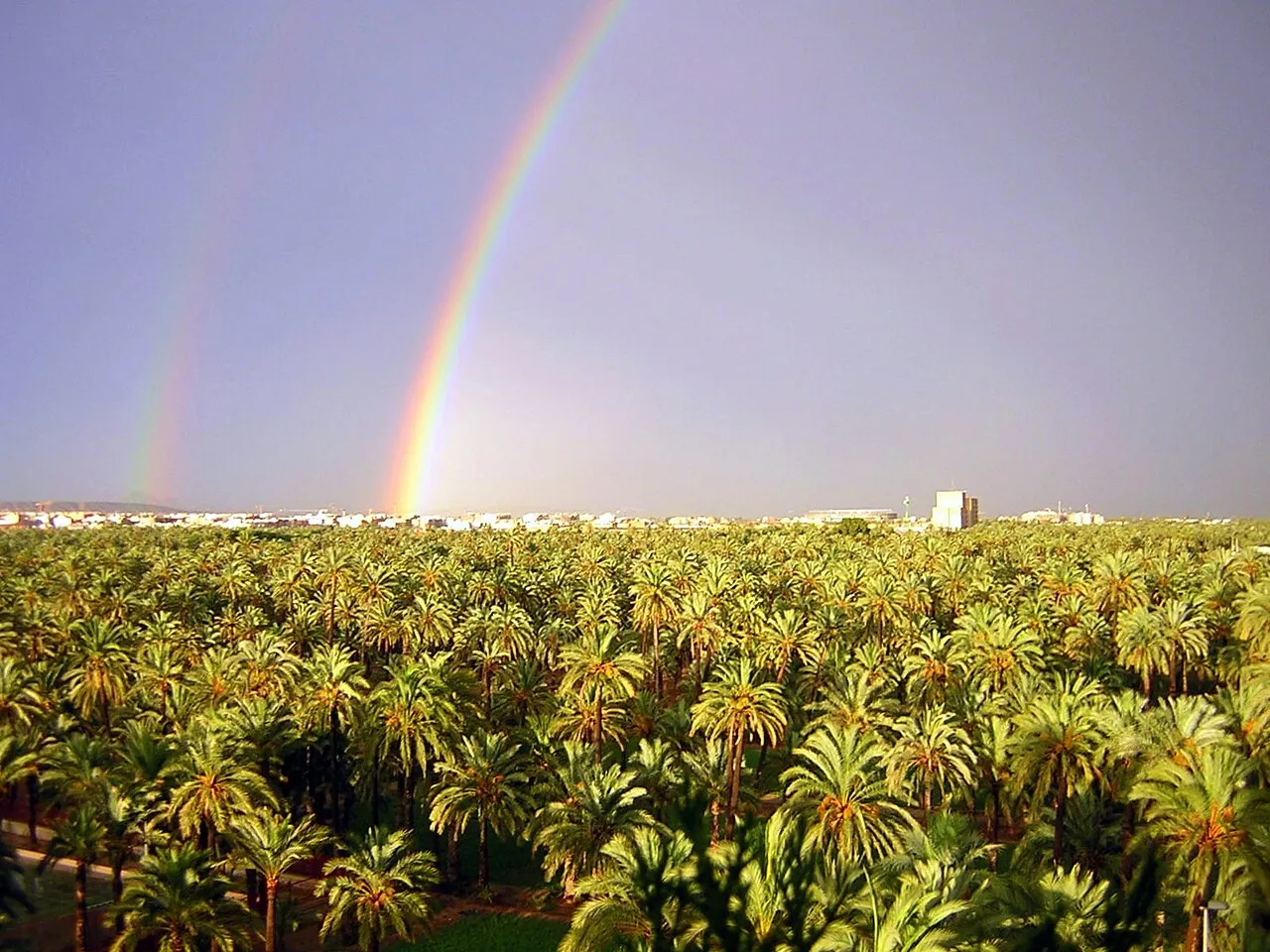
The Palmeral or Palm Grove of Elche (Spanish: Palmeral de Elche; Valencian: Palmerar d'Elx) is the generic name for a system of date palm orchards in the city of Elche, Spain. The Palmeral was planted in Roman times and underwent modifications in the medieval period under Islamic and Christian rulers. The Roman empire introduced water management techniques to Elche, but the 10th c.
Source: Wikipedia · CC BY-SA 4.0
At a glance
- Heritage designation
- World Heritage Site, bien de interés cultural
- Area
- 5 km²
Source: Wikidata
Photos of Palmeral of Elche
-

Pedro J Pacheco · CC BY-SA 4.0 -

Gustavo Morán Chacón · CC BY-SA 3.0 -

Diego Delso · CC BY-SA 4.0 -

Unknown author Unknown author · Public domain -

chisloup · CC BY 3.0


Climate of Palmeral of Elche
Best months for sightseeingBest months for sightseeing: March–May, October–November.
This month · November
A good month to visit
Day 20° · Night 10° · Rain 37 mm
- Hottest month
- August (day 32°)
- Coldest month
- January (night 6°)
- Wettest month
- October (50 mm)
- Driest month
- July (6 mm)
Bars: average monthly low and high temperature. Below: precipitation. Monthly averages for 1970–2000 at about 18 km resolution, adjusted for elevation. Highlighted months are mild and relatively dry. Source: WorldClim 2.1 (CC BY 4.0).
Show values as a table
| Month | Jan | Feb | Mar | Apr | May | Jun | Jul | Aug | Sep | Oct | Nov | Dec |
|---|---|---|---|---|---|---|---|---|---|---|---|---|
| Average high (°C) | 16° | 18° | 19° | 21° | 24° | 28° | 31° | 32° | 29° | 24° | 20° | 17° |
| Average low (°C) | 6° | 6° | 8° | 10° | 13° | 17° | 20° | 21° | 18° | 14° | 10° | 7° |
| Precipitation (mm) | 22 | 26 | 27 | 30 | 33 | 19 | 6 | 9 | 34 | 50 | 37 | 26 |
Other places to visit in this season: March April May October November
How to get to Palmeral of Elche
The nearest airport is Alicante-Elche Miguel Hernández Airport (ALC), 12 km to the east as the crow flies. The nearest large city is Elche, 1 km to the south.
Airports
- Alicante-Elche Miguel Hernández Airport (ALC) Alicante 12 kmeast
- Region of Murcia International Airport (RMU) Corvera 64 kmsouthwest
- Valencia Airport (VLC) Valencia 137 kmnorth
Nearby large cities
- Elche Population: 234.8K 1 kmsouth
- Alicante Population: 348.9K 21 kmnortheast
- Orihuela Population: 101.3K 30 kmsouthwest
- Murcia Population: 472K 49 kmsouthwest
- Cartagena Population: 213.9K 78 kmsouth
Straight-line distances; road distances are longer. Airport data: OurAirports.
Day trips from Palmeral of Elche
Within 100 km: 444 historic and cultural sites, 292 natural sites, 219 lakes, rivers and coasts.
0–25 km179 places
- Museo de La Asegurada Museum 21 kmNE
- MUBAG Museum 21 kmNE
- MARQ - Museo Arqueológico Museum 22 kmNE
- Playa del Postiguet Beach 21 kmNE
25–60 km277 places
- Playa de la Hita Beach 57 kmS
- Playa del Cura Beach 34 kmS
- Playa del Acequión Beach 34 kmS
- Playa de Levante Beach 58 kmNE
60–100 km499 places
- Isla Plana Island 89 kmSW
- Playa de las Mulas Beach 75 kmS
- Playa Larga Beach 74 kmS
- Playa Nort de Gandía Beach 95 kmNE
Straight-line distances.
Nearby attractions & nature
Everything nearby-
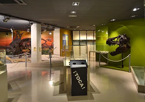 Museo Paleontológico de Elche Museum, Elche0.9 km S
-
Altamira Palace Historic site, Elche0.1 km S
-
Museu de la Festa Museum, Elche0.2 km S
-
Basílica de Santa María Attraction, Elche0.2 km SE
-
Museo del Belén Museum, Elche0.4 km S
-
Gran Teatro de Elche Attraction, Elche0.5 km SE
-
Municipal Park Natural site, Elche0.1 km NE
-
Parc Infantil de Trànsit Natural site, Elche0.3 km N
Nearest towns and villages
-
Elche City, Elche0.8 km S
-
 Aspe Municipality, Alicante11 km NW
-
Torrellano Village, Elche10 km E
-
Crevillent Town, Crevillent9.9 km W
Sources & licences
Data last updated: · 2 independent sources