- Elevation
- 107 m
- above sea level
- Local time
- UTC+01:00
- Europe/Madrid · UTC+01:00
- Airports
- ALC Alicante-Elche Miguel Hernández Airport88 km
- VLC Valencia Airport96 km
About Cabo de San Antonio
Cabo de San Antonio is a natural site. Location: Javea, Alicante. The best months to visit are March–May, October. The nearest airport is Alicante-Elche Miguel Hernández Airport (88 km). Nearby sights include Faro del Cabo de San Antonio and Playa del Arenal.
Climate of Cabo de San Antonio
Best months for sightseeingBest months for sightseeing: March–May, October.
This month · November
Outside the best season
Day 19° · Night 8° · Rain 38 mm
Better nearby cities in November
- Alicante · 78 km southwest20°
- Elche · 99 km southwest20°
- Orihuela · 128 km southwest20°
- Hottest month
- August (day 31°)
- Coldest month
- January (night 4°)
- Wettest month
- October (54 mm)
- Driest month
- July (7 mm)
Bars: average monthly low and high temperature. Below: precipitation. Monthly averages for 1970–2000 at about 18 km resolution, adjusted for elevation. Highlighted months are mild and relatively dry. Source: WorldClim 2.1 (CC BY 4.0).
Show values as a table
| Month | Jan | Feb | Mar | Apr | May | Jun | Jul | Aug | Sep | Oct | Nov | Dec |
|---|---|---|---|---|---|---|---|---|---|---|---|---|
| Average high (°C) | 15° | 17° | 19° | 21° | 24° | 28° | 31° | 31° | 28° | 23° | 19° | 16° |
| Average low (°C) | 4° | 6° | 7° | 9° | 12° | 16° | 19° | 20° | 17° | 12° | 8° | 5° |
| Precipitation (mm) | 23 | 23 | 24 | 30 | 30 | 17 | 7 | 9 | 36 | 54 | 38 | 31 |
Other places to visit in this season: March April May October
How to get to Cabo de San Antonio
The nearest airport is Alicante-Elche Miguel Hernández Airport (ALC), 88 km to the southwest as the crow flies. The nearest large city is Alicante, 78 km to the southwest.
Airports
- Alicante-Elche Miguel Hernández Airport (ALC) Alicante 88 kmsouthwest
- Valencia Airport (VLC) Valencia 96 kmnorthwest
- Ibiza Airport (IBZ) Ibiza (Eivissa) 102 kmeast
Nearby large cities
- Alicante Population: 348.9K 78 kmsouthwest
- Valencia Population: 824.3K 90 kmnorthwest
- Elche Population: 234.8K 99 kmsouthwest
- Orihuela Population: 101.3K 128 kmsouthwest
- Castellon Population: 183.7K 133 kmnorth
Straight-line distances; road distances are longer. Airport data: OurAirports.
Day trips from Cabo de San Antonio
Within 100 km: 323 historic and cultural sites, 172 natural sites, 146 lakes, rivers and coasts.
0–25 km68 places
- Playa de la Granadella Beach 8 kmS
- Playa De La Fossa Beach 20 kmSW
- Playas De Calpe Beach 22 kmSW
- Platja Punta del Raset Beach 11 kmNW
25–60 km159 places
- Playa Nort de Gandía Beach 40 kmNW
- Platja d'Altea Beach 32 kmSW
- Platja de l'Albir Beach 34 kmSW
- Playa de Levante Beach 41 kmSW
60–100 km414 places
- Museo de La Asegurada Museum 78 kmSW
- MUBAG Museum 78 kmSW
- MARQ - Museo Arqueológico Museum 77 kmSW
- Playa del Postiguet Beach 78 kmSW
Straight-line distances.
Nearest towns and villages
-
Xàbia Town, Javea3.5 km SW
-
Aduanas Village, Javea1.6 km SW
-
Denia Town, Dénia9.2 km NW
-
Santa Lucía Village, Dénia4.6 km W
-
Benitachell Village, Benitachell/Poble Nou de Benitatxell, el9 km SW
-
Dénia Municipality, Alicante12 km W
Nearby attractions & nature
Everything nearby-
Faro del Cabo de San Antonio Landmark, Javea0.2 km NW
-
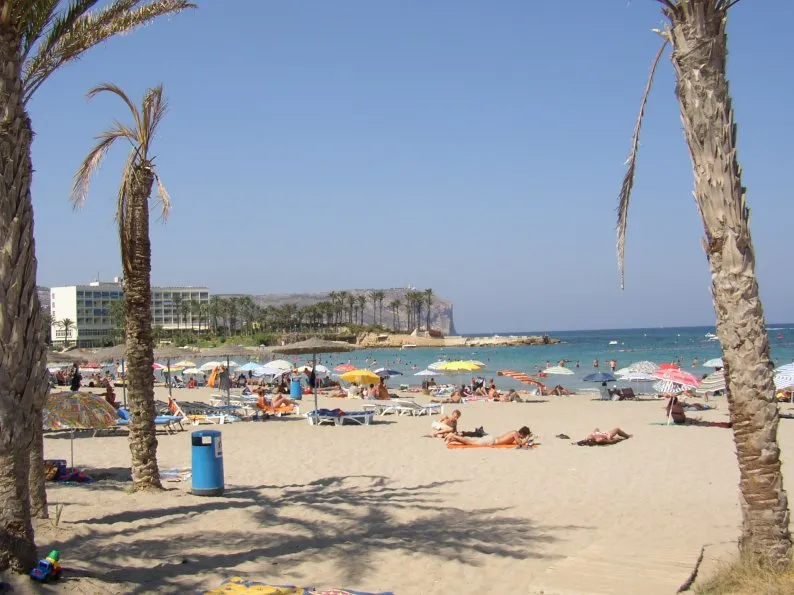 Playa del Arenal Beach, Javea3.3 km S
-
Playa Del Montañar Beach, Alicante1.6 km SW
-
Templete del jardín De Loreto Natural site, Javea3.3 km SW
-
Río Gorgos River, Javea1.9 km SW
-
La Casa Del Cable Espai D'art Museum, Javea1.7 km SW
-
Parc de Montaner Natural site, Javea3.6 km W
-
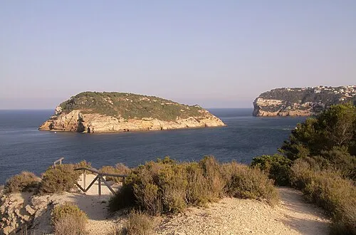 Isla del Portichol Island, Valencia5.8 km SE
Sources & licences
Data last updated: