- Elevation
- 24 m
- above sea level
- Local time
- UTC+01:00
- Europe/Stockholm · UTC+01:00
- Airports
- VBY Visby Airport46 km
- NYO Stockholm Skavsta Airport162 km
About Bunge
Bunge is a village. Location: Gotland Municipality, Gotland County. Elevation: 24 m. The best months to visit are June–August. The nearest airport is Visby Airport (46 km). Nearby sights include Bungenäs and Falholmen.
Climate of Bunge
Best months for sightseeingBest months for sightseeing: June–August.
This month · November
A cold month
Day 6° · Night 2° · Rain 58 mm
- Hottest month
- July (day 20°)
- Coldest month
- February (night -3°)
- Wettest month
- July (64 mm)
- Driest month
- May (26 mm)
Bars: average monthly low and high temperature. Below: precipitation. Monthly averages for 1970–2000 at about 18 km resolution, adjusted for elevation. Highlighted months are mild and relatively dry. Source: WorldClim 2.1 (CC BY 4.0).
Show values as a table
| Month | Jan | Feb | Mar | Apr | May | Jun | Jul | Aug | Sep | Oct | Nov | Dec |
|---|---|---|---|---|---|---|---|---|---|---|---|---|
| Average high (°C) | 1° | 1° | 3° | 7° | 12° | 17° | 20° | 20° | 15° | 10° | 6° | 3° |
| Average low (°C) | -3° | -3° | -2° | 1° | 5° | 10° | 13° | 13° | 9° | 6° | 2° | -1° |
| Precipitation (mm) | 43 | 29 | 34 | 29 | 26 | 36 | 64 | 47 | 53 | 52 | 58 | 49 |
How to get to Bunge
The nearest airport is Visby Airport (VBY), 46 km to the southwest as the crow flies. The nearest large city is Stockholm, 174 km to the north.
Airports
- Visby Airport (VBY) Visby 46 kmsouthwest
- Stockholm Skavsta Airport (NYO) Nyköping 162 kmnorthwest
- Stockholm-Bromma Airport (BMA) Stockholm 179 kmnorth
Nearby large cities
- Stockholm Population: 1.5M 174 kmnorth
- Sollentuna Population: 139.6K 186 kmnorth
- Västerås Population: 127.8K 243 kmnorthwest
- Örebro Population: 156K 273 kmnorthwest
- Jönköping Population: 112.8K 290 kmwest
Straight-line distances; road distances are longer. Airport data: OurAirports.
Nearby attractions & nature
Everything nearby-
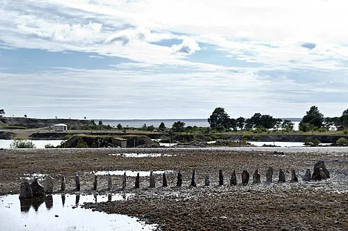 Bungenäs Natural site, Gotland County4.2 km SE
-
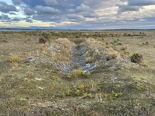 Falholmen Island, Fleringe socken9.6 km NW
-
Furilden Island, Gotland County9.6 km S
-
Marpesholm Island, Gotland County9.6 km N
-
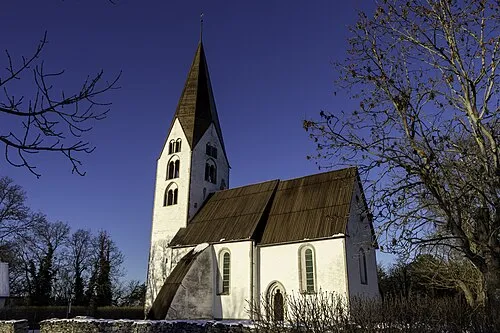 Othems kyrka Attraction, Othem socken21 km SW
-
Fjaugen Island, Gotland County11 km S
Sources & licences
Data last updated: · 2 independent sources