Othem socken
Located in Othem-Boge, Gotland Municipality Coordinates: 57°43′24″ N 18°46′38″ E
- Elevation
- 8 m
- above sea level
- Local time
- UTC+01:00
- Europe/Stockholm · UTC+01:00
- Places inside
- 1
- listed under Othem socken
- Airports
- VBY Visby Airport27 km
- NYO Stockholm Skavsta Airport162 km
About Othem socken
Othem socken is a village. Location: Othem-Boge, Gotland Municipality. Elevation: 8 m. The best months to visit are June–August. The nearest airport is Visby Airport (27 km). Nearby sights include Tingstäde Fortress and Fjaugen.
Photos of Othem socken
-
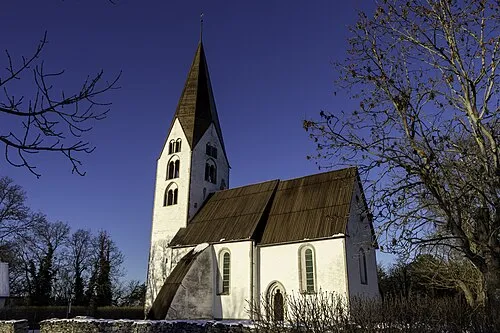
Othems kyrka Bene Riobó · CC BY-SA 4.0

Climate of Othem socken
Best months for sightseeingBest months for sightseeing: June–August.
This month · November
A cold month
Day 6° · Night 2° · Rain 63 mm
- Hottest month
- July (day 21°)
- Coldest month
- February (night -3°)
- Wettest month
- July (63 mm)
- Driest month
- May (29 mm)
Bars: average monthly low and high temperature. Below: precipitation. Monthly averages for 1970–2000 at about 18 km resolution, adjusted for elevation. Highlighted months are mild and relatively dry. Source: WorldClim 2.1 (CC BY 4.0).
Show values as a table
| Month | Jan | Feb | Mar | Apr | May | Jun | Jul | Aug | Sep | Oct | Nov | Dec |
|---|---|---|---|---|---|---|---|---|---|---|---|---|
| Average high (°C) | 1° | 1° | 4° | 8° | 14° | 18° | 21° | 20° | 16° | 11° | 6° | 3° |
| Average low (°C) | -3° | -3° | -2° | 1° | 5° | 10° | 12° | 12° | 9° | 5° | 2° | -1° |
| Precipitation (mm) | 53 | 37 | 41 | 34 | 29 | 38 | 63 | 55 | 60 | 58 | 63 | 60 |
How to get to Othem socken
The nearest airport is Visby Airport (VBY), 27 km to the west as the crow flies. The nearest large city is Stockholm, 184 km to the north.
Airports
- Visby Airport (VBY) Visby 27 kmwest
- Stockholm Skavsta Airport (NYO) Nyköping 162 kmnorthwest
- Norrköping Airport (NRK) Norrköping 177 kmnorthwest
Nearby large cities
- Stockholm Population: 1.5M 184 kmnorth
- Sollentuna Population: 139.6K 196 kmnorth
- Västerås Population: 127.8K 247 kmnorthwest
- Klaipėda Population: 172.3K 267 kmsoutheast
- Örebro Population: 156K 270 kmnorthwest
Straight-line distances; road distances are longer. Airport data: OurAirports.
Day trips from Othem socken
Within 100 km: 3 historic and cultural sites, 5 natural sites, 10 lakes, rivers and coasts.
0–25 km7 places
- Kyrkebingegrunn Island 19 kmS
- Furilden Island 15 kmE
- Fjaugen Island 13 kmE
- Falholmen Island 25 kmNE
25–60 km4 places
- Gotland Island 28 kmSW
- Marpesholm Island 30 kmNE
- Vårdkashöjden Mountain 44 kmSW
- Grasholmen Island 48 kmS
60–100 km7 places
- Killingholm Natural site 86 kmSW
- Faludden Landmark 84 kmS
- Koggen Island 66 kmS
- Karlsöarna Island 65 kmSW
Straight-line distances.
Places in Othem socken
1 placeNearby attractions & nature
Everything nearby-
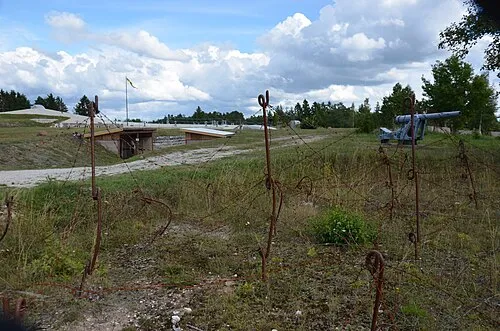 Tingstäde Fortress Historic site, Tingstäde socken9.5 km W
-
Fjaugen Island, Gotland County13 km E
-
Furilden Island, Gotland County15 km E
-
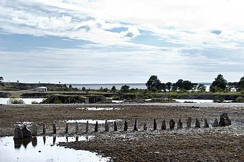 Bungenäs Natural site, Gotland County22 km NE
-
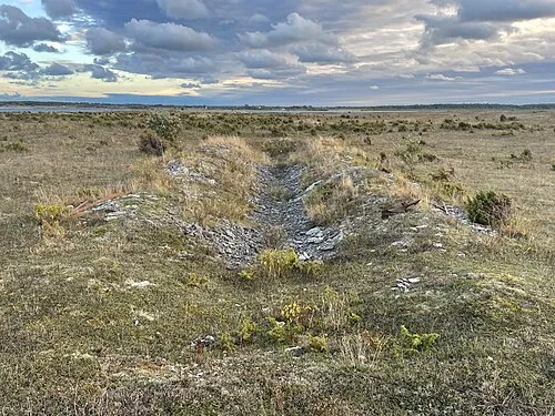 Falholmen Island, Fleringe socken25 km NE
-
Kyrkebingegrunn Island, Gotland County19 km S
Sources & licences
Data last updated: