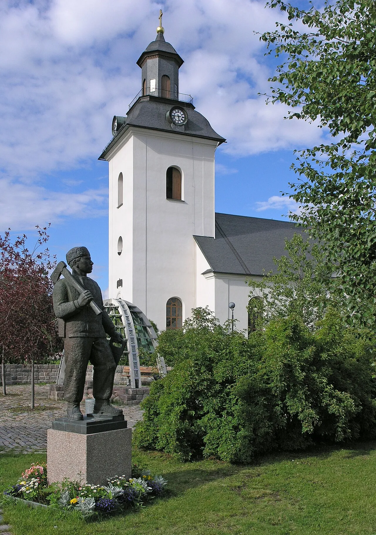
- Population
- 2,543
- 2.5K
- Elevation
- 354 m
- above sea level
- Local time
- UTC+01:00
- Europe/Stockholm · UTC+01:00
- Airports
- MXX Mora Airport120 km
- SCR Scandinavian Mountains Airport126 km
About Sveg
Sveg is a city. Location: Härjedalen Municipality, Jämtland County. Population: 2,543. Elevation: 354 m.
Sveg (Swedish pronunciation: [ˈsveːɡ]) is a locality and the seat of Härjedalen Municipality in Jämtland County, Sweden, with 2,547 inhabitants in 2010.
Source: Wikipedia · CC BY-SA 4.0
At a glance
- Area
- 3.3 km²
Source: Wikidata
Photos of Sveg
-

Alexander Ek · CC BY-SA 3.0 -

Alexander Ek · CC BY-SA 3.0 -

Alexander Ek · CC BY-SA 3.0 -

Alexander Ek · CC BY-SA 3.0 -

Alexander Ek · CC BY-SA 3.0


Travel notes for Sveg
From Wikivoyage
Härjedalen, Latinized form Herdalia, is a province in Norrland, Sweden. With only 10,500 inhabitants, it is Sweden's least populous province (landskap). Sveg is the largest town, and the seat of Härjedalen municipality, roughly corresponding to the province, and belonging to Jämtland County.
Understand+
Sweden annexed Härjedalen from Norway in 1645, during the height of the Swedish Empire. Forestry and peat extraction became important during the 19th century. The ski resorts are now the most successful businesses.
Härjedalen has for a long time been among the most sparsely populated provinces, and the only one without a city (stad). Sveg was merely a town (köping), though there is no practical distinction between the titles since 1971, as all of Sweden is divided into formally equal municipalities.
Settlements:
Sveg, with a population of about 3,000, is the municipal centre.
Hede
Vemdalen a ski resort. The three ski areas are Vemdalsskalet, Klövsjö-Storhogna and Björnrike. Most slopes are easy, and suitable for families and beginners.
Lofsdalen, a calm ski resort
Get in+
By plane:
1 Härjedalen Sveg Airport (EVG IATA). The regional gateway has two daily connections with Stockholm (stop-over in Mora) on weekdays and one on Sundays.
To western Härjedalen, the Røros airport in Norway can be used. Flights from Oslo. A car should be rented. Some ski resorts offer taxi transfer, ask them.
By train:
Inlandsbanan is a non-electrified railway, with daily passenger trains during summer. These tourist trains are slow but passes through wonderful scenery on their way. In the winter, the nearest service by train is Ljusdal which can be accessed by bus.
By car:
European Route E45 runs from Göteborg and Mora, through Sveg, to Östersund. From Stockholm use road E4 - 83 - 84. From Copenhagen, use road E4 - 26 - E45 past Jönköping.
By bus:
Sveg is also served by regular but not frequent bus service.
Härjedalingen is a bus line from Stockholm through Uppsala and Gävle, calling at most settlements in Härjedalen.
Buses from Mora or Ljusdal, which have train connections.
Source: Wikivoyage · CC BY-SA 4.0 · abridged
Population of Sveg over time
| 2010 | 2,547 | |
|---|---|---|
| 2015 | 2,543 | |
| 2016 | 2,550 | |
| 2017 | 2,564 | |
| 2018 | 2,537 | |
| 2019 | 2,542 | |
| 2020 | 2,509 | |
| 2023 | 2,448 |
Censuses and official estimates; source: Wikidata.
Climate of Sveg
Best months for sightseeingBest months for sightseeing: June–August.
This month · November
A cold month
Day 0° · Night -6° · Rain 45 mm
- Hottest month
- July (day 20°)
- Coldest month
- January (night -12°)
- Wettest month
- July (83 mm)
- Driest month
- February (22 mm)
Bars: average monthly low and high temperature. Below: precipitation. Monthly averages for 1970–2000 at about 18 km resolution, adjusted for elevation. Highlighted months are mild and relatively dry. Source: WorldClim 2.1 (CC BY 4.0).
Show values as a table
| Month | Jan | Feb | Mar | Apr | May | Jun | Jul | Aug | Sep | Oct | Nov | Dec |
|---|---|---|---|---|---|---|---|---|---|---|---|---|
| Average high (°C) | -4° | -3° | 2° | 6° | 14° | 18° | 20° | 18° | 13° | 7° | 0° | -3° |
| Average low (°C) | -12° | -12° | -8° | -3° | 2° | 7° | 9° | 8° | 4° | 0° | -6° | -11° |
| Precipitation (mm) | 30 | 22 | 28 | 37 | 44 | 74 | 83 | 65 | 59 | 47 | 45 | 36 |
How to get to Sveg
The nearest airport is Mora Airport (MXX), 120 km to the south as the crow flies. For international flights: Scandinavian Mountains Airport (SCR) (126 km). The nearest large city is Trondheim, 256 km to the northwest.
Airports
- Mora Airport (MXX) Mora 120 kmsouth
- Scandinavian Mountains Airport (SCR) Malung-Sälen 126 kmsouthwest
- Åre Östersund Airport (OSD) Östersund 129 kmnorth
Nearby large cities
- Trondheim Population: 216.5K 256 kmnorthwest
- Västerås Population: 127.8K 294 kmsoutheast
- Oslo Population: 1.1M 307 kmsouthwest
- Örebro Population: 156K 311 kmsouth
- Drammen Population: 106K 341 kmsouthwest
Straight-line distances; road distances are longer. Airport data: OurAirports.
Day trips from Sveg
Within 100 km: 80 natural sites, 1 lake, river or coast.
0–25 km17 places
- Voxhallan Mountain 25 kmSE
- Uftberget Mountain 18 kmW
- Tällberget Mountain 16 kmNE
- Svedberget Mountain 10 kmNE
25–60 km29 places
- Skurberget Mountain 34 kmE
- Tvillingvålen Mountain 36 kmNW
- Trondhatten Mountain 56 kmS
- Toberget Mountain 45 kmSE
60–100 km35 places
- Bockholmen Island 63 kmSE
- Västra Kröket Mountain 97 kmNW
- Vältet Mountain 85 kmW
- Tramsberget Mountain 92 kmNW
Straight-line distances.
Nearby attractions & nature
Everything nearby-
Höjderna Mountain, Härjedalen Municipality5.9 km S
-
Duvbergshammaren Mountain, Härjedalen Municipality8.5 km NW
-
Svedberget Mountain, Härjedalen Municipality9.6 km NE
-
Digerberget Mountain, Härjedalen Municipality11 km N
-
Sålnbergen Mountain, Härjedalen Municipality11 km N
-
Granåsen Mountain, Härjedalen Municipality13 km N
-
Rosstjärnberget Mountain, Härjedalen Municipality13 km N
-
Tällberget Mountain, Härjedalen Municipality16 km NE
Sources & licences
Data last updated: · 2 independent sources