- Population
- 27,034
- 27K
- Elevation
- 19 m
- above sea level
- Local time
- UTC+01:00
- Europe/Stockholm · UTC+01:00
- Airports
- ARN Stockholm-Arlanda Airport5 km
- BMA Stockholm-Bromma Airport30 km
About Märsta
Märsta is a town. Location: Sigtuna Municipality, Stockholm County. Population: 27,034. Elevation: 19 m.
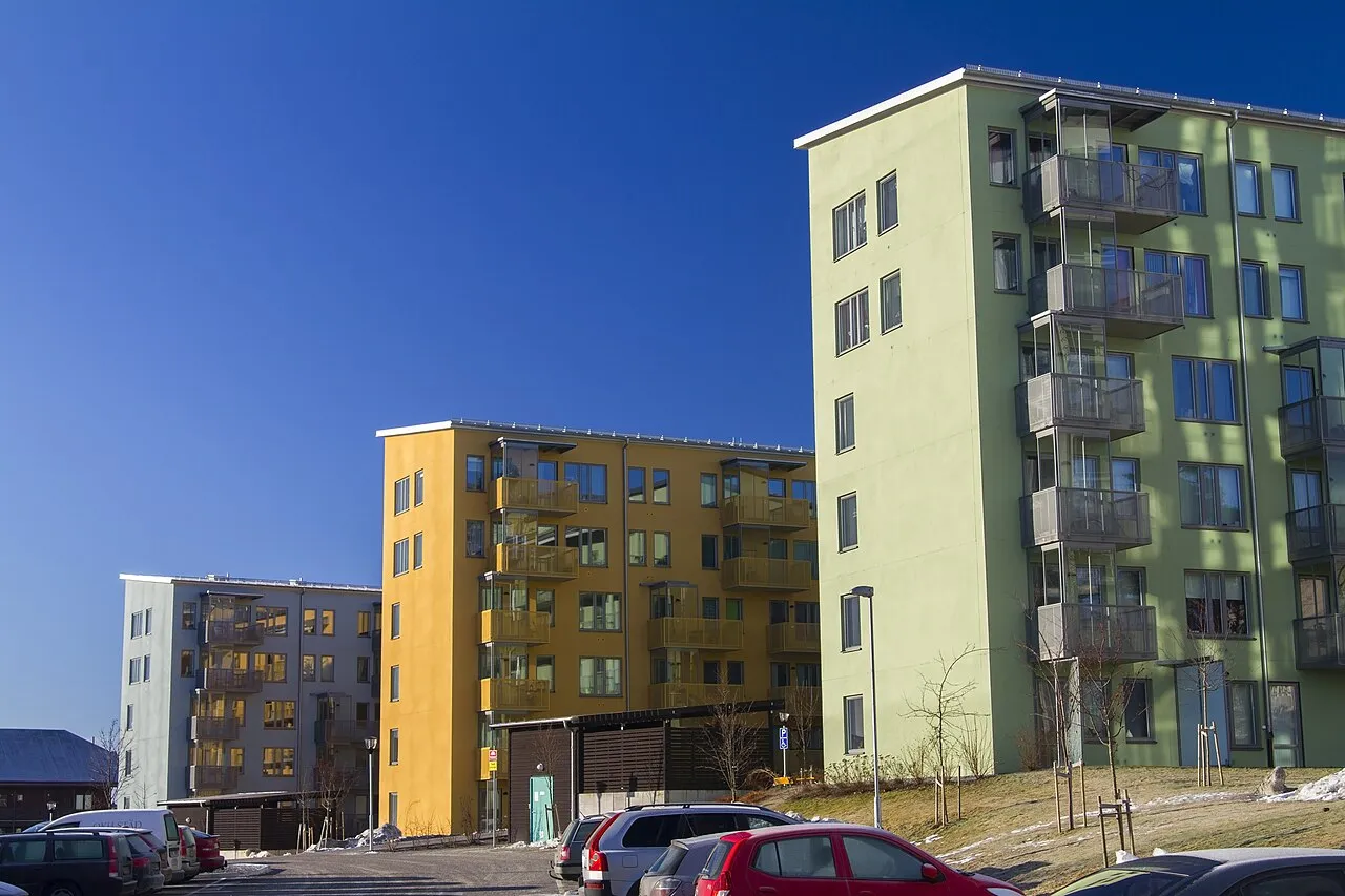
Märsta (Swedish: [ˈmæ̂ːʂʈa]) is a suburb of Metropolitan Stockholm, a locality and the seat of Sigtuna Municipality, Stockholm County, Sweden with 27,034 inhabitants in 2015. The town is situated close to Stockholm's main international airport, Arlanda. Even though its origins go back to around 500 AD, Märsta is a widespread modern residential area. Märsta has a mix of multi-storey dwellings and smaller houses.
Source: Wikipedia · CC BY-SA 4.0
At a glance
- Area
- 7 km²
Source: Wikidata
Travel notes for Märsta
From Wikivoyage
Märsta is with its 27,000 inhabitants the largest city in Sigtuna Municipality in Stockholm County in Sweden. It is located between the capital Stockholm, some 35 km to the south, and Sweden's fourth largest city Uppsala, some 30 km to the north, and some 4 km from Stockholm-Arlanda Airport.
Understand+
Märsta has historically been an important postal stop on the route between Stockholm and Uppsala. As a railway opened between these cities in 1866 and Märsta became one of the railway stops. In 1960 Stockholm-Arlanda Airport opened only a few kilometres from Märsta, and the city grew from some 2,900 inhabitants in 1960 to 16,400 in 1970. When the city was constructed it was intended to cover four hills; Valsta, Pinbacken, Brista and Norrbacka. However, as Arlanda expanded it was deemed that Pinbacken and Brista were too close to the airport, wherefore only Valsta and Norrbacka where settled. As a consequence of this the economic and cultural centre of Märsta is actually located in the geographical outskirts of the city.
Rosersberg is a small settlement between Märsta and Stockholm's northern suburbs, notable for the two palaces Rosersberg and Skånelaholm, and the beautiful lake Frysingen.
Get in+
By plane:
1 Stockholm-Arlanda Airport (ARN IATA) is by far the largest airport in Sweden, and is 4 km north east of Märsta. The terminals are numbered 2, 3, 4 and 5. The airport is clean, safe and well-functioning. Seating is scarce, especially landside. Shopping and dining are concentrated to the landside transit mall Sky City. Dining and drinking at the airport is a bit overpriced; be prepared to pay around 100 kr for a simple meal, and 75 kr for a glass of beer. There are several means of transport between Arlanda and Stockholm: airport coach, express train, commuter train and regional train.
By public transit:
2 Märsta Central Station is a stop on the railway between Stockholm and Uppsala. The rail road is operated by two operators; the Stockholm County Commuter train (SL) and the national operator SJ. SL tickets are cheaper compared to SJ tickets, but SL trains are also slower as their trains stops more frequently.
By car:
The highway E4 carry traffic between Stockholm and Uppsala and pass Märsta some 3 km east of the city.
Source: Wikivoyage · CC BY-SA 4.0 · abridged
Population of Märsta over time
| 1950 | 943 | |
|---|---|---|
| 1960 | 2,882 | |
| 1965 | 10,372 | |
| 1970 | 16,786 | |
| 2005 | 22,550 | |
| 2010 | 24,068 | |
| 2016 | 27,960 | |
| 2017 | 28,445 | |
| 2018 | 29,199 | |
| 2019 | 29,433 | |
| 2020 | 29,815 | |
| 2023 | 30,576 |
Censuses and official estimates; source: Wikidata.
Climate of Märsta
Best months for sightseeingBest months for sightseeing: June–August.
This month · November
A cold month
Day 4° · Night -1° · Rain 55 mm
- Hottest month
- July (day 22°)
- Coldest month
- February (night -6°)
- Wettest month
- July (72 mm)
- Driest month
- February (26 mm)
Bars: average monthly low and high temperature. Below: precipitation. Monthly averages for 1970–2000 at about 18 km resolution, adjusted for elevation. Highlighted months are mild and relatively dry. Source: WorldClim 2.1 (CC BY 4.0).
Show values as a table
| Month | Jan | Feb | Mar | Apr | May | Jun | Jul | Aug | Sep | Oct | Nov | Dec |
|---|---|---|---|---|---|---|---|---|---|---|---|---|
| Average high (°C) | 0° | 0° | 3° | 9° | 16° | 20° | 22° | 21° | 15° | 10° | 4° | 1° |
| Average low (°C) | -6° | -6° | -3° | 0° | 5° | 10° | 12° | 11° | 7° | 4° | -1° | -4° |
| Precipitation (mm) | 36 | 26 | 32 | 34 | 32 | 49 | 72 | 60 | 55 | 49 | 55 | 44 |
How to get to Märsta
The nearest airport is Stockholm-Arlanda Airport (ARN), 5 km to the northeast as the crow flies. The nearest large city is Sollentuna, 22 km to the south.
Airports
- Stockholm-Arlanda Airport (ARN) Stockholm 5 kmnortheast
- Stockholm-Bromma Airport (BMA) Stockholm 30 kmsouth
- Stockholm Västerås Airport (VST) Stockholm / Västerås 69 kmwest
Nearby large cities
- Sollentuna Population: 139.6K 22 kmsouth
- Stockholm Population: 1.5M 35 kmsouth
- Västerås Population: 127.8K 73 kmwest
- Örebro Population: 156K 155 kmwest
- Jönköping Population: 112.8K 297 kmsouthwest
Straight-line distances; road distances are longer. Airport data: OurAirports.
Day trips from Märsta
Within 100 km: 38 historic and cultural sites, 89 natural sites, 1,158 lakes, rivers and coasts.
0–25 km13 places
- Myrskär Island 23 kmSW
- Östra Högholmen Island 21 kmSW
- Munkholmen Island 11 kmS
- Lindskär Island 21 kmSW
25–60 km416 places
- Rindö Island 40 kmSE
- Husarö Island 58 kmE
- Granskär Island 37 kmSW
- Galtholmen Island 54 kmSE
60–100 km856 places
- Runmarö Island 64 kmSE
- Norrön Island 86 kmNE
- Lillö Island 94 kmE
- Björkön Island 99 kmN
Straight-line distances.
Nearby attractions & nature
Everything nearby-
Broholmen Island, Stockholm County9.5 km W
-
Munkholmen Island, Upplands-Bro Municipality11 km S
-
Foderholmen Island, Upplands-Bro Municipality21 km S
-
Eldgarnsön Island, Ekerö Municipality24 km SW
-
Lindskär Island, Låssa socken21 km SW
-
Östra Högholmen Island, Låssa socken21 km SW
-
Ullnabacken Mountain, Täby Municipality23 km SE
-
Lindholm Island, Kungsängen socken22 km SW
Other cities and towns in Sigtuna Municipality
Sources & licences
Data last updated: · 2 independent sources