Skalunda
Located in Lidköping Municipality, Västra Götaland County Coordinates: 58°33′00″ N 13°00′00″ E
- Population
- 58
- 58
- Elevation
- 64 m
- above sea level
- Local time
- UTC+01:00
- Europe/Stockholm · UTC+01:00
- Airports
- THN Trollhättan-Vänersborg Airport46 km
- KSD Karlstad Airport102 km
About Skalunda
Skalunda is a village. Location: Lidköping Municipality, Västra Götaland County. Population: 58. Elevation: 64 m.
Skalunda is a village at Lidköping Municipality in Västergötland, Sweden. Skalunda was an important location dating to the Iron Age and was one of the eight royal estates of early medieval Västergötland (cf. Uppsala öd). Skalunda is the site of Skalunda Church dating to the during Middle Ages. At Skalunda there are also several ancient remains, including the site of Skalunda Barrow, a historic burial mound.
Source: Wikipedia · CC BY-SA 4.0
At a glance
- Area
- 22 ha
Source: Wikidata
Photos of Skalunda
-
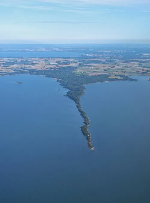
Hinden Geological Survey of Sweden SGU from Sweden · CC BY 2.0

Climate of Skalunda
Best months for sightseeingBest months for sightseeing: June–August.
This month · November
A cold month
Day 5° · Night 0° · Rain 60 mm
- Hottest month
- July (day 21°)
- Coldest month
- February (night -5°)
- Wettest month
- September (72 mm)
- Driest month
- February (30 mm)
Bars: average monthly low and high temperature. Below: precipitation. Monthly averages for 1970–2000 at about 18 km resolution, adjusted for elevation. Highlighted months are mild and relatively dry. Source: WorldClim 2.1 (CC BY 4.0).
Show values as a table
| Month | Jan | Feb | Mar | Apr | May | Jun | Jul | Aug | Sep | Oct | Nov | Dec |
|---|---|---|---|---|---|---|---|---|---|---|---|---|
| Average high (°C) | 1° | 1° | 4° | 9° | 16° | 19° | 21° | 20° | 15° | 10° | 5° | 2° |
| Average low (°C) | -5° | -5° | -2° | 1° | 6° | 10° | 11° | 11° | 7° | 4° | 0° | -3° |
| Precipitation (mm) | 43 | 30 | 36 | 39 | 42 | 59 | 63 | 63 | 72 | 65 | 60 | 51 |
How to get to Skalunda
The nearest airport is Trollhättan-Vänersborg Airport (THN), 46 km to the southwest as the crow flies. For international flights: Göteborg Landvetter Airport (GOT) (108 km). The nearest large city is Jönköping, 109 km to the southeast.
Airports
- Trollhättan-Vänersborg Airport (THN) Trollhättan 46 kmsouthwest
- Karlstad Airport (KSD) Karlstad 102 kmnorth
- Göteborg Landvetter Airport (GOT) Göteborg 108 kmsouthwest
Nearby large cities
- Jönköping Population: 112.8K 109 kmsoutheast
- Gothenburg Population: 608.5K 112 kmsouthwest
- Örebro Population: 156K 151 kmnortheast
- Oslo Population: 1.1M 199 kmnorthwest
- Drammen Population: 106K 208 kmnorthwest
Straight-line distances; road distances are longer. Airport data: OurAirports.
Day trips from Skalunda
Within 100 km: 3 historic and cultural sites, 48 natural sites, 147 lakes, rivers and coasts.
0–25 km6 places
- Kållandsö Island 16 kmNE
- Lilla Eken Island 22 kmNE
- Långö Island 7 kmN
- Klitt Island 10 kmN
25–60 km33 places
- Djurö Island 44 kmNE
- Dillö Island 47 kmNE
- Korsholmen Island 35 kmN
- Lindön Island 39 kmNE
60–100 km159 places
- Orust Island 91 kmSW
- Skaftölandet Island 97 kmW
- Visingsö Island 96 kmSE
- Flötemarksön Island 81 kmW
Straight-line distances.
Nearby attractions & nature
Everything nearby-
Långö Island, Västra Götaland County7.5 km N
-
Hinden Natural site, Västra Götaland County7 km W
-
Klitt Island, Västra Götaland County9.7 km N
-
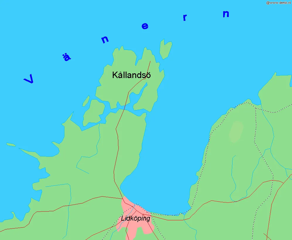 Kållandsö Island, Västra Götaland County16 km NE
-
Björkholme Island, Västra Götaland County18 km SW
-
Lilla Eken Island, Västra Götaland County22 km NE
Sources & licences
Data last updated: · 2 independent sources