- Elevation
- 838 m
- above sea level
- Local time
- UTC+01:00
- Europe/Zurich · UTC+01:00
- Airports
- ZRH Zürich Airport39 km
- BSL EuroAirport Basel–Mulhouse–Freiburg43 km
About Asperstrihe
Asperstrihe is a mountain. Location: Densbüren, Bezirk Aarau. Elevation: 838 m. The best months to visit are June–August. The nearest airport is Zürich Airport (39 km). Nearby sights include Mittlisberg and Herzberg.
Photos of Asperstrihe
-
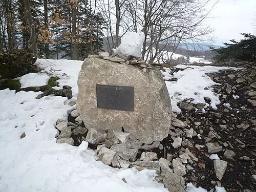
Geissflue StFr · CC0

Climate of Asperstrihe
Best months for sightseeingBest months for sightseeing: June–August.
This month · November
A wet month
Day 5° · Night -2° · Rain 111 mm
- Hottest month
- July (day 22°)
- Coldest month
- January (night -5°)
- Wettest month
- June (125 mm)
- Driest month
- March (85 mm)
Bars: average monthly low and high temperature. Below: precipitation. Monthly averages for 1970–2000 at about 18 km resolution, adjusted for elevation. Highlighted months are mild and relatively dry. Source: WorldClim 2.1 (CC BY 4.0).
Show values as a table
| Month | Jan | Feb | Mar | Apr | May | Jun | Jul | Aug | Sep | Oct | Nov | Dec |
|---|---|---|---|---|---|---|---|---|---|---|---|---|
| Average high (°C) | 1° | 3° | 7° | 11° | 16° | 19° | 22° | 21° | 17° | 11° | 5° | 2° |
| Average low (°C) | -5° | -5° | -2° | 1° | 5° | 8° | 10° | 10° | 7° | 3° | -2° | -4° |
| Precipitation (mm) | 100 | 99 | 85 | 93 | 107 | 125 | 116 | 109 | 90 | 102 | 111 | 114 |
How to get to Asperstrihe
The nearest airport is Zürich Airport (ZRH), 39 km to the east as the crow flies. The nearest large city is Basel, 37 km to the west.
Airports
- Zürich Airport (ZRH) Zurich 39 kmeast
- EuroAirport Basel–Mulhouse–Freiburg (BSL) Bâle / Mulhouse 43 kmnorthwest
- Bern Airport (BRN) Bern 71 kmsouthwest
Nearby large cities
- Basel Population: 177.6K 37 kmwest
- Zurich Population: 415.4K 40 kmeast
- Winterthur Population: 111.8K 52 kmeast
- Freiburg im Breisgau Population: 237.5K 63 kmnorth
- Mulhouse Population: 111.4K 63 kmnorthwest
Straight-line distances; road distances are longer. Airport data: OurAirports.
Day trips from Asperstrihe
Within 100 km: 516 historic and cultural sites, 3,703 natural sites, 742 lakes, rivers and coasts.
0–25 km136 places
- Arbeiterstrandbad Tennwil Beach 21 kmSE
- Lake Hallwil Lake 22 kmSE
- Büselweier Lake 11 kmE
- Seidenhoflochweiher Lake 15 kmSW
25–60 km945 places
- Fahr Abbey Attraction 31 kmE
- Schönenwerd Island 58 kmSE
- Saffa Insel Island 39 kmE
- Sankt-Niklausen-Insle Island 52 kmSE
60–100 km3,880 places
- Kleiner Bremgartenwald Mountain 70 kmSW
- Mainau Island 92 kmE
- Dominikanerinsel Konstanz Island 90 kmE
- Strandbad Steckborn Beach 74 kmE
Straight-line distances.
Nearest towns and villages
Nearby attractions & nature
Everything nearby-
Mittlisberg Mountain, Densbüren0.7 km SE
-
Herzberg Mountain, Densbüren1.2 km E
-
Wasserflue Mountain, Oberhof1.5 km SW
-
Hombergegg Mountain, Küttigen2.7 km SE
-
Würz Mountain, Thalheim3.2 km E
-
Räbenchopf Mountain, Kienberg4 km W
-
Homberg Mountain, Thalheim4.8 km NE
-
Geissflue Mountain, Oltingen6.4 km W
Sources & licences
Data last updated: · 2 independent sources