Crêt des Allemands
Located in Val-de-Travers, Val-de-Travers District Coordinates: 46°55′49″ N 6°33′43″ E
- Elevation
- 1,163 m
- above sea level
- Local time
- UTC+01:00
- Europe/Zurich · UTC+01:00
- Airports
- BRN Bern Airport71 km
- GVA Geneva International Airport84 km
About Crêt des Allemands
Crêt des Allemands is a mountain. Location: Val-de-Travers, Val-de-Travers District. Elevation: 1,163 m. The best months to visit are July–August. The nearest airport is Bern Airport (71 km). Nearby sights include Haut de la Vy and Signal des Français.
Photos of Crêt des Allemands
-
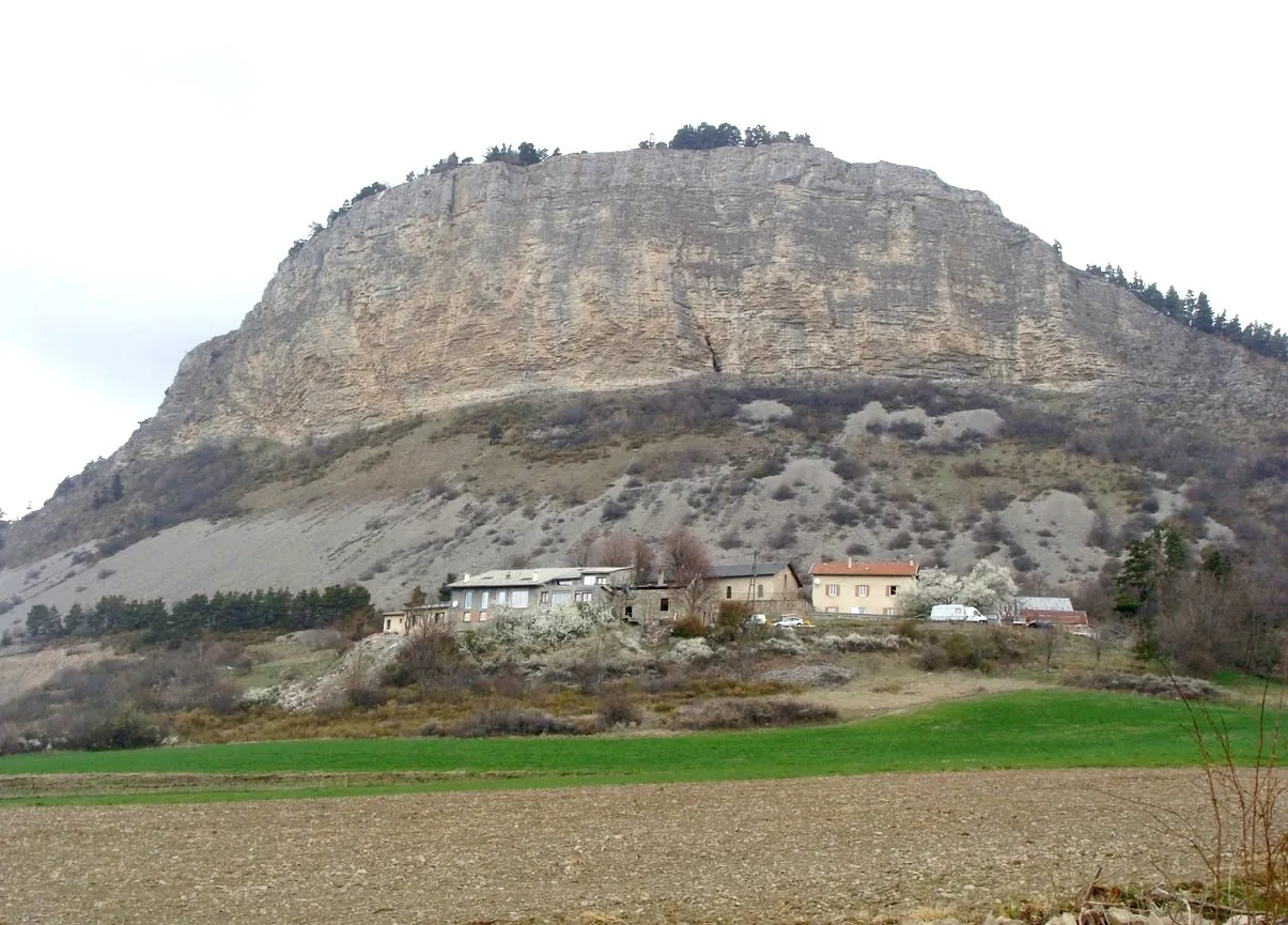
Chapeau de Napoleon Fr.Latreille · CC BY-SA 3.0

Climate of Crêt des Allemands
Best months for sightseeingBest months for sightseeing: July–August.
This month · November
A wet month
Day 5° · Night -1° · Rain 125 mm
- Hottest month
- July (day 19°)
- Coldest month
- January (night -5°)
- Wettest month
- December (132 mm)
- Driest month
- March (99 mm)
Bars: average monthly low and high temperature. Below: precipitation. Monthly averages for 1970–2000 at about 18 km resolution, adjusted for elevation. Highlighted months are mild and relatively dry. Source: WorldClim 2.1 (CC BY 4.0).
Show values as a table
| Month | Jan | Feb | Mar | Apr | May | Jun | Jul | Aug | Sep | Oct | Nov | Dec |
|---|---|---|---|---|---|---|---|---|---|---|---|---|
| Average high (°C) | 1° | 2° | 5° | 8° | 13° | 16° | 19° | 19° | 15° | 10° | 5° | 2° |
| Average low (°C) | -5° | -5° | -3° | 0° | 4° | 7° | 9° | 9° | 7° | 3° | -1° | -4° |
| Precipitation (mm) | 116 | 116 | 99 | 102 | 118 | 128 | 111 | 111 | 112 | 113 | 125 | 132 |
How to get to Crêt des Allemands
The nearest airport is Bern Airport (BRN), 71 km to the east as the crow flies. For international flights: Geneva International Airport (GVA) (84 km). The nearest large city is Lausanne, 46 km to the south.
Airports
- Bern Airport (BRN) Bern 71 kmeast
- Geneva International Airport (GVA) Geneva 84 kmsouthwest
- Dole Tavaux Airport (DLE) Dole 87 kmwest
Nearby large cities
- Lausanne Population: 139.1K 46 kmsouth
- Besançon Population: 128.4K 54 kmnorthwest
- Bern Population: 121.6K 67 kmeast
- Geneva Population: 201.7K 87 kmsouth
- Basel Population: 177.6K 104 kmnortheast
Straight-line distances; road distances are longer. Airport data: OurAirports.
Day trips from Crêt des Allemands
Within 100 km: 221 historic and cultural sites, 1,631 natural sites, 349 lakes, rivers and coasts.
0–25 km92 places
- Lake Neuchâtel Lake 24 kmE
- Lac des Taillères Lake 4 kmN
- Lac de Moron Lake 23 kmNE
- Lac des Brenets Lake 19 kmNE
25–60 km313 places
- Sankt Petersinsel Island 47 kmE
- Ile de Salagnon Island 60 kmSE
- Ile d'Ogoz Island 49 kmSE
- Lake Wohlen Lake 58 kmE
60–100 km1,796 places
- Kleiner Bremgartenwald Mountain 66 kmE
- Strandbad Neuhaus Beach 100 kmE
- Strandbad Manor Farm Beach 99 kmE
- Strandbad Leissigen Beach 97 kmE
Straight-line distances.
Nearest towns and villages
-
Saint-Sulpice Village, Val-de-Travers2.1 km S
-
Fleurier Village, Val-de-Travers3.5 km SE
-
Môtiers Village, Val-de-Travers4.3 km SE
-
Les Bayards Village, Val-de-Travers4.1 km SW
-
Buttes Village, Val-de-Travers4.7 km S
-
Couvet Village, Val-de-Travers5.4 km E
Nearby attractions & nature
Everything nearby-
Haut de la Vy Mountain, Val-de-Travers2.5 km SE
-
Signal des Français Mountain, Val-de-Travers2 km E
-
Crêt des Devens Mountain, Canton of Neuchâtel2.7 km S
-
Chapeau de Napoleon Mountain, Val-de-Travers3.1 km S
-
Val de Travers Natural site, Canton of Vaud3.6 km SE
-
Mont Brenin Mountain, Val-de-Travers4.4 km NE
-
Le Signal Mountain, Val-de-Travers4.9 km SW
-
Crêt Rond Mountain, Val-de-Travers5.3 km S
Sources & licences
Data last updated: