
- Elevation
- 1,157 m
- above sea level
- Local time
- UTC+01:00
- Europe/Zurich · UTC+01:00
- Airports
- GVA Geneva International Airport25 km
- NCY Annecy Meythet airport60 km
About La Cure
La Cure is a village. Location: Saint-Cergue, Nyon District. Elevation: 1,157 m.
La Cure (French pronunciation: [la kyʁ]) is a village located some 20 kilometres (15 mi) northwest of Lake Geneva, straddling the Franco-Swiss border. Administratively, the Swiss half of La Cure is part of the municipality of Saint-Cergue, while the French half is part of the municipality of Les Rousses. The international border bisects at least four buildings, notably the Hotel Arbez, in which the dining hall and other rooms are bisected by the border.
Source: Wikipedia · CC BY-SA 4.0
Photos of La Cure
-

Ludovic Péron · CC BY-SA 3.0 -

Alexey M · CC BY-SA 4.0 -

Arkelin · CC BY 4.0 -

Peter Sabol · CC BY-SA 4.0 -

Pmau · CC BY-SA 4.0


Climate of La Cure
Best months for sightseeingBest months for sightseeing: July–August.
This month · November
A wet month
Day 5° · Night -1° · Rain 133 mm
- Hottest month
- July (day 20°)
- Coldest month
- January (night -5°)
- Wettest month
- December (134 mm)
- Driest month
- August (99 mm)
Bars: average monthly low and high temperature. Below: precipitation. Monthly averages for 1970–2000 at about 18 km resolution, adjusted for elevation. Highlighted months are mild and relatively dry. Source: WorldClim 2.1 (CC BY 4.0).
Show values as a table
| Month | Jan | Feb | Mar | Apr | May | Jun | Jul | Aug | Sep | Oct | Nov | Dec |
|---|---|---|---|---|---|---|---|---|---|---|---|---|
| Average high (°C) | 1° | 2° | 5° | 8° | 14° | 17° | 20° | 20° | 16° | 11° | 5° | 2° |
| Average low (°C) | -5° | -4° | -2° | 0° | 5° | 7° | 10° | 10° | 7° | 4° | -1° | -3° |
| Precipitation (mm) | 121 | 119 | 101 | 102 | 115 | 123 | 102 | 99 | 117 | 121 | 133 | 134 |
How to get to La Cure
The nearest airport is Geneva International Airport (GVA), 25 km to the south as the crow flies. The nearest large city is Geneva, 30 km to the south.
Airports
- Geneva International Airport (GVA) Geneva 25 kmsouth
- Annecy Meythet airport (NCY) Annecy 60 kmsouth
- Dole Tavaux Airport (DLE) Dole 81 kmnorthwest
Nearby large cities
- Geneva Population: 201.7K 30 kmsouth
- Lausanne Population: 139.1K 43 kmeast
- Besançon Population: 128.4K 87 kmnorth
- Bern Population: 121.6K 118 kmnortheast
- Villeurbanne Population: 131.4K 121 kmsouthwest
Straight-line distances; road distances are longer. Airport data: OurAirports.
Day trips from La Cure
Within 100 km: 189 historic and cultural sites, 1,578 natural sites, 329 lakes, rivers and coasts.
0–25 km68 places
- Lac Aubonne Lake 23 kmE
- Le Mont Risoux Mountain 16 kmN
- La Barillette Mountain 5 kmSE
- Pointe de Poêle Chaud Mountain 4 kmSE
25–60 km382 places
- Lac de Joux Lake 26 kmNE
- Lake Leman Lake 30 kmE
- Lac Brenet Lake 30 kmNE
- Etang du Moulin de Vert Lake 32 kmS
60–100 km1,646 places
- Ile de Salagnon Island 62 kmE
- Ile d'Ogoz Island 83 kmE
- Schwarzsee Lake 95 kmE
- Lake Neuchâtel Lake 80 kmNE
Straight-line distances.
Nearby attractions & nature
Everything nearby-
Premanon Biathlon Stadium Landmark, Prémanon1.7 km S
-
Le Noirmont Mountain, Arzier-Le Muids3.9 km NE
-
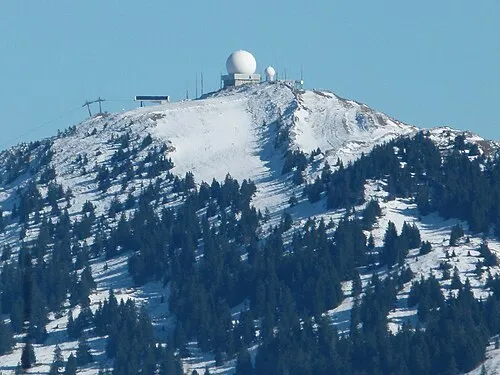 La Dôle Mountain, Gingins4.8 km SE
-
Pointe de Fin Château Mountain, Gingins4.1 km SE
-
Pointe de Poêle Chaud Mountain, Gingins4.2 km SE
-
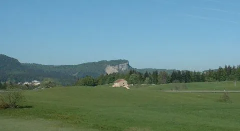 Mont Fier Mountain, Prémanon5.7 km W
Sources & licences
Data last updated: · 2 independent sources