Sendeturm Monte Ceneri
Located in Monteceneri, Lugano District Coordinates: 46°08′26″ N 8°54′56″ E
- Local time
- UTC+01:00
- Europe/Zurich · UTC+01:00
- Elevation
- 613 m
- above sea level
- Airports
- LUG Lugano Airport15 km
- MXP Milan Malpensa International Airport59 km
About Sendeturm Monte Ceneri
Sendeturm Monte Ceneri is a landmark. Location: Monteceneri, Lugano District. The best months to visit are June–September. The nearest airport is Lugano Airport (15 km). Nearby sights include Motto della Costa and Pista Kart.
Photos of Sendeturm Monte Ceneri
-
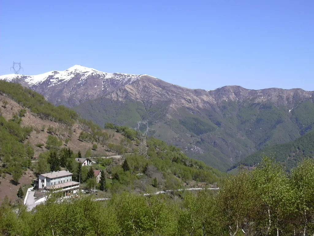
Monte Tamaro No machine-readable author provided. Ilario assumed · CC BY 2.5

Climate of Sendeturm Monte Ceneri
Best months for sightseeingBest months for sightseeing: June–September.
This month · November
A wet month
Day 10° · Night 2° · Rain 101 mm
- Hottest month
- July (day 25°)
- Coldest month
- January (night -2°)
- Wettest month
- May (160 mm)
- Driest month
- February (61 mm)
Bars: average monthly low and high temperature. Below: precipitation. Monthly averages for 1970–2000 at about 18 km resolution, adjusted for elevation. Highlighted months are mild and relatively dry. Source: WorldClim 2.1 (CC BY 4.0).
Show values as a table
| Month | Jan | Feb | Mar | Apr | May | Jun | Jul | Aug | Sep | Oct | Nov | Dec |
|---|---|---|---|---|---|---|---|---|---|---|---|---|
| Average high (°C) | 6° | 7° | 11° | 14° | 18° | 22° | 25° | 24° | 20° | 15° | 10° | 7° |
| Average low (°C) | -2° | -1° | 1° | 4° | 9° | 12° | 15° | 14° | 11° | 7° | 2° | -1° |
| Precipitation (mm) | 77 | 61 | 92 | 129 | 160 | 157 | 128 | 148 | 150 | 143 | 101 | 70 |
Other places to visit in this season: June July August September
How to get to Sendeturm Monte Ceneri
The nearest airport is Lugano Airport (LUG), 15 km to the south as the crow flies. For international flights: Milan Malpensa International Airport (MXP) (59 km). The nearest large city is Zurich, 139 km to the north.
Airports
- Lugano Airport (LUG) Agno 15 kmsouth
- Milan Malpensa International Airport (MXP) Ferno (VA) 59 kmsouth
- Il Caravaggio International Airport (BGY) Orio al Serio (BG) 81 kmsoutheast
Nearby large cities
- Zurich Population: 415.4K 139 kmnorth
- Bern Population: 121.6K 144 kmnorthwest
- Winterthur Population: 111.8K 152 kmnorth
- Lausanne Population: 139.1K 181 kmwest
- Basel Population: 177.6K 188 kmnorthwest
Straight-line distances; road distances are longer. Airport data: OurAirports.
Day trips from Sendeturm Monte Ceneri
Within 100 km: 104 historic and cultural sites, 5,873 natural sites, 736 lakes, rivers and coasts.
0–25 km340 places
- Isole di Brissago Island 14 kmW
- Sant' Apollinare Island 14 kmW
- San Pancrazio Island 14 kmW
- Laghetto di Muzzano Lake 16 kmS
25–60 km1,696 places
- Lago Nero Lake 45 kmNW
- Lago Tremorgio Lake 41 kmN
- Lago Sfundau Lake 47 kmNW
- Lago del Sambuco Lake 41 kmNW
60–100 km4,677 places
- Strandbad Iseltwald Beach 96 kmNW
- Strandbad Brienz Beach 95 kmNW
- Schnäggeninseli Island 97 kmNW
- Neptun-Inseln Island 87 kmN
Straight-line distances.
Nearby attractions & nature
Everything nearby-
Motto della Costa Mountain, Monteceneri3 km E
-
Pista Kart Natural site, Canton Ticino2.7 km NW
-
Mugia Mountain, Monteceneri3.9 km SW
-
Poncino della Croce Mountain, Gambarogno3.3 km W
-
L'Uomo del Sasso Mountain, Gambarogno3.5 km W
-
Sendemast Monte Ceneri Landmark, Isone5.8 km E
-
Monte Tamaro Mountain, Gambarogno5.6 km SW
-
Cimetto Mountain, Gambarogno3.9 km SW
Nearest towns and villages
-
Contone Village, Gambarogno1.4 km NE
-
Cadenazzo Municipality, Bellinzona District2.7 km E
-
Monte Ceneri Village, Monteceneri0.7 km W
-
Bironico Village, Monteceneri3.3 km SE
Sources & licences
Data last updated: