Eeserveen
Located in Borger-Odoorn Municipality, Drenthe Coordinates: 52°52′03″ N 6°45′55″ E
- Elevation
- 18 m
- above sea level
- Local time
- UTC+01:00
- Europe/Amsterdam · UTC+01:00
About Eeserveen
Eeserveen is a village. Location: Borger-Odoorn Municipality, Drenthe. Elevation: 18 m.
Eeserveen is a village in the Dutch province of Drenthe. It is a part of the municipality of Borger-Odoorn, and lies about 14 km northwest of Emmen. The village was first mentioned between 1851 and 1855 as Eesterveen, and means "peat excavation settlement belonging to Ees". The excavation of the peat started around 1870. It used to consists mainly of sod houses which were later replaced by stone houses. Until 1997, the village was split between Borger and Odoorn.
Read more on Wikipedia Text: Wikipedia contributors · CC BY-SA 4.0 · shortened
In comparison
Climate of Eeserveen
Best months for sightseeing: June–August.
| Month | Jan | Feb | Mar | Apr | May | Jun | Jul | Aug | Sep | Oct | Nov | Dec |
|---|---|---|---|---|---|---|---|---|---|---|---|---|
| Average high (°C) | 4° | 5° | 9° | 13° | 17° | 20° | 21° | 22° | 18° | 14° | 8° | 5° |
| Average low (°C) | -1° | -1° | 1° | 3° | 7° | 10° | 12° | 11° | 9° | 6° | 3° | 1° |
| Precipitation (mm) | 73 | 51 | 68 | 48 | 57 | 74 | 77 | 59 | 73 | 75 | 78 | 81 |
Monthly averages for 1970–2000 at about 18 km resolution, adjusted for elevation. Highlighted months are mild and relatively dry. Source: WorldClim 2.1 (CC BY 4.0).
Airports nearest to Eeserveen
- Groningen Airport Eelde (GRQ) Groningen 31 km
- Münster Osnabrück Airport (FMO) Greven 103 km
- Bremen Airport (BRE) Bremen 137 km
Straight-line distance; airports with scheduled flights only. Source: OurAirports (public domain).
Nearby attractions & nature
Everything nearby-
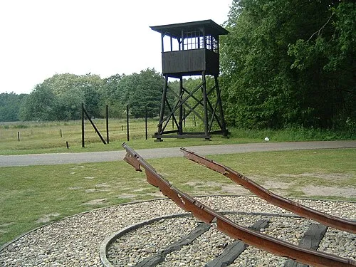 Police Custody Camp Westerbork Historic site, Gemeente Midden-Drenthe11 km W
-
Breiberg Mountain, Coevorden22 km S
Sources & licences
Data last updated: · 2 independent sources