- Population
- 65
- 65
- Elevation
- 17 m
- above sea level
- Local time
- UTC+01:00
- Europe/Amsterdam · UTC+01:00
- Airports
- GRQ Groningen Airport Eelde42 km
- FMO Münster Osnabrück Airport92 km
About Diphoorn
Diphoorn is a village. Location: Coevorden, Drenthe. Population: 65. Elevation: 17 m.
Diphoorn is a hamlet in the Netherlands and it is part of the Coevorden municipality in Drenthe. It was first mentioned in 1542 as ten Diephoorn. The etymology is unclear. Diphoorn is dependent on Sleen, however it has its own postal code. In 1842, it was home to 82 people.
Read more on Wikipedia Text: Wikipedia contributors · CC BY-SA 4.0 · shortened
In comparison
- No. 29 of 29 places in Coevorden by population
- Nearest larger town: Sleen, 1 km W
Climate of Diphoorn
Best months for sightseeingBest months for sightseeing: June–August.
Bars: average monthly low and high temperature. Below: precipitation. Monthly averages for 1970–2000 at about 18 km resolution, adjusted for elevation. Highlighted months are mild and relatively dry. Source: WorldClim 2.1 (CC BY 4.0).
Show values as a table
| Month | Jan | Feb | Mar | Apr | May | Jun | Jul | Aug | Sep | Oct | Nov | Dec |
|---|---|---|---|---|---|---|---|---|---|---|---|---|
| Average high (°C) | 5° | 5° | 9° | 13° | 18° | 20° | 22° | 22° | 18° | 14° | 9° | 5° |
| Average low (°C) | -1° | -1° | 1° | 3° | 7° | 10° | 12° | 11° | 9° | 6° | 3° | 1° |
| Precipitation (mm) | 70 | 50 | 66 | 46 | 56 | 77 | 75 | 55 | 70 | 72 | 74 | 78 |
Airports nearest to Diphoorn
- Groningen Airport Eelde (GRQ) Groningen 42 km
- Münster Osnabrück Airport (FMO) Greven 92 km
- Bremen Airport (BRE) Bremen 136 km
Straight-line distance; airports with scheduled flights only. Source: OurAirports (public domain).
Nearby attractions & nature
Everything nearby-
Breiberg Mountain, Coevorden15 km SW
-
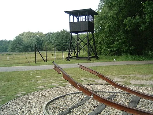 Police Custody Camp Westerbork Historic site, Gemeente Midden-Drenthe17 km NW
-
Auf dem Bült Mountain, Twist23 km SE
-
Radewijke River, Thuringia24 km S
-
Twister Aa River, Twist21 km SE
-
Lee River, Lower Saxony25 km S
Sources & licences
Data last updated: · 2 independent sources