- Population
- 13,090
- 13.1K
- Elevation
- 1 m
- above sea level
- Local time
- UTC+01:00
- Europe/Amsterdam · UTC+01:00
- Airports
- GRQ Groningen Airport Eelde55 km
- AMS Amsterdam Airport Schiphol101 km
About Joure
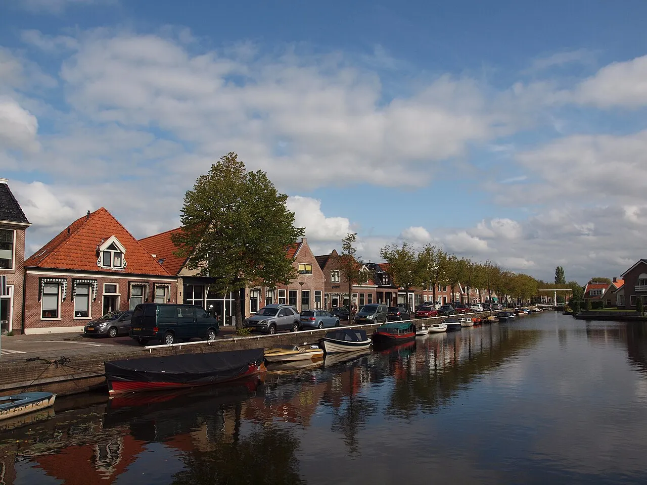
Joure is a city. Location: De Fryske Marren Municipality, Friesland. Population: 13,090. Elevation: 1 m.
Joure (Dutch pronunciation: [ˈjʌurə]; West Frisian: De Jouwer) is a town in the north of the Netherlands. It is the administrative center of De Fryske Marren, Friesland. With 13,090 inhabitants, it is also the most populous town in the municipality. Residents of Joure are called Jousters; they are also commonly referred to as Jouster Keallepoaten.
Source: Wikipedia · CC BY-SA 4.0
Photos of Joure
-

Unknown author Unknown author · Public domain -

Unknown author Unknown author · Public domain -

Blacknight · Public domain -
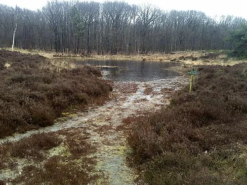
Kiekenberg Macel Brilman · CC BY-SA 3.0


Travel notes for Joure
From Wikivoyage
De Fryske Marren (Dutch: De Friese Meren) is a municipality in southwest Friesland.
Understand+
De Fryske Marren (Dutch: De Friese Meren; English: The Frisian Lakes) is a municipality in Friesland created in 2014 out of the former municipalities of Gaasterland-Sloten (Frisian: Gaasterlân-Sleat), Skarsterlân, Lemsterland and a part of Boornsterhem (Boarnsterhim). The municipality counts some 51,200 inhabitants and is the fourth biggest municipalities of the Netherlands, being behind on Noordoostpolder, Súdwest-Fryslân and Hollands Kroon. Amongst the towns in the municipalities you will find the fortified town of Sloten, with the biggest places being Balk, Joure and Lemmer.
Being named after the biggest and most predominant feature of the region, the Frisian lakes, has a large quantity of water. Some of the biggest lakes are the 1 Groote Brekken (Grutte Brekken) , 2 Koevordermeer (De Kûlfurd) , 3 Slotermeer (Sleattemer Mar) , 4 Sneekermeer (Snitser Mar) and 5 Tjeukemeer (Tsjûkemar). Water infrastructure in general is highly represented, with over forty canals, streams and waterways spanning between the different lakes. The highlight of the area is the Ingenieur D.F. Woudagemaal (Engineer D.F. Wouda Pumping Station) in Lemmer, which is listed as UNESCO World Heritage. Historical and noteworthy buildings can be found throughout the region, though Sloten, Balk and Lemmer make up the top ten, with 50, 33 and 29 respectively.
Get in+
By car:
By far the easiest way to get to De Marren is by car. The A6 and A7 highways meet at the interchange just south of Joure, which can be found in between Sneek and Heerenveen (both on the A7) and Lemmer (A6). Exits 17 and 19 of the A6 are the best exits to use, with them connecting to Lemmer and Sint Nicolaasga respectively, while Joure has an entire interchange with off-ramps for itself.
By public transit:
The Frisian Lakes have no train connection to be found. Instead, buses make up the public transit in the area, with the main hubs being in Joure, which is accessible from Groningen and Emmeloord (line 315), Heerenveen (lines 41 to Balk, 98, 99 and 199), Leeuwarden (line 95) and Sneek (line 99 and 199). All of these destinations have their bus halts right outside the station, with Heerenveen being the closest station that is serviced with Intercity trains.
By boat:
The region, being littered with waterways and lakes, has, to no-one's surprise, some twenty marinas. When coming from outside the region, the IJsselmeer is most likely your best way in.
Source: Wikivoyage · CC BY-SA 4.0 · abridged
Climate of Joure
Best months for sightseeingBest months for sightseeing: June–August.
This month · November
A cold month
Day 9° · Night 4° · Rain 84 mm
- Hottest month
- August (day 21°)
- Coldest month
- January (night 0°)
- Wettest month
- November (84 mm)
- Driest month
- April (44 mm)
Bars: average monthly low and high temperature. Below: precipitation. Monthly averages for 1970–2000 at about 18 km resolution, adjusted for elevation. Highlighted months are mild and relatively dry. Source: WorldClim 2.1 (CC BY 4.0).
Show values as a table
| Month | Jan | Feb | Mar | Apr | May | Jun | Jul | Aug | Sep | Oct | Nov | Dec |
|---|---|---|---|---|---|---|---|---|---|---|---|---|
| Average high (°C) | 5° | 6° | 9° | 12° | 17° | 19° | 21° | 21° | 18° | 14° | 9° | 6° |
| Average low (°C) | 0° | 0° | 2° | 4° | 8° | 10° | 12° | 12° | 10° | 7° | 4° | 1° |
| Precipitation (mm) | 68 | 50 | 60 | 44 | 57 | 73 | 73 | 61 | 79 | 78 | 84 | 78 |
How to get to Joure
The nearest airport is Groningen Airport Eelde (GRQ), 55 km to the east as the crow flies. The nearest large city is Leeuwarden, 26 km to the north.
Airports
- Groningen Airport Eelde (GRQ) Groningen 55 kmeast
- Amsterdam Airport Schiphol (AMS) Amsterdam 101 kmsouthwest
- Rotterdam The Hague Airport (RTM) Rotterdam 146 kmsouthwest
Nearby large cities
- Leeuwarden Population: 124.5K 26 kmnorth
- Zwolle Population: 129.8K 54 kmsouth
- Groningen Population: 244.8K 58 kmnortheast
- Almere Stad Population: 176.4K 77 kmsouthwest
- Apeldoorn Population: 136.7K 85 kmsouth
Straight-line distances; road distances are longer. Airport data: OurAirports.
Day trips from Joure
Within 100 km: 96 historic and cultural sites, 104 natural sites, 39 lakes, rivers and coasts.
0–25 km1 place
- Kiekenberg Mountain 19 kmE
25–60 km30 places
- Ameland Island 54 kmN
- Het Rif Beach 59 kmN
- Het Hen Beach 56 kmN
- Beach Ameland Beach 55 kmN
60–100 km208 places
- Texel Island 66 kmW
- Borkum Island 91 kmNE
- Putjensberg Mountain 64 kmS
- Nordstrand Beach 96 kmNE
Straight-line distances.
Sources & licences
Data last updated: · 2 independent sources