Sint Nicolaasga
Located in De Fryske Marren Municipality, Friesland Coordinates: 52°55′23″ N 5°44′33″ E

- Population
- 3,285
- 3.3K
- Elevation
- 3 m
- above sea level
- Local time
- UTC+01:00
- Europe/Amsterdam · UTC+01:00
- Airports
- GRQ Groningen Airport Eelde60 km
- AMS Amsterdam Airport Schiphol95 km
About Sint Nicolaasga
Sint Nicolaasga is a village. Location: De Fryske Marren Municipality, Friesland. Population: 3,285. Elevation: 3 m.
Sint Nicolaasga (West Frisian: Sint Nyk) is a village in the Dutch province of Friesland. It is located in the municipality of De Fryske Marren, and had a population of around 3330 in 2017.
Source: Wikipedia · CC BY-SA 4.0
Photos of Sint Nicolaasga
-

bertknot from scarborough, australia · CC BY-SA 2.0 -

bertknot from scarborough, australia · CC BY-SA 2.0


Climate of Sint Nicolaasga
Best months for sightseeingBest months for sightseeing: June–August.
This month · November
A cold month
Day 9° · Night 4° · Rain 84 mm
- Hottest month
- August (day 21°)
- Coldest month
- January (night 0°)
- Wettest month
- November (84 mm)
- Driest month
- April (44 mm)
Bars: average monthly low and high temperature. Below: precipitation. Monthly averages for 1970–2000 at about 18 km resolution, adjusted for elevation. Highlighted months are mild and relatively dry. Source: WorldClim 2.1 (CC BY 4.0).
Show values as a table
| Month | Jan | Feb | Mar | Apr | May | Jun | Jul | Aug | Sep | Oct | Nov | Dec |
|---|---|---|---|---|---|---|---|---|---|---|---|---|
| Average high (°C) | 5° | 6° | 9° | 12° | 17° | 19° | 21° | 21° | 18° | 14° | 9° | 6° |
| Average low (°C) | 0° | 0° | 2° | 4° | 8° | 10° | 12° | 12° | 10° | 7° | 4° | 1° |
| Precipitation (mm) | 68 | 50 | 60 | 44 | 57 | 73 | 73 | 61 | 79 | 78 | 84 | 78 |
How to get to Sint Nicolaasga
The nearest airport is Groningen Airport Eelde (GRQ), 60 km to the east as the crow flies. The nearest large city is Leeuwarden, 31 km to the north.
Airports
- Groningen Airport Eelde (GRQ) Groningen 60 kmeast
- Amsterdam Airport Schiphol (AMS) Amsterdam 95 kmsouthwest
- Rotterdam The Hague Airport (RTM) Rotterdam 139 kmsouthwest
Nearby large cities
- Leeuwarden Population: 124.5K 31 kmnorth
- Zwolle Population: 129.8K 51 kmsoutheast
- Groningen Population: 244.8K 64 kmnortheast
- Almere Stad Population: 176.4K 71 kmsouthwest
- Apeldoorn Population: 136.7K 81 kmsouth
Straight-line distances; road distances are longer. Airport data: OurAirports.
Day trips from Sint Nicolaasga
Within 100 km: 101 historic and cultural sites, 103 natural sites, 34 lakes, rivers and coasts.
0–25 km2 places
- Kiekenberg Mountain 24 kmE
- Poldertoren Landmark 24 kmS
25–60 km23 places
- Ameland Island 58 kmN
- Beach Ameland Beach 60 kmN
- Waterplasberg Mountain 56 kmS
- Trijsberg Mountain 55 kmS
60–100 km213 places
- Texel Island 64 kmW
- Borkum Island 97 kmNE
- Putjensberg Mountain 61 kmS
- Borkum Island 96 kmNE
Straight-line distances.
Nearby attractions & nature
Everything nearby-
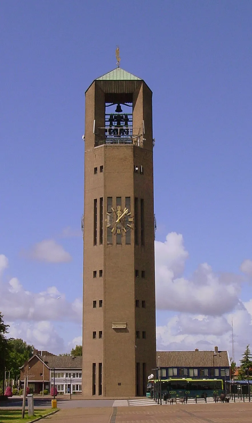 Poldertoren Landmark, Noordoostpolder Municipality24 km S
-
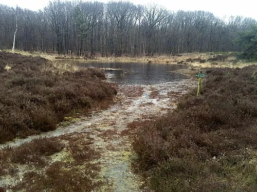 Kiekenberg Mountain, Heerenveen Municipality24 km E
Other cities and towns in De Fryske Marren Municipality
-
 Tjerkgaast Village, De Fryske Marren Municipality4.8 km SW
-
 Follega Village, De Fryske Marren Municipality4.2 km S
-
 Boornzwaag Village, De Fryske Marren Municipality4 km N
-
 Oldeouwer Village, De Fryske Marren Municipality3.9 km E
-
 Ouwsterhaule Village, De Fryske Marren Municipality5.1 km E
-
 Dijken Village, De Fryske Marren Municipality3.8 km NW
Sources & licences
Data last updated: · 2 independent sources