Vegelinsoord
Located in De Fryske Marren Municipality, Friesland Coordinates: 53°00′00″ N 5°51′53″ E

- Population
- 385
- 385
- Elevation
- 1 m
- above sea level
- Local time
- UTC+01:00
- Europe/Amsterdam · UTC+01:00
- Airports
- GRQ Groningen Airport Eelde50 km
- AMS Amsterdam Airport Schiphol107 km
About Vegelinsoord
Vegelinsoord is a village. Location: De Fryske Marren Municipality, Friesland. Population: 385. Elevation: 1 m.
Vegelinsoord (West Frisian: Vegelinsoard) is a village in De Fryske Marren municipality in the province of Friesland, the Netherlands. It had a population of around 390 in 2017. There is a windmill in the village, De Deels.
Source: Wikipedia · CC BY-SA 4.0
Photos of Vegelinsoord
-

Condor3d · CC BY 4.0 -

Ytzen · CC BY-SA 3.0


Climate of Vegelinsoord
Best months for sightseeingBest months for sightseeing: June–August.
This month · November
A cold month
Day 9° · Night 3° · Rain 84 mm
- Hottest month
- August (day 22°)
- Coldest month
- January (night 0°)
- Wettest month
- November (84 mm)
- Driest month
- April (46 mm)
Bars: average monthly low and high temperature. Below: precipitation. Monthly averages for 1970–2000 at about 18 km resolution, adjusted for elevation. Highlighted months are mild and relatively dry. Source: WorldClim 2.1 (CC BY 4.0).
Show values as a table
| Month | Jan | Feb | Mar | Apr | May | Jun | Jul | Aug | Sep | Oct | Nov | Dec |
|---|---|---|---|---|---|---|---|---|---|---|---|---|
| Average high (°C) | 5° | 6° | 9° | 13° | 17° | 19° | 22° | 22° | 18° | 14° | 9° | 6° |
| Average low (°C) | 0° | 0° | 2° | 4° | 8° | 10° | 12° | 12° | 10° | 7° | 3° | 1° |
| Precipitation (mm) | 70 | 51 | 62 | 46 | 58 | 76 | 75 | 63 | 78 | 78 | 84 | 78 |
How to get to Vegelinsoord
The nearest airport is Groningen Airport Eelde (GRQ), 50 km to the east as the crow flies. The nearest large city is Leeuwarden, 23 km to the north.
Airports
- Groningen Airport Eelde (GRQ) Groningen 50 kmeast
- Amsterdam Airport Schiphol (AMS) Amsterdam 107 kmsouthwest
- Rotterdam The Hague Airport (RTM) Rotterdam 151 kmsouthwest
Nearby large cities
- Leeuwarden Population: 124.5K 23 kmnorth
- Groningen Population: 244.8K 53 kmnortheast
- Zwolle Population: 129.8K 56 kmsouth
- Almere Stad Population: 176.4K 83 kmsouthwest
- Apeldoorn Population: 136.7K 88 kmsouth
Straight-line distances; road distances are longer. Airport data: OurAirports.
Day trips from Vegelinsoord
Within 100 km: 100 historic and cultural sites, 109 natural sites, 56 lakes, rivers and coasts.
0–25 km4 places
- Kiekenberg Mountain 16 kmE
- Leeuwarden Concentration Camp Historic site 23 kmN
- Cambuur Stadion Landmark 23 kmN
- Natuurmuseum Fryslân Museum 23 kmN
25–60 km25 places
- Ameland Island 50 kmN
- Het Rif Beach 54 kmN
- Het Hen Beach 52 kmN
- Beach Ameland Beach 52 kmN
60–100 km236 places
- Texel Island 70 kmW
- Borkum Island 85 kmNE
- Putjensberg Mountain 68 kmS
- Nordstrand Beach 91 kmNE
Straight-line distances.
Nearby attractions & nature
Everything nearby-
 Cambuur Stadion Landmark, Leeuwarden Municipality23 km N
-
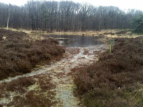 Kiekenberg Mountain, Heerenveen Municipality16 km E
-
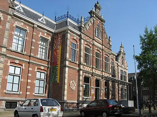 Natuurmuseum Fryslân Museum, Leeuwarden Municipality23 km N
-
Leeuwarden Concentration Camp Historic site, Leeuwarden Municipality23 km N
Other cities and towns in De Fryske Marren Municipality
-
 Haskerhorne Village, De Fryske Marren Municipality5.7 km SW
-
 Akmarijp Village, De Fryske Marren Municipality5.1 km W
-
 Terherne Village, De Fryske Marren Municipality6.6 km NW
-
 Nijehaske Village, De Fryske Marren Municipality4.8 km SE
-
 Terkaple Village, De Fryske Marren Municipality5.9 km NW
-
 Sintjohannesga Village, De Fryske Marren Municipality7.6 km S
Sources & licences
Data last updated: · 2 independent sources