Bolsward
Local name: Boalsert
Located in Southwest Friesland, Friesland Coordinates: 53°03′56″ N 5°31′54″ E
- Population
- 9,160
- 9.2K
- Elevation
- 2 m
- above sea level
- Local time
- UTC+01:00
- Europe/Amsterdam · UTC+01:00
- Airports
- GRQ Groningen Airport Eelde70 km
- AMS Amsterdam Airport Schiphol99 km
About Bolsward
Bolsward is a town. Location: Southwest Friesland, Friesland. Population: 9,160. Elevation: 2 m.
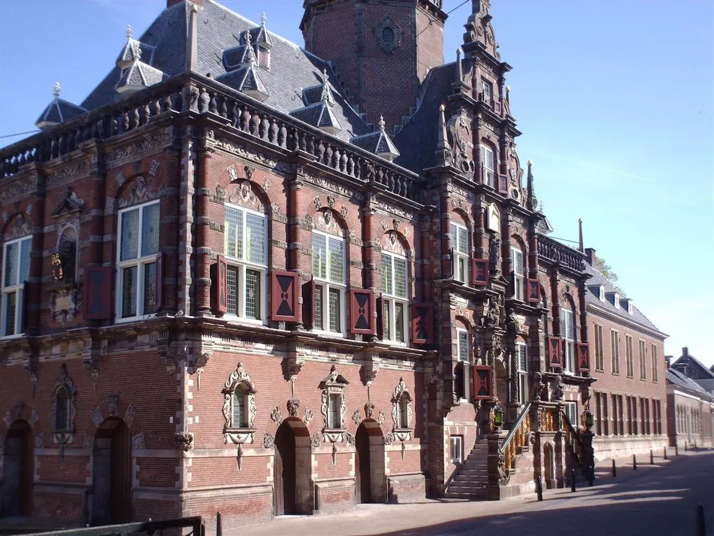
Bolsward (Dutch pronunciation: [ˈbɔlsʋɑrt] , West Frisian: Boalsert) is a city in Súdwest-Fryslân in the province of Friesland, the Netherlands. Bolsward has a population of just under 10,200. It is located 10 km W.N.W. of Sneek.
Source: Wikipedia · CC BY-SA 4.0
At a glance
- Area
- 9.4 km²
Source: Wikidata
Photos of Bolsward
-

Gouwenaar · CC BY-SA 4.0 -

Gouwenaar · CC BY-SA 4.0 -

MB-one · CC BY-SA 4.0 -

H.P.Burger · CC BY 3.0 -

txllxt @ Mapillary.com · CC BY-SA 4.0


Travel notes for Bolsward
From Wikivoyage
Bolsward is a town in Friesland.
Understand+
Bolsward is one of the original eleven Frisian cities after which the most popular Dutch ice skating event Elfstedentocht (eleven-city tour) is named. However in comparison to other cities in the region it is considered to be more of a town nowadays. It's much quieter than its neighbours Sneek and Harlingen.
Get in+
Bolsward has no rail connections but is easily reached by road.
By car:
Bolsward is right next to the A7 motorway which goes from Amsterdam to Groningen, just take the exit Bolsward and follow the Centrum signs and you'll be in the old town centre in no time. There's plenty of free parking space at Plein 1455, at the edge of the town centre, just follow the signs 'P - Gratis'.
By bus:
Buses run right through the town centre with frequent connections to Sneek, Heerenveen and Harlingen, all of which have a direct train connection. There are also a lot of less frequent bus lines to the many villages surrounding Bolsward. In the north of the Netherlands, a lot of bus services are limited during the evening and weekends.
Source: Wikivoyage · CC BY-SA 4.0 · abridged
Climate of Bolsward
Best months for sightseeingBest months for sightseeing: June–August.
This month · November
A cold month
Day 9° · Night 4° · Rain 87 mm
- Hottest month
- August (day 21°)
- Coldest month
- February (night 0°)
- Wettest month
- November (87 mm)
- Driest month
- April (41 mm)
Bars: average monthly low and high temperature. Below: precipitation. Monthly averages for 1970–2000 at about 18 km resolution, adjusted for elevation. Highlighted months are mild and relatively dry. Source: WorldClim 2.1 (CC BY 4.0).
Show values as a table
| Month | Jan | Feb | Mar | Apr | May | Jun | Jul | Aug | Sep | Oct | Nov | Dec |
|---|---|---|---|---|---|---|---|---|---|---|---|---|
| Average high (°C) | 5° | 5° | 8° | 12° | 16° | 18° | 21° | 21° | 18° | 14° | 9° | 6° |
| Average low (°C) | 0° | 0° | 2° | 4° | 7° | 10° | 12° | 12° | 10° | 7° | 4° | 1° |
| Precipitation (mm) | 68 | 49 | 58 | 41 | 52 | 64 | 66 | 60 | 82 | 80 | 87 | 77 |
How to get to Bolsward
The nearest airport is Groningen Airport Eelde (GRQ), 70 km to the east as the crow flies. The nearest large city is Leeuwarden, 24 km to the northeast.
Airports
- Groningen Airport Eelde (GRQ) Groningen 70 kmeast
- Amsterdam Airport Schiphol (AMS) Amsterdam 99 kmsouthwest
- Rotterdam The Hague Airport (RTM) Rotterdam 144 kmsouthwest
Nearby large cities
- Leeuwarden Population: 124.5K 24 kmnortheast
- Groningen Population: 244.8K 71 kmeast
- Zwolle Population: 129.8K 72 kmsoutheast
- Almere Stad Population: 176.4K 80 kmsouth
- Zaanstad Population: 140.1K 84 kmsouthwest
Straight-line distances; road distances are longer. Airport data: OurAirports.
Day trips from Bolsward
Within 100 km: 89 historic and cultural sites, 60 natural sites, 29 lakes, rivers and coasts.
0–25 km3 places
- Leeuwarden Concentration Camp Historic site 23 kmNE
- Cambuur Stadion Landmark 25 kmNE
- Natuurmuseum Fryslân Museum 23 kmNE
25–60 km27 places
- Texel Island 47 kmW
- Ameland Island 46 kmN
- Strandslag Zandloper Beach 58 kmW
- Onrust Beach 55 kmW
60–100 km148 places
- Borkum Island 96 kmNE
- Putjensberg Mountain 81 kmSE
- Borkum Island 95 kmNE
- Tüskendörsee Lake 99 kmNE
Straight-line distances.
Nearby attractions & nature
Everything nearby-
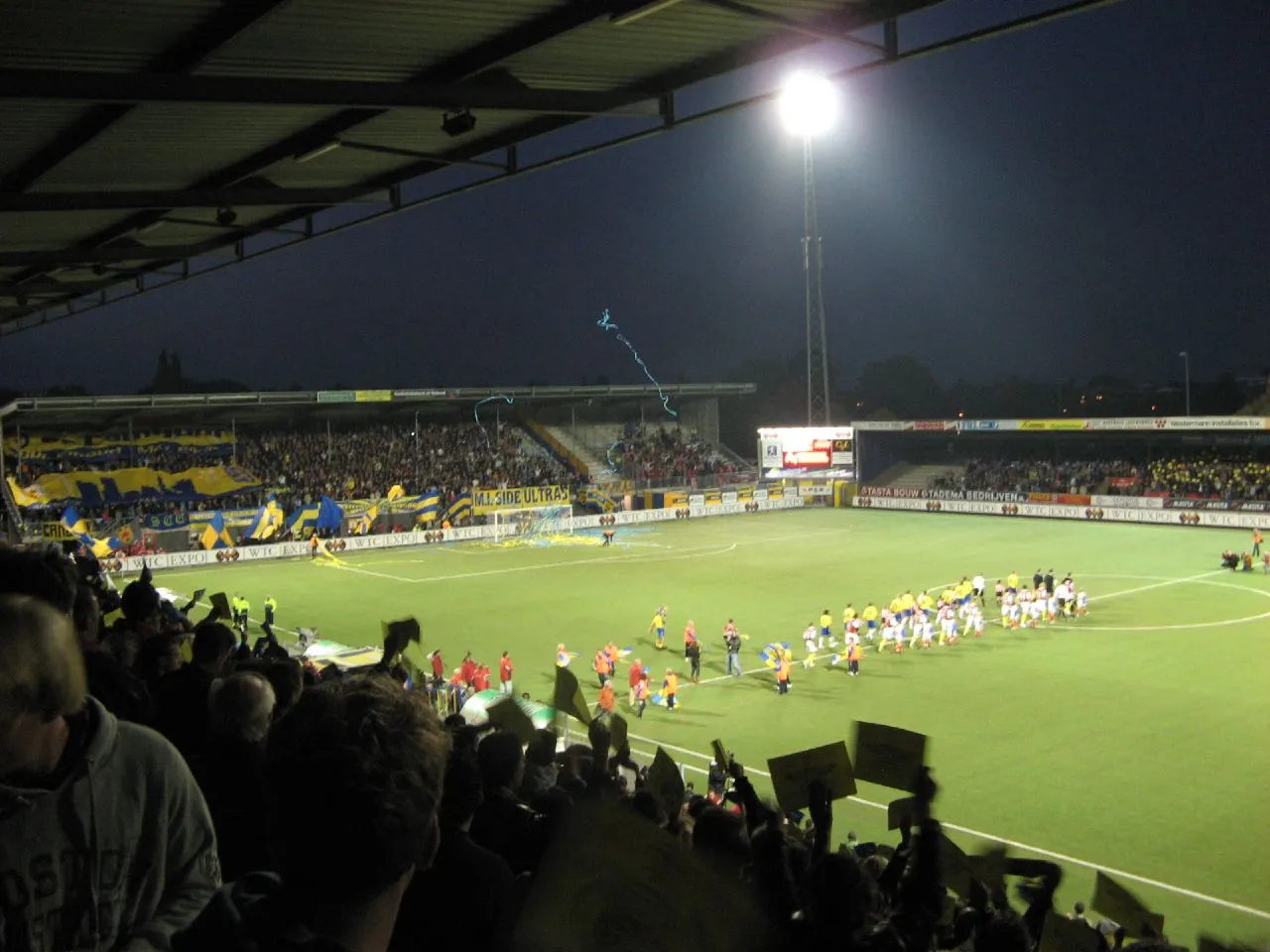 Cambuur Stadion Landmark, Leeuwarden Municipality25 km NE
-
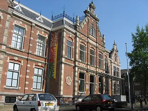 Natuurmuseum Fryslân Museum, Leeuwarden Municipality23 km NE
-
Leeuwarden Concentration Camp Historic site, Leeuwarden Municipality23 km NE
Sources & licences
Data last updated: · 2 independent sources