Southwest Friesland
Located in Friesland, The Netherlands Coordinates: 53°00′38″ N 5°31′33″ E
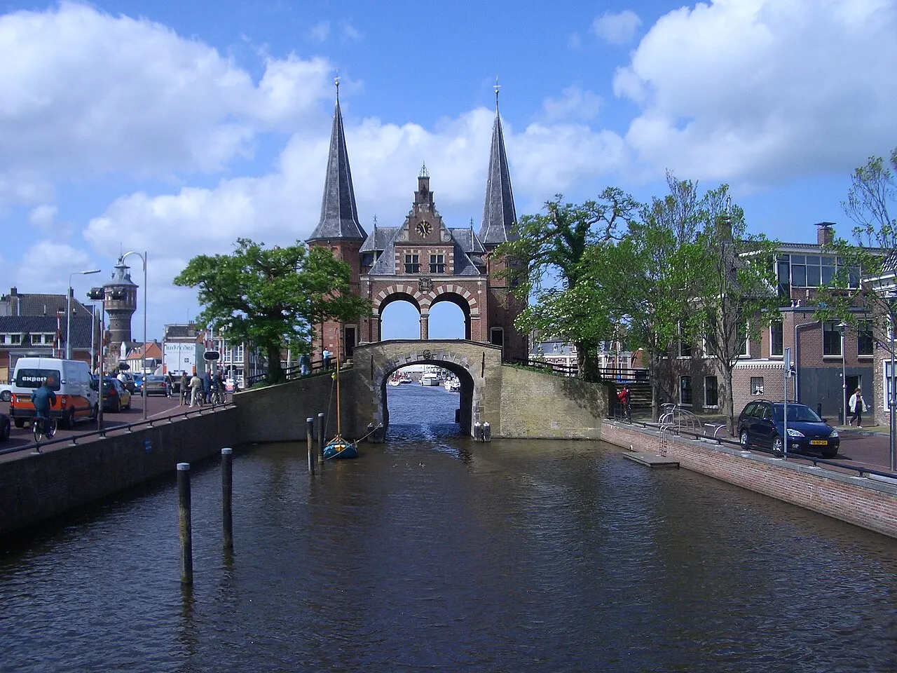
- Population
- 89,999
- 90K
- Elevation
- -2 m
- above sea level
- Local time
- UTC+01:00
- Europe/Amsterdam · UTC+01:00
- Places inside
- 101
- listed under Southwest Friesland
- Airports
- GRQ Groningen Airport Eelde72 km
- AMS Amsterdam Airport Schiphol94 km
About Southwest Friesland
Southwest Friesland is a district. Location: Friesland, The Netherlands. Population: 89,999. The best months to visit are June–August. The nearest airport is Groningen Airport Eelde (72 km).
Climate of Southwest Friesland
Best months for sightseeingBest months for sightseeing: June–August.
This month · November
A cold month
Day 9° · Night 4° · Rain 87 mm
- Hottest month
- August (day 21°)
- Coldest month
- February (night 0°)
- Wettest month
- November (87 mm)
- Driest month
- April (41 mm)
Bars: average monthly low and high temperature. Below: precipitation. Monthly averages for 1970–2000 at about 18 km resolution, adjusted for elevation. Highlighted months are mild and relatively dry. Source: WorldClim 2.1 (CC BY 4.0).
Show values as a table
| Month | Jan | Feb | Mar | Apr | May | Jun | Jul | Aug | Sep | Oct | Nov | Dec |
|---|---|---|---|---|---|---|---|---|---|---|---|---|
| Average high (°C) | 5° | 5° | 8° | 12° | 16° | 18° | 21° | 21° | 18° | 14° | 9° | 6° |
| Average low (°C) | 0° | 0° | 2° | 4° | 7° | 10° | 12° | 12° | 10° | 7° | 4° | 1° |
| Precipitation (mm) | 68 | 49 | 58 | 41 | 52 | 64 | 66 | 60 | 82 | 80 | 87 | 77 |
How to get to Southwest Friesland
The nearest airport is Groningen Airport Eelde (GRQ), 72 km to the east as the crow flies. The nearest large city is Leeuwarden, 29 km to the northeast.
Airports
- Groningen Airport Eelde (GRQ) Groningen 72 kmeast
- Amsterdam Airport Schiphol (AMS) Amsterdam 94 kmsouthwest
- Rotterdam The Hague Airport (RTM) Rotterdam 139 kmsouthwest
Nearby large cities
- Leeuwarden Population: 124.5K 29 kmnortheast
- Zwolle Population: 129.8K 67 kmsoutheast
- Groningen Population: 244.8K 73 kmeast
- Almere Stad Population: 176.4K 74 kmsouth
- Zaanstad Population: 140.1K 79 kmsouthwest
Straight-line distances; road distances are longer. Airport data: OurAirports.
Day trips from Southwest Friesland
Within 100 km: 93 historic and cultural sites, 57 natural sites, 23 lakes, rivers and coasts.
25–60 km33 places
- Texel Island 47 kmW
- Ameland Island 52 kmN
- Strandslag Zandloper Beach 56 kmW
- Strandslag Voordijk Beach 58 kmW
60–100 km140 places
- Putjensberg Mountain 75 kmSE
- Borkum Island 99 kmNE
- Greune Stee Natural site 100 kmNE
- Radewijkerbeek River 89 kmSE
Straight-line distances.
Places in Southwest Friesland
101 places- 1 Sneek 32.8K
- 2 Bolsward 9.2K
- 3 Workum 4.3K
- 4 Makkum 3.3K
- 5 IJlst 3.2K
- 6 Stadsfenne 3.1K
- 7 Koudum 2.6K
- 8 Tinga 2.1K
- 9 Wommels 2.1K
- 10 Heeg 2K
- 11 De Domp 1.9K
- 12 Witmarsum 1.6K
- 13 Scharnegoutum 1.5K
- 14 Woudsend 1.4K
- 15 Oppenhuizen 1.1K
- 16 Stavoren 900
- 17 Arum 895
- 18 Hindeloopen 785
- 19 Oosterend 785
- 20 Nijland 775
- 21 Warns 725
- 22 Ysbrechtum 654
- 23 Raerd 630
- 24 Hommerts 595
- 25 Oudega 595
- 26 Blauwhuis 590
- 27 Hemelum 505
- 28 Kimswerd 485
- 29 Pingjum 445
- 30 Exmorra 390
- 31 Sibrandabuorren 370
- 32 Gauw 365
- 33 Tersoal 350
- 34 Uitwellingerga 345
- 35 Parrega 335
- 36 It Heidenskip 330
- 37 Bozum 325
- 38 Folsgare 325
- 39 Tjerkwerd 295
- 40 Wons 285
- 41 Oosthem 275
- 42 Lollum 260
- 43 Burgwerd 255
- 44 Molkwerum 255
- 45 Itens 230
- 46 Jutrijp 230
- 47 Offingawier 230
- 48 Idsegahuizum 220
- 49 Gaastmeer 215
- 50 Schettens 210
- 51 Gaast 180
- 52 Schraard 180
- 53 Kûbaard 170
- 54 Poppenwier 170
- 55 Goënga 165
- 56 Ferwoude 145
- 57 Zurich 145
- 58 Dearsum 130
- 59 Hidaard 130
- 60 Hartwerd 125
Bar: population relative to the most populous place in this list.
Sources & licences
Data last updated: