- Population
- 708
- 708
- Elevation
- 6 m
- above sea level
- Local time
- UTC+01:00
- Europe/Amsterdam · UTC+01:00
- Airports
- NRN Weeze (Niederrhein) Airport62 km
- EIN Eindhoven Airport95 km
About Empe
Empe is a village. Location: Brummen Municipality, Gelderland. Population: 708. Elevation: 6 m.
Empe is a village in the municipality of Brummen in the province of Gelderland in the Netherlands. Empe is located on the Apeldoorn-Zutphen railway, 4 km west of Zutphen. The NS railway station Voorst-Empe was reopened on 10 December 2006. The castle Huis Empe, built around 1550 lies on the edge of the village.
Source: Wikipedia · CC BY-SA 4.0
Climate of Empe
Best months for sightseeingBest months for sightseeing: June–August.
This month · November
A cold month
Day 9° · Night 3° · Rain 77 mm
- Hottest month
- August (day 23°)
- Coldest month
- February (night 0°)
- Wettest month
- December (83 mm)
- Driest month
- April (48 mm)
Bars: average monthly low and high temperature. Below: precipitation. Monthly averages for 1970–2000 at about 18 km resolution, adjusted for elevation. Highlighted months are mild and relatively dry. Source: WorldClim 2.1 (CC BY 4.0).
Show values as a table
| Month | Jan | Feb | Mar | Apr | May | Jun | Jul | Aug | Sep | Oct | Nov | Dec |
|---|---|---|---|---|---|---|---|---|---|---|---|---|
| Average high (°C) | 5° | 6° | 9° | 13° | 18° | 20° | 22° | 23° | 19° | 14° | 9° | 6° |
| Average low (°C) | 0° | 0° | 2° | 4° | 8° | 10° | 12° | 12° | 10° | 6° | 3° | 1° |
| Precipitation (mm) | 75 | 51 | 71 | 48 | 61 | 74 | 72 | 61 | 74 | 70 | 77 | 83 |
How to get to Empe
The nearest airport is Weeze (Niederrhein) Airport (NRN), 62 km to the south as the crow flies. The nearest large city is Apeldoorn, 13 km to the northwest.
Airports
- Weeze (Niederrhein) Airport (NRN) Weeze 62 kmsouth
- Eindhoven Airport (EIN) Eindhoven 95 kmsouthwest
- Amsterdam Airport Schiphol (AMS) Amsterdam 95 kmwest
Nearby large cities
- Apeldoorn Population: 136.7K 13 kmnorthwest
- Arnhem Population: 162.4K 25 kmsouthwest
- Zwolle Population: 129.8K 40 kmnorth
- Nijmegen Population: 177.4K 40 kmsouthwest
- Amersfoort Population: 139.9K 51 kmwest
Straight-line distances; road distances are longer. Airport data: OurAirports.
Day trips from Empe
Within 100 km: 207 historic and cultural sites, 357 natural sites, 232 lakes, rivers and coasts.
0–25 km35 places
- Zwarte Berg Mountain 15 kmSW
- Zuurberg Mountain 24 kmNE
- Waterberg Mountain 17 kmW
- Valkenberg Mountain 21 kmNW
25–60 km176 places
- Putjensberg Mountain 29 kmN
- Wijlermeer Lake 40 kmS
- Strang Lake 35 kmS
- Schmales Meer Lake 47 kmSE
60–100 km585 places
- Kasteel Arcen Historic site 76 kmS
- Halterner Talsperre Lake 87 kmSE
- Schrolik Lake 90 kmS
- Schönwasser Lake 96 kmS
Straight-line distances.
Nearby attractions & nature
Everything nearby-
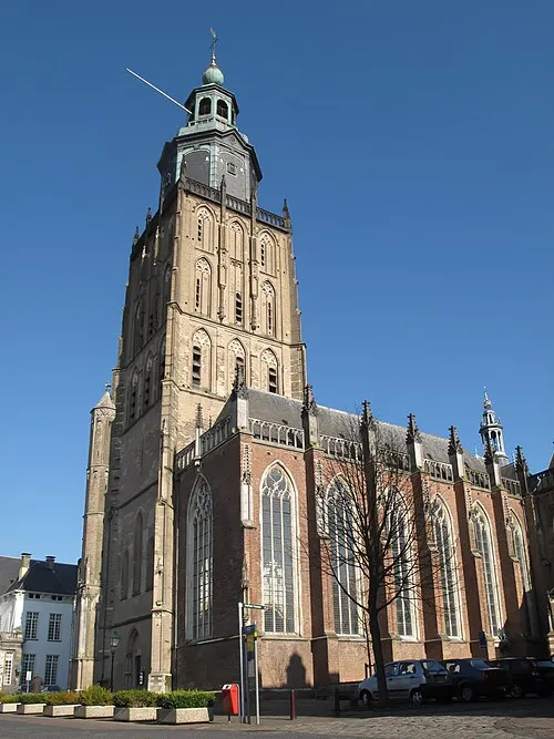 St Walburgis Church Attraction, Gemeente Zutphen4.3 km SE
-
De Reeënberg Mountain, Apeldoorn Municipality11 km W
-
Jutberg Mountain, Rheden Municipality11 km SW
-
Geitenberg Mountain, Rheden Municipality12 km S
-
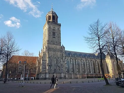 Lebuïnuskerk Attraction, Deventer Municipality11 km N
-
Schalterberg Mountain, Apeldoorn Municipality12 km W
Sources & licences
Data last updated: · 2 independent sources