- Population
- 5,575
- 5.6K
- Elevation
- 16 m
- above sea level
- Local time
- UTC+01:00
- Europe/Amsterdam · UTC+01:00
- Airports
- NRN Weeze (Niederrhein) Airport39 km
- DUS Düsseldorf Airport77 km
About Gaanderen
Gaanderen is a town. Location: Doetinchem Municipality, Gelderland. Population: 5,575. Elevation: 16 m.
Gaanderen is a village in the Dutch province of Gelderland. It is located in the municipality of Doetinchem. The number of inhabitants is around 5,575 (2020). It was first mentioned around 1200 as de Gernere, and means "tapering land on a sandy ridge". Gaanderen was home to 482 people in 1840. The St Martinus Church dates from 1913 and is a replacement of a 1854 church. The tower of the old church remained.
Source: Wikipedia · CC BY-SA 4.0
Climate of Gaanderen
Best months for sightseeingBest months for sightseeing: June–August.
This month · November
A cold month
Day 9° · Night 3° · Rain 66 mm
- Hottest month
- July (day 23°)
- Coldest month
- February (night 0°)
- Wettest month
- June (73 mm)
- Driest month
- April (43 mm)
Bars: average monthly low and high temperature. Below: precipitation. Monthly averages for 1970–2000 at about 18 km resolution, adjusted for elevation. Highlighted months are mild and relatively dry. Source: WorldClim 2.1 (CC BY 4.0).
Show values as a table
| Month | Jan | Feb | Mar | Apr | May | Jun | Jul | Aug | Sep | Oct | Nov | Dec |
|---|---|---|---|---|---|---|---|---|---|---|---|---|
| Average high (°C) | 5° | 6° | 9° | 13° | 18° | 21° | 23° | 23° | 19° | 14° | 9° | 6° |
| Average low (°C) | 0° | 0° | 2° | 4° | 8° | 11° | 13° | 12° | 10° | 6° | 3° | 1° |
| Precipitation (mm) | 63 | 45 | 62 | 43 | 61 | 73 | 69 | 58 | 69 | 61 | 66 | 72 |
How to get to Gaanderen
The nearest airport is Weeze (Niederrhein) Airport (NRN), 39 km to the south as the crow flies. The nearest large city is Arnhem, 30 km to the west.
Airports
- Weeze (Niederrhein) Airport (NRN) Weeze 39 kmsouth
- Düsseldorf Airport (DUS) Düsseldorf 77 kmsouth
- Eindhoven Airport (EIN) Eindhoven 86 kmsouthwest
Nearby large cities
- Arnhem Population: 162.4K 30 kmwest
- Nijmegen Population: 177.4K 35 kmwest
- Apeldoorn Population: 136.7K 41 kmnorthwest
- Enschede Population: 153.7K 50 kmnortheast
- Moers Population: 103.5K 56 kmsouth
Straight-line distances; road distances are longer. Airport data: OurAirports.
Day trips from Gaanderen
Within 100 km: 253 historic and cultural sites, 458 natural sites, 346 lakes, rivers and coasts.
0–25 km45 places
- Strang Lake 15 kmSW
- Schmales Meer Lake 19 kmS
- Millinger Meer Lake 15 kmS
- Lange Renne Lake 24 kmSE
25–60 km328 places
- Putjensberg Mountain 58 kmNW
- Kasteel Arcen Historic site 52 kmS
- Wijlermeer Lake 30 kmSW
- Kaplanskuhlen Lake 52 kmS
60–100 km684 places
- Veldhoven Bos Natural site 95 kmSW
- Varkensbos Natural site 96 kmSW
- Sint-Martens-Heide Natural site 98 kmSW
- Pastoorsbos Natural site 96 kmSW
Straight-line distances.
Nearby attractions & nature
Everything nearby-
Galgenberg Mountain, Gemeente Montferland7.8 km SW
-
Keurvorstenheuvel Mountain, Gemeente Montferland8.8 km W
-
Rijsberg Mountain, Gemeente Montferland9.3 km W
-
Regnieter Bach River, Germany7.3 km S
-
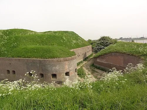 Fort Pannerden Historic site, Gemeente Lingewaard23 km W
-
Burg Anholt Historic site, Isselburg11 km SE
-
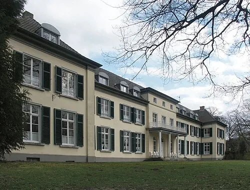 Gnadenthal Historic site, Kleve21 km SW
-
Carolinaberg Mountain, Rheden Municipality22 km NW
Sources & licences
Data last updated: · 2 independent sources