Gemeente Wageningen
Located in Gelderland, The Netherlands Coordinates: 51°58′08″ N 5°40′00″ E
- Population
- 39,635
- 39.6K
- Elevation
- 14 m
- above sea level
- Local time
- UTC+01:00
- Europe/Amsterdam · UTC+01:00
- Places inside
- 2
- listed under Gemeente Wageningen
- Airports
- NRN Weeze (Niederrhein) Airport52 km
- EIN Eindhoven Airport61 km
About Gemeente Wageningen
Gemeente Wageningen is a district. Location: Gelderland, The Netherlands. Population: 39,635.
Wageningen (Dutch pronunciation: [ˈʋaːɣənɪŋə(n)] ) is a municipality and a historic city in the central Netherlands, in the province of Gelderland. It is famous for Wageningen University, which specialises in life sciences. The municipality had a population of 39,635 in 2021, of which many thousands are students from over 150 countries.
Source: Wikipedia · CC BY-SA 4.0
Photos of Gemeente Wageningen
-
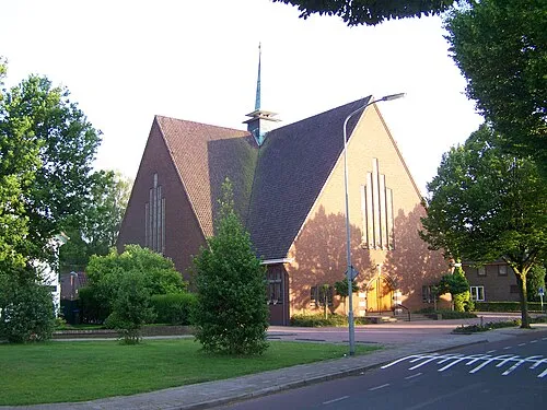
Nieuwe Kerk ArjanH · CC BY-SA 3.0 -
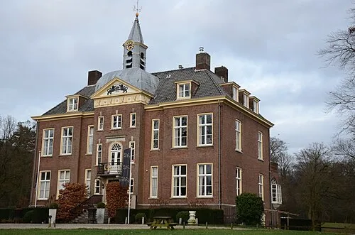
Hoekelum Henk Monster · CC BY 3.0 -
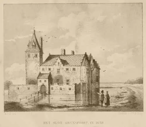
Kasteel Grunsfoort M.S.N. del · Public domain


Travel notes for Gemeente Wageningen
From Wikivoyage
Wageningen is a town along the Rhine river within the province of Gelderland in the Netherlands. Because of its famous agricultural university, it is more lively than one would expect from a Dutch town with 39,000 inhabitants (2019). In 2007 it had residents from 152 different countries, mainly being students at the university. Wageningen was the site of the formal surrender of the Germans to the Allies in the Netherlands on May 5, 1945, a day that is a public holiday in the Netherlands. Wageningen hosts a military veterans parade and this is followed by great alcohol consumption in the town.
Understand+
Wageningen lies close to the right bank of the branch of the Rhine estuary known in the Netherlands as the Nederrijn. Excavations date a settlement at this site back to the Stone Age. The hills to the east of the town provided protection for a Bronze Age tribe from flooding of the Rhine and from enemies and the earliest record of the name (in 838AD) is from the same hilly area. The town has had a chequered history, being occupied or destroyed on several occasions. Also, in 1421 the Rhine changed course, moving further south and, in the process, having a detrimental effect on Wageningen's trade. In the 17th century the town started tobacco cultivation and there were several cigar manufacturers. The floodplain of the Rhine to the south also had several brick factories, one of which can still be seen.
In 1876 the Dutch government decided to build the first agricultural school in Wageningen on the grounds that it was in the heart of the country and was surrounded by a wide variety of soils. Since then the town has boomed and Wageningen University is now a world-renowned Life Sciences university. Wageningen also has the largest inland port in the Netherlands.
Get in+
The story goes that Wageningen was given the choice of getting a university or a train station. It chose the university, and still doesn't have a station. There is a station called Ede-Wageningen but it is close to Ede and 8 km from Wageningen.
The Ede-Wageningen station is about an hour from Amsterdam or from Schiphol airport. From these stations look for trains headed to Arnhem and Nijmegen. There is a train every half an hour from Amsterdam and every half an hour from Schiphol. If you miss the direct train you can take a train to Utrecht and change there. Arriving at Ede-Wageningen, take Bus No. 88 to downtown Wageningen (turn left at bottom of stairs leading down from the platforms). This stops at many of the student residences en route. By taxi (turn right at bottom of stairs) the journey will cost €25.
From Arnhem, take Bus No. 51 or 52 from Arnhem station to Wageningen bus station.
Wageningen can be reached by car from highway A12, which passes to the north, A15, which passes to the south and can be reached by a ferry over the Rhine, and the A50, which passes to the east.
For information on the various types of bus and train tickets see Netherlands#Get around.
Source: Wikivoyage · CC BY-SA 4.0 · abridged
Twin towns and sister cities of Gemeente Wageningen
- Gödöllő· Hungary
Source: Wikidata. Only places with a page on this site are shown.
Population of Gemeente Wageningen over time
| 1960 | 22,904 | |
|---|---|---|
| 1971 | 27,454 | |
| 1980 | 30,651 | |
| 1990 | 32,818 | |
| 2000 | 33,826 | |
| 2010 | 36,642 | |
| 2016 | 37,865 | |
| 2017 | 38,458 | |
| 2018 | 38,412 | |
| 2019 | 38,774 | |
| 2020 | 39,664 | |
| 2021 | 39,635 |
Censuses and official estimates; source: Wikidata.
Climate of Gemeente Wageningen
Best months for sightseeingBest months for sightseeing: June–August.
This month · November
A cold month
Day 9° · Night 3° · Rain 76 mm
- Hottest month
- August (day 23°)
- Coldest month
- February (night 0°)
- Wettest month
- December (79 mm)
- Driest month
- April (47 mm)
Bars: average monthly low and high temperature. Below: precipitation. Monthly averages for 1970–2000 at about 18 km resolution, adjusted for elevation. Highlighted months are mild and relatively dry. Source: WorldClim 2.1 (CC BY 4.0).
Show values as a table
| Month | Jan | Feb | Mar | Apr | May | Jun | Jul | Aug | Sep | Oct | Nov | Dec |
|---|---|---|---|---|---|---|---|---|---|---|---|---|
| Average high (°C) | 5° | 6° | 10° | 13° | 18° | 20° | 23° | 23° | 19° | 14° | 9° | 6° |
| Average low (°C) | 0° | 0° | 2° | 4° | 8° | 11° | 12° | 12° | 10° | 6° | 3° | 1° |
| Precipitation (mm) | 71 | 51 | 68 | 47 | 61 | 75 | 69 | 59 | 73 | 70 | 76 | 79 |
How to get to Gemeente Wageningen
The nearest airport is Weeze (Niederrhein) Airport (NRN), 52 km to the southeast as the crow flies. The nearest large city is Arnhem, 17 km to the east.
Airports
- Weeze (Niederrhein) Airport (NRN) Weeze 52 kmsoutheast
- Eindhoven Airport (EIN) Eindhoven 61 kmsouth
- Amsterdam Airport Schiphol (AMS) Amsterdam 72 kmnorthwest
Nearby large cities
- Arnhem Population: 162.4K 17 kmeast
- Nijmegen Population: 177.4K 19 kmsoutheast
- Amersfoort Population: 139.9K 28 kmnorthwest
- Apeldoorn Population: 136.7K 34 kmnortheast
- 's-Hertogenbosch Population: 160.8K 39 kmsouthwest
Straight-line distances; road distances are longer. Airport data: OurAirports.
Day trips from Gemeente Wageningen
Within 100 km: 205 historic and cultural sites, 301 natural sites, 226 lakes, rivers and coasts.
0–25 km33 places
- Oude Rijn River 25 kmE
- Zwarte Berg Mountain 23 kmNE
- Valenberg Mountain 12 kmNE
- Tonberg Mountain 21 kmE
25–60 km151 places
- Putjensberg Mountain 53 kmNE
- Wijlermeer Lake 26 kmSE
- Strang Lake 38 kmE
- Schmales Meer Lake 57 kmSE
60–100 km548 places
- IJsselmonde Island 80 kmW
- Zandbergen Natural site 92 kmSW
- Zeven-Heerlijkhedenheide Natural site 85 kmS
- Wegmeerheide Natural site 80 kmSW
Straight-line distances.
Places in Gemeente Wageningen
2 places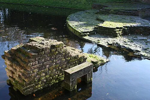
Wageningen
Population: 35.4K
Nearby attractions & nature
Everything nearby-
Kasteel Grunsfoort Historic site, Renkum Municipality3.8 km E
-
Hoekelum Historic site, Ede Municipality5.2 km N
-
Nieuwe Kerk Attraction, Ede Municipality7.6 km N
-
Paasheuvel Mountain, Rhenen Municipality8.1 km W
-
Drieberg Mountain, Ede Municipality8.9 km N
-
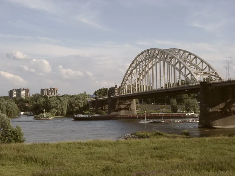 Waalbrug Landmark, Nijmegen Municipality19 km SE
Sources & licences
Data last updated: · 2 independent sources