- Population
- 510
- 510
- Elevation
- 7 m
- above sea level
- Local time
- UTC+01:00
- Europe/Amsterdam · UTC+01:00
- Airports
- NRN Weeze (Niederrhein) Airport36 km
- EIN Eindhoven Airport44 km
About Balgoy
Balgoy is a village. Location: Gemeente Wijchen, Gelderland. Population: 510. Elevation: 7 m.
Balgoij or Balgoy (Dutch pronunciation: [bɑlˈɣoːi̯]) is a village in Gelderland, Netherlands, near the river Meuse. It belongs to the Wijchen municipality. Until 1923, Balgoij was a separate municipality. In 1958, the hamlet of Keent was transferred to Oss in North Brabant due to the canalisation of the Maas. The village was first mentioned in 1172 as Balgoie, and means swelling of land near water. In 1840, it was home to 406 people.
Source: Wikipedia · CC BY-SA 4.0
Population of Balgoy over time
| 1815 | 346 | |
|---|---|---|
| 1830 | 393 | |
| 1840 | 397 | |
| 1849 | 414 | |
| 1859 | 403 | |
| 1869 | 441 | |
| 1879 | 460 | |
| 1889 | 449 | |
| 1909 | 510 |
Censuses and official estimates; source: Wikidata.
Climate of Balgoy
Best months for sightseeingBest months for sightseeing: June–August.
This month · November
A cold month
Day 9° · Night 3° · Rain 71 mm
- Hottest month
- August (day 23°)
- Coldest month
- February (night 0°)
- Wettest month
- June (73 mm)
- Driest month
- April (45 mm)
Bars: average monthly low and high temperature. Below: precipitation. Monthly averages for 1970–2000 at about 18 km resolution, adjusted for elevation. Highlighted months are mild and relatively dry. Source: WorldClim 2.1 (CC BY 4.0).
Show values as a table
| Month | Jan | Feb | Mar | Apr | May | Jun | Jul | Aug | Sep | Oct | Nov | Dec |
|---|---|---|---|---|---|---|---|---|---|---|---|---|
| Average high (°C) | 5° | 6° | 10° | 13° | 18° | 21° | 23° | 23° | 19° | 14° | 9° | 6° |
| Average low (°C) | 0° | 0° | 2° | 4° | 8° | 11° | 12° | 12° | 10° | 6° | 3° | 1° |
| Precipitation (mm) | 66 | 49 | 66 | 45 | 60 | 73 | 66 | 56 | 70 | 65 | 71 | 73 |
How to get to Balgoy
The nearest airport is Weeze (Niederrhein) Airport (NRN), 36 km to the southeast as the crow flies. The nearest large city is Nijmegen, 12 km to the northeast.
Airports
- Weeze (Niederrhein) Airport (NRN) Weeze 36 kmsoutheast
- Eindhoven Airport (EIN) Eindhoven 44 kmsouthwest
- Amsterdam Airport Schiphol (AMS) Amsterdam 88 kmnorthwest
Nearby large cities
- Nijmegen Population: 177.4K 12 kmnortheast
- Arnhem Population: 162.4K 26 kmnortheast
- 's-Hertogenbosch Population: 160.8K 30 kmwest
- Eindhoven Population: 235.7K 41 kmsouthwest
- Amersfoort Population: 139.9K 47 kmnorthwest
Straight-line distances; road distances are longer. Airport data: OurAirports.
Day trips from Balgoy
Within 100 km: 269 historic and cultural sites, 388 natural sites, 357 lakes, rivers and coasts.
0–25 km23 places
- Wijlermeer Lake 17 kmE
- Forst Reichswald Natural site 23 kmE
- Wallwässerung River 22 kmE
- Steinwässerung River 18 kmE
25–60 km207 places
- Poppelsche Leij River 52 kmSW
- Warmbeek River 56 kmS
- Rioolbeek River 56 kmS
- Goorle Loop River 58 kmSW
60–100 km784 places
- IJsselmonde Island 83 kmW
- Putjensberg Mountain 71 kmN
- Putse Moer Lake 99 kmSW
- Stappensven Lake 97 kmSW
Straight-line distances.
Nearby attractions & nature
Everything nearby-
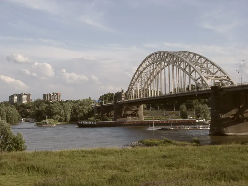 Waalbrug Landmark, Nijmegen Municipality13 km NE
-
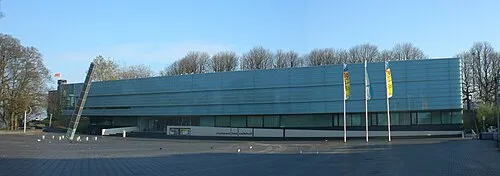 Museum Het Valkhof Museum, Nijmegen Municipality13 km NE
-
Hooge Langeberg Mountain, Berg en Dal Municipality12 km E
-
Lage Langeberg Mountain, Berg en Dal Municipality12 km E
-
Muntberg Mountain, Berg en Dal Municipality13 km E
-
Hooge Hoenderberg Mountain, Berg en Dal Municipality13 km E
Sources & licences
Data last updated: · 2 independent sources