- Population
- 295
- 295
- Elevation
- 9 m
- above sea level
- Local time
- UTC+01:00
- Europe/Amsterdam · UTC+01:00
- Airports
- NRN Weeze (Niederrhein) Airport39 km
- EIN Eindhoven Airport44 km
About Niftrik
Niftrik is a village. Location: Gemeente Wijchen, Gelderland. Population: 295. Elevation: 9 m.
Niftrik (Dutch pronunciation: [ˈnɪftrɪk]) is a village in the Dutch province of Gelderland. It is located in the municipality of Wijchen, about 4 km southwest of that town. The village was first mentioned in 1117 as Nifterka. The etymology is unclear. The first church was built in 1308. After the Eighty Years' War, it became a Dutch Reformed church. In 1715, the Catholics built a clandestine church in the village. In 1795, the village church was returned to Roman Catholic church.
Source: Wikipedia · CC BY-SA 4.0
Climate of Niftrik
Best months for sightseeingBest months for sightseeing: June–August.
This month · November
A cold month
Day 9° · Night 3° · Rain 71 mm
- Hottest month
- August (day 23°)
- Coldest month
- February (night 0°)
- Wettest month
- June (73 mm)
- Driest month
- April (45 mm)
Bars: average monthly low and high temperature. Below: precipitation. Monthly averages for 1970–2000 at about 18 km resolution, adjusted for elevation. Highlighted months are mild and relatively dry. Source: WorldClim 2.1 (CC BY 4.0).
Show values as a table
| Month | Jan | Feb | Mar | Apr | May | Jun | Jul | Aug | Sep | Oct | Nov | Dec |
|---|---|---|---|---|---|---|---|---|---|---|---|---|
| Average high (°C) | 5° | 6° | 10° | 13° | 18° | 21° | 23° | 23° | 19° | 14° | 9° | 6° |
| Average low (°C) | 0° | 0° | 2° | 4° | 8° | 11° | 12° | 12° | 10° | 6° | 3° | 1° |
| Precipitation (mm) | 66 | 49 | 66 | 45 | 60 | 73 | 66 | 56 | 70 | 65 | 71 | 73 |
How to get to Niftrik
The nearest airport is Weeze (Niederrhein) Airport (NRN), 39 km to the southeast as the crow flies. The nearest large city is Nijmegen, 14 km to the northeast.
Airports
- Weeze (Niederrhein) Airport (NRN) Weeze 39 kmsoutheast
- Eindhoven Airport (EIN) Eindhoven 44 kmsouthwest
- Amsterdam Airport Schiphol (AMS) Amsterdam 84 kmnorthwest
Nearby large cities
- Nijmegen Population: 177.4K 14 kmnortheast
- Arnhem Population: 162.4K 26 kmnortheast
- 's-Hertogenbosch Population: 160.8K 28 kmsouthwest
- Eindhoven Population: 235.7K 42 kmsouth
- Amersfoort Population: 139.9K 44 kmnorthwest
Straight-line distances; road distances are longer. Airport data: OurAirports.
Nearby attractions & nature
Everything nearby-
 Waalbrug Landmark, Nijmegen Municipality15 km NE
-
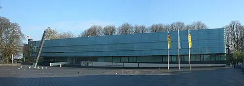 Museum Het Valkhof Museum, Nijmegen Municipality15 km E
-
Hooge Langeberg Mountain, Berg en Dal Municipality15 km E
-
 Duivelsberg Mountain, Berg en Dal Municipality19 km E
-
Lage Langeberg Mountain, Berg en Dal Municipality15 km E
-
Muntberg Mountain, Berg en Dal Municipality16 km E
Sources & licences
Data last updated: · 2 independent sources