's-Hertogenbosch
Local name: Den Bosch
Located in Gemeente 's-Hertogenbosch, North Brabant Coordinates: 51°41′57″ N 5°18′15″ E
- Population
- 160,783
- 160.8K
- Elevation
- 7 m
- above sea level
- Local time
- UTC+01:00
- Europe/Amsterdam · UTC+01:00
- Airports
- EIN Eindhoven Airport28 km
- NRN Weeze (Niederrhein) Airport59 km
About 's-Hertogenbosch
's-Hertogenbosch is a city. Location: Gemeente 's-Hertogenbosch, North Brabant. Population: 160,783. Elevation: 7 m.
's-Hertogenbosch (Dutch: [ˌsɛrtoːɣə(m)ˈbɔs] ), colloquially known as Den Bosch (pronounced [dɛm ˈbɔs] ), is a city and municipality in the Netherlands with a population of 160,783. It is the capital of the province of North Brabant and its fourth largest city by population. The city is directly south of the Maas river and near the Waal.
Source: Wikipedia · CC BY-SA 4.0
Photos of 's-Hertogenbosch
-

DanielvdBrink · CC BY-SA 4.0 -

FrDr · CC BY-SA 4.0 -

Daan0416 · CC0 -

Jaap-073 · CC0 -

Jaap-073 · CC0


Travel notes for 's-Hertogenbosch
From Wikivoyage
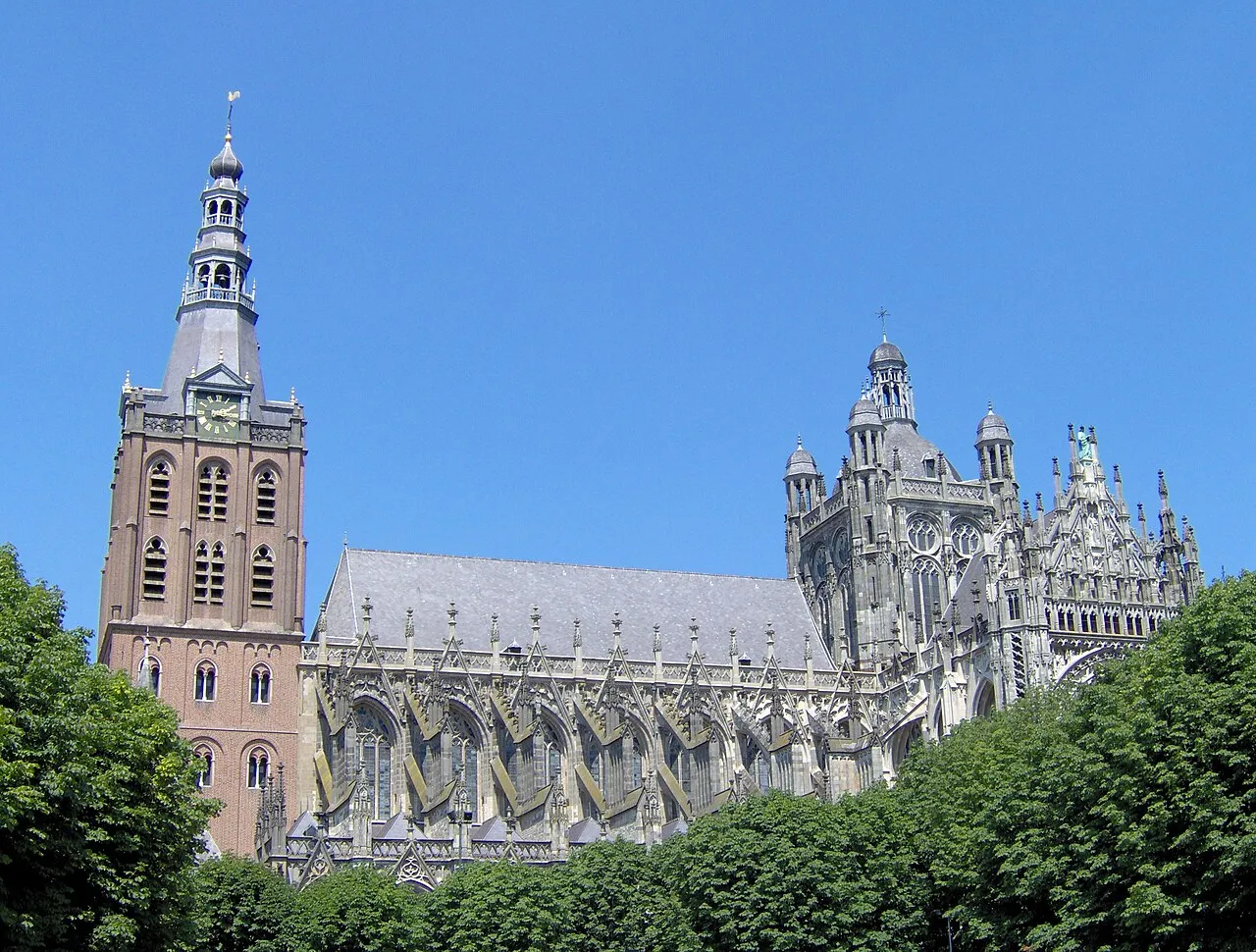
's-Hertogenbosch, commonly known as Den Bosch, is a city in the south of the Netherlands and the capital of the province of North Brabant. Once a stronghold, vital in the protection of the young Dutch nation, Den Bosch has a charming and well-preserved medieval centre. Wander through the winding streets to see Saint John's Cathedral and then pick out a street terrace on the market square to relax with a chilling beer. Take a boat to see part of the unique Binnendieze, a subterranean network of canals under the city, or head to the south part of town where the ancient ramparts still mark the border of the city and the beginning of a natural reserve area. In short: what Den Bosch lacks in fame, it makes up for in charm. A place well worth visiting.
Understand+
Located where the rivers Aa and Dommel meet, the city of 's-Hertogenbosch became a city in 1184. It is one of the foremost cities of the historic Duchy of Brabant (1183 - 1794), which roughly consisted of the Dutch province of Noord-Brabant and large pieces of Flanders. Being one of the first cities founded in the Low Countries during the Mediaeval period, the charter which granted Den Bosch its city rights was subsequently used and adapted by a lot of other newly founded cities throughout the Low Countries.
's-Hertogenbosch lends its name to the very Duchy it was once located in, meaning "The Duke's forest". Its shorter name, Den Bosch, is an abbreviation of said name. In other languages of mainland Europe, the name of the city is often translated (German: Herzogenbusch, French: Bois-le-Duc), which is fairly unique with Dutch cities.
The city holds significance for the Netherlands as a whole due to its siege of 1629 being a turning point for the Dutch revolution and the independence war that formed from said revolution. The city until that point had been considered to be impossible to successfully besiege, earning it the nickname De Moerasdraak (The Swamp Dragon). The capitulation of the city after a siege of half a year, gave stadtholder Frederik Hendrik the highest victory of his military career with him thus forth being known as De Stedendwinger (The subjugator of cities), but also led to an exodus of many Catholic citizens and clergy, as a reparation for the siege.
The population of Den Bosch is approximately 151,000 and with that it is reaching its limits, because almost all the ground available for building has been used. This does not mean that the whole area is one big city, as there are several (big) parks. Likewise, the southern edge of the city is totally green as this is a protected natural reserve.
Den Bosch can be seen in 9 regions (note: these regions are built up of several neighborhoods):
Get in+
By plane:
Amsterdam Airport Schiphol (AMS IATA), the largest airport in the Netherlands and of Europe's most important intercontinental hubs, is roughly 1½ hr away from Den Bosch by train. The cost is €17.80 for the complete journey. There are multiple times an hour allowing such connections. Consult e.g. 9292.nl for the most convenient option.
Eindhoven Airport (EIN IATA), the country's second largest, is in Brabant and is mainly served by low-fare carriers from many European cities, with special emphasis on Eastern Europe and the Mediterranean. Getting to Den Bosch from Eindhoven is as simple as taking one of the many trains shuttling every hour between the cities, taking less than 20 minutes to connect them, but you must get a bus ride from the airport to Eindhoven station first, adding another 20 minutes to the travel time. With some walking and waiting factored it, the total journey time should not be over 50 minutes and will only cost you €6.30 in total.
Rotterdam The Hague Airport (RTM IATA) is a smaller, business-focused airport in the city of Rotterdam, which can be used as an alternative to Schiphol from some destinations. The airport also does not have a direct train connection - you need to take the bus to Rotterdam Centraal (20 min) and then a direct Intercity train to 's Hertogenbosch. Total journey time is under two hours and cost is less than €18.
By train:
Den Bosch has a good location within the railway system of the "Nederlandse Spoorwegen" (Dutch Railroads) and almost every city has a direct connection or with a single stopover. Trains depart from Den Bosch main station in city center, which is located at the 'Stationsweg', towards Utrecht-Amsterdam-Haarlem and Utrecht-Schiphol in the north, in the direction of Nijmegen-Arnhem-Zwolle in the east, towards Eindhoven-Maastricht in the south and Tilburg-Breda-Roosendaal in the west.
By car:
Source: Wikivoyage · CC BY-SA 4.0 · abridged
Places bordering 's-Hertogenbosch
- Hoenzadriel
- Maren-Kessel
- Rosmalen
- Den Dungen
- Sint-Michielsgestel
- Vught
- Cromvoirt
- Vlijmen
- Hedikhuizen
- Well
- Ammerzoden
- Hedel
Twin towns and sister cities of 's-Hertogenbosch
- Trier· Germany
Source: Wikidata. Only places with a page on this site are shown.
Climate of 's-Hertogenbosch
Best months for sightseeingBest months for sightseeing: June–August.
This month · November
A cold month
Day 9° · Night 3° · Rain 75 mm
- Hottest month
- August (day 23°)
- Coldest month
- February (night 0°)
- Wettest month
- November (75 mm)
- Driest month
- April (45 mm)
Bars: average monthly low and high temperature. Below: precipitation. Monthly averages for 1970–2000 at about 18 km resolution, adjusted for elevation. Highlighted months are mild and relatively dry. Source: WorldClim 2.1 (CC BY 4.0).
Show values as a table
| Month | Jan | Feb | Mar | Apr | May | Jun | Jul | Aug | Sep | Oct | Nov | Dec |
|---|---|---|---|---|---|---|---|---|---|---|---|---|
| Average high (°C) | 6° | 6° | 10° | 13° | 18° | 20° | 23° | 23° | 19° | 14° | 9° | 7° |
| Average low (°C) | 0° | 0° | 2° | 4° | 8° | 10° | 12° | 12° | 10° | 6° | 3° | 1° |
| Precipitation (mm) | 68 | 50 | 67 | 45 | 61 | 70 | 69 | 57 | 71 | 70 | 75 | 73 |
How to get to 's-Hertogenbosch
The nearest airport is Eindhoven Airport (EIN), 28 km to the south as the crow flies. The nearest large city is Tilburg, 22 km to the southwest.
Airports
- Eindhoven Airport (EIN) Eindhoven 28 kmsouth
- Weeze (Niederrhein) Airport (NRN) Weeze 59 kmeast
- Rotterdam The Hague Airport (RTM) Rotterdam 66 kmnorthwest
Nearby large cities
- Tilburg Population: 221.9K 22 kmsouthwest
- Eindhoven Population: 235.7K 31 kmsoutheast
- Breda Population: 184.1K 39 kmwest
- Nijmegen Population: 177.4K 41 kmnortheast
- Dordrecht Population: 119.3K 45 kmwest
Straight-line distances; road distances are longer. Airport data: OurAirports.
Day trips from 's-Hertogenbosch
Within 100 km: 262 historic and cultural sites, 378 natural sites, 503 lakes, rivers and coasts.
0–25 km13 places
- Poppelsche Leij River 25 kmSW
- Schoonberg Mountain 10 kmS
- Patersberg Mountain 4 kmS
- Fort Isabella Historic site 3 kmS
25–60 km201 places
- IJsselmonde Island 57 kmW
- Zandbergen Natural site 55 kmS
- Zeven-Heerlijkhedenheide Natural site 49 kmS
- Wegmeerheide Natural site 41 kmSW
60–100 km929 places
- Putjensberg Mountain 91 kmNE
- Putse Moer Lake 70 kmSW
- Stappensven Lake 68 kmSW
- Kleine Weel Lake 91 kmSW
Straight-line distances.
's-Hertogenbosch and similar cities
Side by side with cities of similar size in the same country: population, elevation and climate.
| Measure | 's-Hertogenbosch | Arnhem | Haarlem | Enschede |
|---|---|---|---|---|
| Population | 160.8K | 162.4K | 162.5K | 153.7K |
| Elevation | 7 m | 16 m | 10 m | 45 m |
| Summer day (hottest month) | 23° | 23° | 21° | 22° |
| Winter night (coldest month) | 0° | 0° | 1° | -1° |
| Annual rainfall | 776 mm | 791 mm | 828 mm | 776 mm |
| Best months | Jun–Aug | Jun–Aug | Jun–Aug | Jun–Aug |
| Distance | — | 52 km | 89 km | 124 km |
Climate values are 1970–2000 monthly averages; straight-line distance.
Nearby attractions & nature
Everything nearby-
Herzogenbusch Concentration Camp (Continental) Historic site, Gemeente 's-Hertogenbosch0.2 km S
-
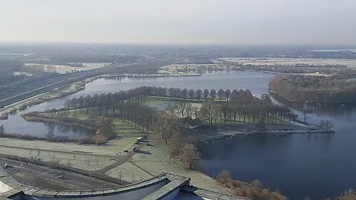 Pettelaarse Schans Historic site, Gemeente 's-Hertogenbosch3 km SE
-
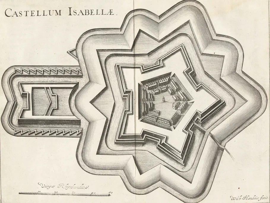 Fort Isabella Historic site, Gemeente Vught3 km S
-
Patersberg Mountain, Sint-Michielsgestel Municipality3.8 km S
-
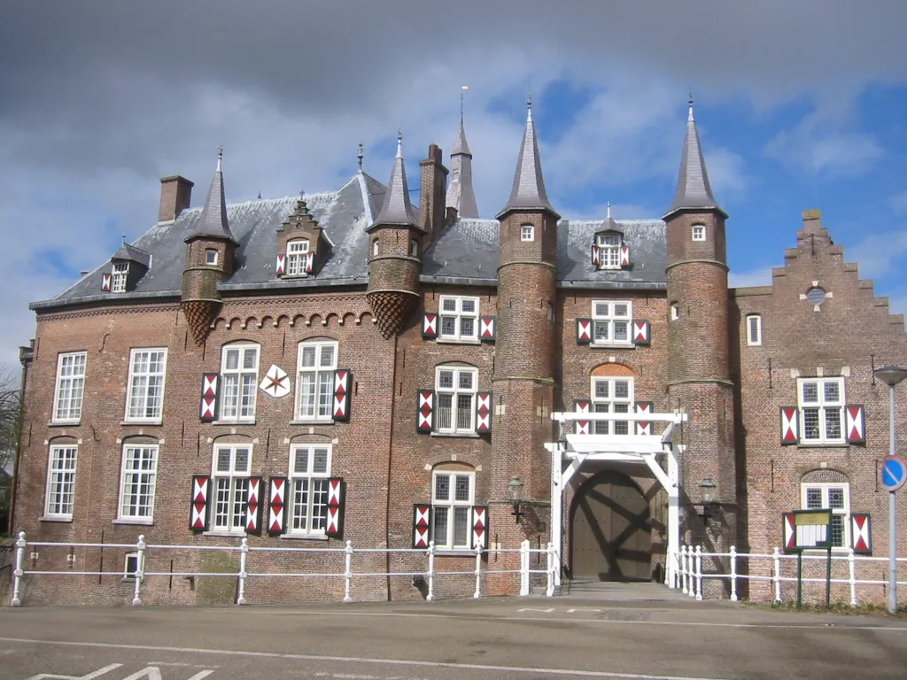 Kasteel Maurick Historic site, Gemeente Vught4.5 km S
-
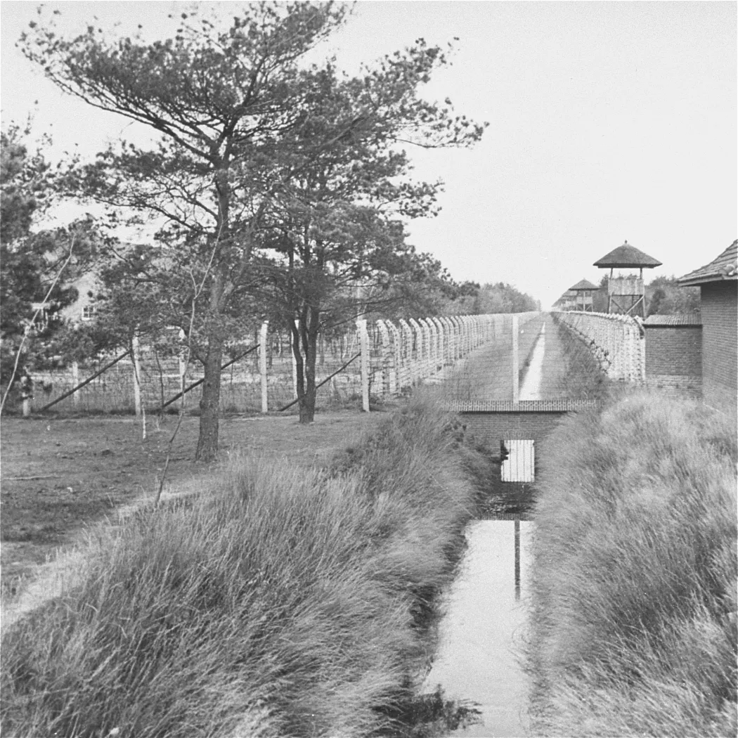 Herzogenbusch Concentration Camp Historic site, Gemeente Vught5 km SW
-
Sint Michielsgestel Concentration Camp Historic site, Sint-Michielsgestel Municipality7.3 km SE
-
Schoonberg Mountain, Sint-Michielsgestel Municipality10 km S
Sources & licences
Data last updated: · 2 independent sources