Beek en Donk
Located in Laarbeek Municipality, North Brabant Coordinates: 51°32′30″ N 5°37′34″ E
- Population
- 9,300
- 9.3K
- Elevation
- 13 m
- above sea level
- Local time
- UTC+01:00
- Europe/Amsterdam · UTC+01:00
- Airports
- EIN Eindhoven Airport20 km
- NRN Weeze (Niederrhein) Airport36 km
About Beek en Donk
Beek en Donk is a village. Location: Laarbeek Municipality, North Brabant. Population: 9,300. Elevation: 13 m.
Beek en Donk is a town in the province North Brabant, Netherlands. There are 10,028 inhabitants. The spoken language is Peellands (an East Brabantian dialect, which is very similar to colloquial Dutch).
Source: Wikipedia · CC BY-SA 4.0
Photos of Beek en Donk
-
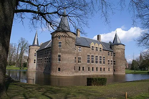
Kasteel Helmond Kasteelbeer · CC BY-SA 3.0 nl

Population of Beek en Donk over time
| 1869 | 1,410 | |
|---|---|---|
| 1879 | 1,481 | |
| 1889 | 1,565 | |
| 1899 | 1,792 | |
| 1909 | 2,117 | |
| 1920 | 2,500 | |
| 1930 | 3,188 | |
| 1947 | 3,842 | |
| 1960 | 5,279 | |
| 1971 | 7,092 | |
| 1980 | 8,615 | |
| 1990 | 9,300 |
Censuses and official estimates; source: Wikidata.
Climate of Beek en Donk
Best months for sightseeingBest months for sightseeing: June–August.
This month · November
A cold month
Day 9° · Night 3° · Rain 71 mm
- Hottest month
- August (day 23°)
- Coldest month
- February (night 0°)
- Wettest month
- December (72 mm)
- Driest month
- April (45 mm)
Bars: average monthly low and high temperature. Below: precipitation. Monthly averages for 1970–2000 at about 18 km resolution, adjusted for elevation. Highlighted months are mild and relatively dry. Source: WorldClim 2.1 (CC BY 4.0).
Show values as a table
| Month | Jan | Feb | Mar | Apr | May | Jun | Jul | Aug | Sep | Oct | Nov | Dec |
|---|---|---|---|---|---|---|---|---|---|---|---|---|
| Average high (°C) | 6° | 6° | 10° | 13° | 18° | 21° | 23° | 23° | 19° | 15° | 9° | 7° |
| Average low (°C) | 0° | 0° | 2° | 4° | 8° | 10° | 12° | 12° | 10° | 6° | 3° | 1° |
| Precipitation (mm) | 66 | 50 | 65 | 45 | 60 | 71 | 64 | 57 | 68 | 65 | 71 | 72 |
How to get to Beek en Donk
The nearest airport is Eindhoven Airport (EIN), 20 km to the southwest as the crow flies. The nearest large city is Eindhoven, 15 km to the southwest.
Airports
- Eindhoven Airport (EIN) Eindhoven 20 kmsouthwest
- Weeze (Niederrhein) Airport (NRN) Weeze 36 kmeast
- Maastricht Aachen Airport (MST) Maastricht 71 kmsouth
Nearby large cities
- Eindhoven Population: 235.7K 15 kmsouthwest
- 's-Hertogenbosch Population: 160.8K 28 kmnorthwest
- Nijmegen Population: 177.4K 37 kmnortheast
- Tilburg Population: 221.9K 37 kmwest
- Venlo Population: 102K 42 kmsoutheast
Straight-line distances; road distances are longer. Airport data: OurAirports.
Day trips from Beek en Donk
Within 100 km: 319 historic and cultural sites, 500 natural sites, 577 lakes, rivers and coasts.
0–25 km11 places
- Vossenheuvel Mountain 24 kmSE
- Schoonberg Mountain 22 kmW
- Hondsberg Mountain 21 kmE
- Hansenberg Mountain 22 kmE
25–60 km319 places
- Zandbergen Natural site 52 kmSW
- Zeven-Heerlijkhedenheide Natural site 42 kmSW
- Wegmeerheide Natural site 48 kmW
- Warandeheide Natural site 40 kmSW
60–100 km1,066 places
- IJsselmonde Island 85 kmNW
- Putjensberg Mountain 99 kmN
- Île Monsin Island 98 kmS
- Île de Franche Garenne Island 94 kmS
Straight-line distances.
Nearby attractions & nature
Everything nearby-
Kasteel Helmond Historic site, Gemeente Helmond7.4 km S
-
 Philips Stadium Landmark, Eindhoven Municipality16 km SW
-
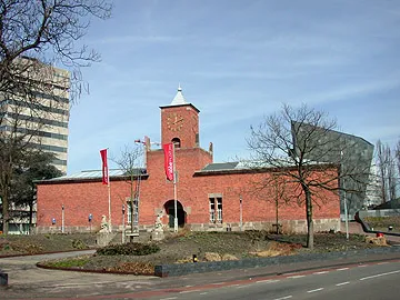 Van Abbe museum Museum, Eindhoven Municipality16 km SW
-
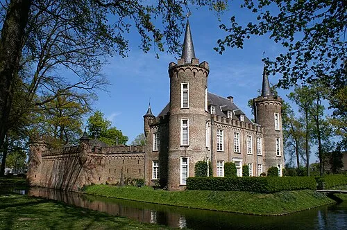 Henkenshage Historic site, Meierijstad12 km W
-
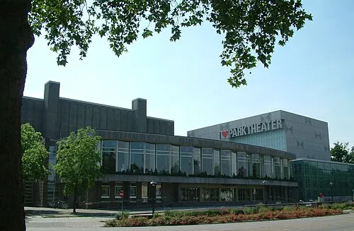 Parktheater Eindhoven Attraction, Eindhoven Municipality16 km SW
-
Eindhoven Concentration Camp Historic site, Eindhoven Municipality16 km SW
Sources & licences
Data last updated: · 2 independent sources