Amstelveen
Located in Amstelveen Municipality, North Holland Coordinates: 52°18′03″ N 4°51′50″ E
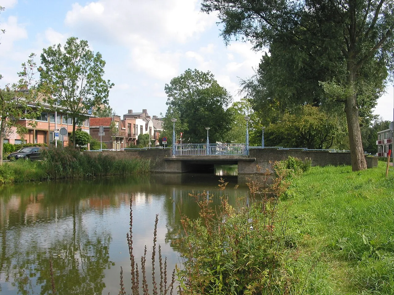
- Population
- 79,639
- 79.6K
- Elevation
- 0 m
- above sea level
- Local time
- UTC+01:00
- Europe/Amsterdam · UTC+01:00
- Airports
- AMS Amsterdam Airport Schiphol7 km
- RTM Rotterdam The Hague Airport48 km
About Amstelveen
Amstelveen is a town. Location: Amstelveen Municipality, North Holland. Population: 79,639. Elevation: 0 m. The best months to visit are June–August. The nearest airport is Amsterdam Airport Schiphol (7 km). Nearby sights include Olympic Stadium and Monument Indië-Nederland.
Photos of Amstelveen
-

Han Jongeneel · CC BY 3.0 -

Han Jongeneel · CC BY 3.0 -
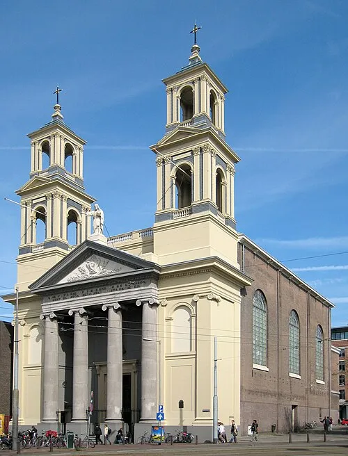
Mozes en Aäronkerk S Sepp · CC BY-SA 3.0 -
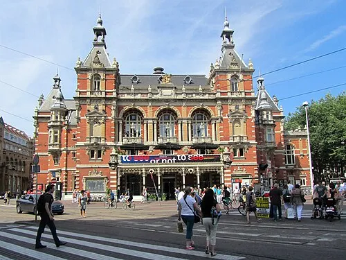
Stadsschouwburg Amsterdam Jvhertum · CC BY-SA 3.0 -
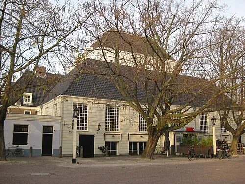
Amstelkerk Marion Golsteijn · CC BY-SA 3.0


Travel notes for Amstelveen
From Wikivoyage
Amstelveen is a town in Amstelland. It is a suburb of Amsterdam. In 2003 Amstelveen was named Most attractive city of the Netherlands for its proximity to the nation's capital Amsterdam, its safety, accessibility and richness of culture.
Understand+
Amstelveen, known as Nieuwer-Amstel until 1964, is a city in the Amstelland. The city grew from a town founded for the harvesting of bog, which was a popular fuel at the time. During the seventeenth and eighteenth century, wealthy Amsterdammers moved to the town in search of some peace and quiet. Southern Amsterdam used to be a part of the municipality. After annexation of Amsterdam Zuid, the former town hall of Nieuwer-Amstel housed the Amsterdam city archives from 1914 to 2007.
Not late after the first annexation, in 1921, another annexation followed taking away the northern and most densely populated part of Amstelveen. This left the municipality to conclude of the town of Amstelveen as well as several small towns. Amstelveen, however, kept its appeal to the wealthier citizens of Amsterdam, which shows from the suburbs built around 1930 in the northwest of the municipality.
After the Second World War, Nieuwer-Amstel became an overflow for Amsterdam, housing more and more people that could not find or did not want a home in Amsterdam, and for people that worked at the growing Schiphol Airport. During the 1960s Amstelveen was the fastest growing city of the Netherlands. In 1964 the municipality was renamed after the city that by now was considered an extension of Amsterdam.
Since the last half of the 1990s, Amstelveen's expansion has become more and more gradual. At this time, no further expansion is planned. The most recent expansion is Westwijk to the southwest of town. To suit the needs of the existing population, Stadshart has been created to replace the old town centre, located about 1 kilometre (0.6 mi) west of Stadsplein, Stadshart's main square. In Stadshart you will find a central library, a large mall, cultural and gastronomical services, and offices.
Get in+
By car:
The A9 crosses straight through the municipality and functions as a ring-road for traffic that does not need to go to Amsterdam per se. Amstelveen can be reached from The Hague, Rotterdam and Leiden using the A4 followed by the A9 once having passed by Schiphol. Utrecht, Den Bosch and Eindhoven can use the A2, followed by the A9 after passing by Abcoude. Apeldoorn and everything north of there is best off using the A1, followed by a kilometre of A2 heading away from Amsterdam, quickly followed by the A9.
By public transit:
Tram line 5 comes from Leidesplein in Amsterdam (connecting there with other tram lines from Amsterdam Centraal Station), passes Amsterdam Zuid station and terminates at 1 Stadshart (former name: Binnenhof) in Amstelveen. Tram line 25 runs between Amsterdam Zuid station and Uithoorn; it bypasses Stadshart. The 2 Amstelveen bus station is about 700 metres east of the Stadshart tram terminal, near the Stadsplein. Busses also run from the central busstation to Aalsmeer (line 171, 257 and 357), Uithoorn (line 174), Haarlem (line 300 and 356), Amsterdam Bijlmer ArenA (line 300 and 356) and Amsterdam Elandsgracht (line 357).
GVB and Connexxion have timetables and maps for public transit in the area.
By museum tram:
On Sundays from April to November, one can take a vintage tram (operating as Electrische Museumtramlijn Amsterdam) from Haarlemmermeerstation in Amsterdam/Zuid to 3 Station Amstelveen near an attractive small-town area with restaurants. Because of a construction project, the museum line will be shortened until 2026 to run south only to Molenweg, about 1 kilometre (0.6 mi) north of Amstelveen's old town centre.
Source: Wikivoyage · CC BY-SA 4.0 · abridged
Climate of Amstelveen
Best months for sightseeingBest months for sightseeing: June–August.
This month · November
A cold month
Day 9° · Night 4° · Rain 89 mm
- Hottest month
- August (day 22°)
- Coldest month
- February (night 0°)
- Wettest month
- November (89 mm)
- Driest month
- April (46 mm)
Bars: average monthly low and high temperature. Below: precipitation. Monthly averages for 1970–2000 at about 18 km resolution, adjusted for elevation. Highlighted months are mild and relatively dry. Source: WorldClim 2.1 (CC BY 4.0).
Show values as a table
| Month | Jan | Feb | Mar | Apr | May | Jun | Jul | Aug | Sep | Oct | Nov | Dec |
|---|---|---|---|---|---|---|---|---|---|---|---|---|
| Average high (°C) | 5° | 6° | 9° | 12° | 17° | 19° | 21° | 22° | 18° | 14° | 9° | 7° |
| Average low (°C) | 1° | 0° | 2° | 4° | 8° | 10° | 12° | 12° | 10° | 7° | 4° | 2° |
| Precipitation (mm) | 69 | 51 | 65 | 46 | 54 | 71 | 71 | 62 | 82 | 85 | 89 | 81 |
How to get to Amstelveen
The nearest airport is Amsterdam Airport Schiphol (AMS), 7 km to the west as the crow flies. The nearest large city is Amsterdam, 8 km to the north.
Airports
- Amsterdam Airport Schiphol (AMS) Amsterdam 7 kmwest
- Rotterdam The Hague Airport (RTM) Rotterdam 48 kmsouthwest
- Eindhoven Airport (EIN) Eindhoven 101 kmsouth
Nearby large cities
- Amsterdam Population: 741.6K 8 kmnorth
- Hoofddorp Population: 132.7K 12 kmwest
- Zaanstad Population: 140.1K 17 kmnorth
- Haarlem Population: 162.5K 18 kmnorthwest
- Almere Stad Population: 176.4K 25 kmeast
Straight-line distances; road distances are longer. Airport data: OurAirports.
Day trips from Amstelveen
Within 100 km: 139 historic and cultural sites, 95 natural sites, 39 lakes, rivers and coasts.
0–25 km65 places
- Zwarte Berg Mountain 24 kmSE
- Hoorneboeg Mountain 23 kmSE
- Eikenberg Mountain 24 kmE
- Bait-ul-Afiyat Attraction 21 kmE
25–60 km68 places
- IJsselmonde Island 54 kmSW
- Habana Beach Beach 51 kmSW
- Strandslag Sint Maartenszee Beach 57 kmN
- Strandslag Petten Beach 54 kmN
60–100 km140 places
- Texel Island 87 kmN
- Putjensberg Mountain 78 kmE
- Hassel Bos Natural site 99 kmS
- Gouverneurs Bos Natural site 96 kmS
Straight-line distances.
Amstelveen and similar cities
Side by side with cities of similar size in the same country: population, elevation and climate.
| Measure | Amstelveen | Lelystad | Hengelo | Assen |
|---|---|---|---|---|
| Population | 79.6K | 79.8K | 82.3K | 68.8K |
| Elevation | 0 m | -1 m | 18 m | 12 m |
| Summer day (hottest month) | 22° | 22° | 23° | 22° |
| Winter night (coldest month) | 0° | 1° | -1° | -1° |
| Annual rainfall | 826 mm | 803 mm | 777 mm | 829 mm |
| Best months | Jun–Aug | Jun–Aug | Jun–Aug | Jun–Aug |
| Distance | — | 48 km | 132 km | 139 km |
Climate values are 1970–2000 monthly averages; straight-line distance.
Nearby attractions & nature
Everything nearby-
Olympic Stadium Landmark, Gemeente Amsterdam4.8 km N
-
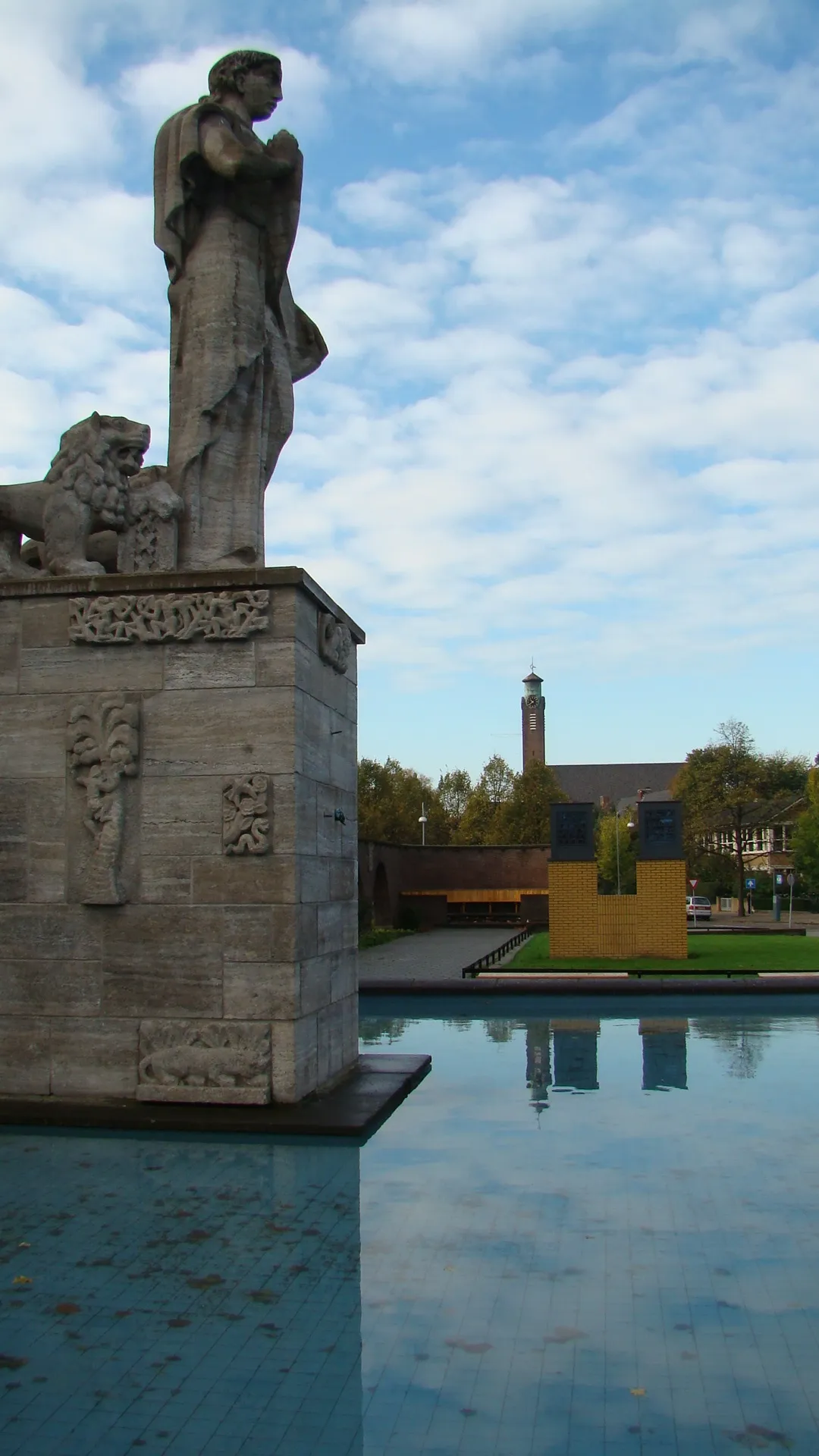 Monument Indië-Nederland Landmark, Gemeente Amsterdam5.5 km N
-
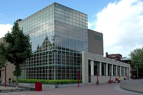 Van Gogh Museum Museum, Gemeente Amsterdam6.5 km N
-
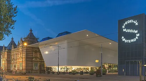 Stedelijk Museum Amsterdam Museum, Gemeente Amsterdam6.5 km N
-
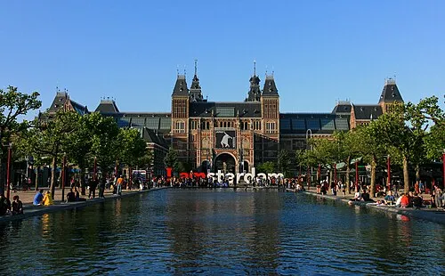 Rijksmuseum Amsterdam Museum, Gemeente Amsterdam6.7 km N
-
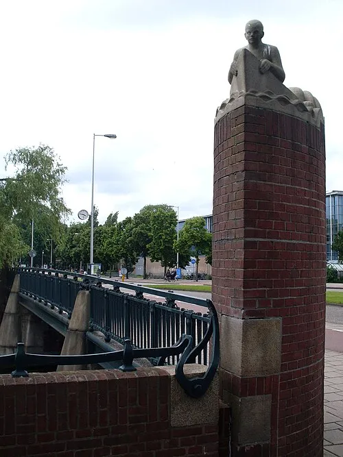 Hildo Kropbrug Landmark, Gemeente Amsterdam5.4 km N
-
Obrechtkerk Attraction, Gemeente Amsterdam6.2 km N
-
Stadsschouwburg Amsterdam Attraction, Gemeente Amsterdam7.2 km N
Sources & licences
Data last updated: