- Population
- 18,738
- 18.7K
- Elevation
- 2 m
- above sea level
- Local time
- UTC+01:00
- Europe/Amsterdam · UTC+01:00
- Airports
- AMS Amsterdam Airport Schiphol57 km
- GRQ Groningen Airport Eelde98 km
About Enkhuizen
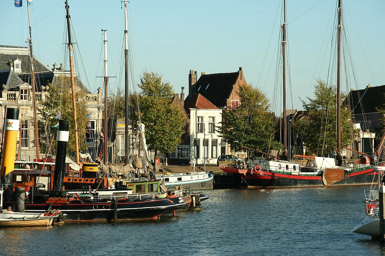
Enkhuizen is a town. Location: Gemeente Enkhuizen, North Holland. Population: 18,738. Elevation: 2 m. The best months to visit are June–August. The nearest airport is Amsterdam Airport Schiphol (57 km). Nearby sights include De Ven and Kasteel Radboud.
Photos of Enkhuizen
-

Frank Markesteijn · CC BY-SA 4.0 -

Janwillemvanaalst · CC BY-SA 4.0 -

archengigi · CC BY 3.0 -

Michielverbeek · CC BY 4.0 -

piotr iłowiecki from POLAND · CC BY-SA 2.0


Travel notes for Enkhuizen
From Wikivoyage
The small city of Enkhuizen is an old Dutch harbour town, and one of the most prominent ones of the Dutch Golden Age. It lost its trade position by the late 17th century, due to the wars with England, the silting of its waters and the rise of Amsterdam, but maintained much of its historic grandeur. Today, the town is famous for its herring and a beloved destination for its traditional Dutch feel and water sports facilities.
Understand+
This is an old city with many centuries of maritime tradition. It gained city rights in 1355 and grew to be one of the main trade harbours of the VOC, the Dutch East Indies trade company. The town was one of the first to rally behind the Prince of Orange and in return was granted the exclusive right to produce and place the sea-marks in the Zuiderzee. For that, it was allowed to charge all vessels on that sea, making the whole thing a very lucrative affair. Enkhuizen blossomed in the 17th century, gaining wealth through international trade and herring fishery. Some 25,000 people resided in the city around 1650; substantially more even than today, as some 18,500 people live here (2019). The tide changed at the end of the 17th century, however, as shifting sands made the harbour less accessible, the wars with England took great costs and nearby Amsterdam rose to fame. By 1850, the population had dramatically declined to only 5400 and Enkhuizen became a sleepy fishermen's town.
Get in+
The main road into town is the N302. It connects to Hoorn and the A7 in the west, while running as a causeway to the east, connecting Enkhuizen to Lelystad at the other side of the IJsselmeer water. The smaller 506 provides an additional direct road connection to Hoorn.
Enkhuizen is connected by rail, with all trains running in the direction of Amsterdam (1 hour). Until Hoorn, trains provide a "stop service", stopping at several smaller stations, while operating as an intercity fast train after that. Direct connections from Enkhuizen (all via Amsterdam) include Amsterdam Sloterdijk, Amsterdam Central Station, Hilversum, Amersfoort, Apeldoorn and Deventer. Amsterdam of course offers a wide range of other transfers.
In summer, there are two ferry services across the IJsselmeer:
Rederij V&O connects Enkhuizen to Stavoren in Friesland (May-September, plus more limited services in April). The ferries run 2 or 3 times per day, stopping also at the Zuiderzeemuseum, and their schedules match train times. The ferry takes about 80 minutes one way and costs €20/28.50 for an adult's single/return ticket, children up to 12 years €13.50/20, bikes €7.50/10 (as of 2026). Departure times in summer are usually 08:30, 12:30 and 16:30 from the Enkhuizen platform, near the train station, but check in advance.
De Zuiderzee has two daily departures to Urk in July and August. The journey is around 90 minutes. Adults €17.50/22.50 (single/day return), children up to 12 years €10/15, bikes €7.50/10.
Source: Wikivoyage · CC BY-SA 4.0 · abridged
Climate of Enkhuizen
Best months for sightseeingBest months for sightseeing: June–August.
This month · November
A cold month
Day 10° · Night 4° · Rain 87 mm
- Hottest month
- August (day 21°)
- Coldest month
- January (night 1°)
- Wettest month
- November (87 mm)
- Driest month
- April (43 mm)
Bars: average monthly low and high temperature. Below: precipitation. Monthly averages for 1970–2000 at about 18 km resolution, adjusted for elevation. Highlighted months are mild and relatively dry. Source: WorldClim 2.1 (CC BY 4.0).
Show values as a table
| Month | Jan | Feb | Mar | Apr | May | Jun | Jul | Aug | Sep | Oct | Nov | Dec |
|---|---|---|---|---|---|---|---|---|---|---|---|---|
| Average high (°C) | 5° | 6° | 8° | 11° | 16° | 18° | 21° | 21° | 18° | 14° | 10° | 7° |
| Average low (°C) | 1° | 1° | 2° | 4° | 8° | 11° | 13° | 13° | 11° | 8° | 4° | 2° |
| Precipitation (mm) | 66 | 48 | 62 | 43 | 51 | 63 | 66 | 64 | 82 | 86 | 87 | 77 |
How to get to Enkhuizen
The nearest airport is Amsterdam Airport Schiphol (AMS), 57 km to the southwest as the crow flies. The nearest large city is Almere Stad, 37 km to the south.
Airports
- Amsterdam Airport Schiphol (AMS) Amsterdam 57 kmsouthwest
- Groningen Airport Eelde (GRQ) Groningen 98 kmnortheast
- Rotterdam The Hague Airport (RTM) Rotterdam 101 kmsouthwest
Nearby large cities
- Almere Stad Population: 176.4K 37 kmsouth
- Zaanstad Population: 140.1K 43 kmsouthwest
- Amsterdam Population: 741.6K 46 kmsouthwest
- Haarlem Population: 162.5K 57 kmsouthwest
- Zwolle Population: 129.8K 58 kmeast
Straight-line distances; road distances are longer. Airport data: OurAirports.
Day trips from Enkhuizen
Within 100 km: 111 historic and cultural sites, 88 natural sites, 19 lakes, rivers and coasts.
0–25 km5 places
- Oosterkerk Attraction 17 kmSW
- De Ven Landmark 4 kmN
- Urk Lighthouse Landmark 21 kmE
- Kasteel Radboud Historic site 14 kmNW
25–60 km114 places
- Texel Island 52 kmNW
- Putjensberg Mountain 59 kmSE
- Strandslag Zandloper Beach 45 kmNW
- Strandslag Voordijk Beach 43 kmNW
60–100 km99 places
- Radewijkerbeek River 91 kmE
- Radewijke River 98 kmE
- Ameland Island 89 kmN
- Het Hen Beach 95 kmNE
Straight-line distances.
Nearby attractions & nature
Everything nearby-
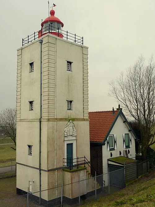 De Ven Landmark, Gemeente Enkhuizen4.3 km N
-
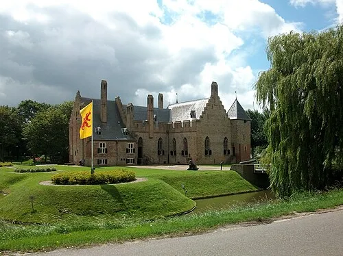 Kasteel Radboud Historic site, Medemblik Municipality14 km NW
-
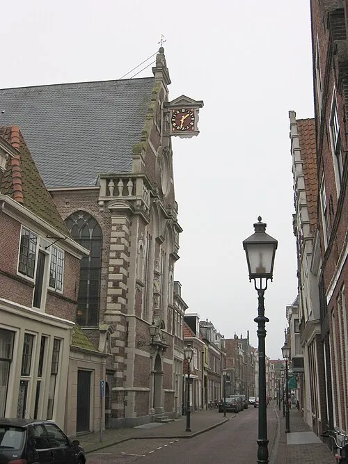 Oosterkerk Attraction, Hoorn Municipality17 km SW
-
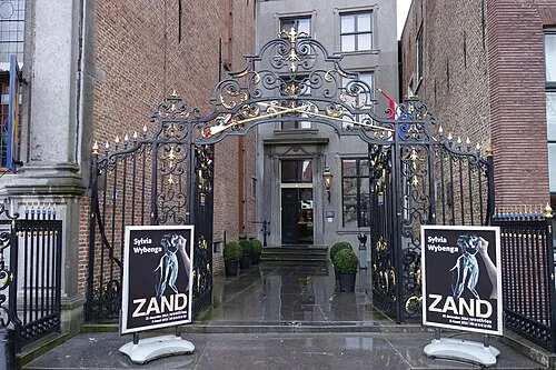 Westfries Museum Museum, Hoorn Municipality17 km SW
-
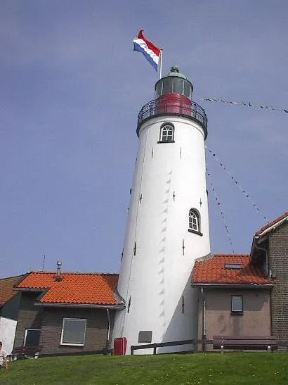 Urk Lighthouse Landmark, Urk Municipality21 km E
Sources & licences
Data last updated: