Delfzijl
Located in Eemsdelta Municipality, Province of Groningen Coordinates: 53°19′48″ N 6°55′05″ E
- Population
- 28,649
- 28.6K
- Elevation
- 0 m
- above sea level
- Local time
- UTC+01:00
- Europe/Amsterdam · UTC+01:00
- Airports
- GRQ Groningen Airport Eelde33 km
- FCN Sea-Airport Cuxhaven/Nordholz / Nordholz Naval Airbase125 km
About Delfzijl
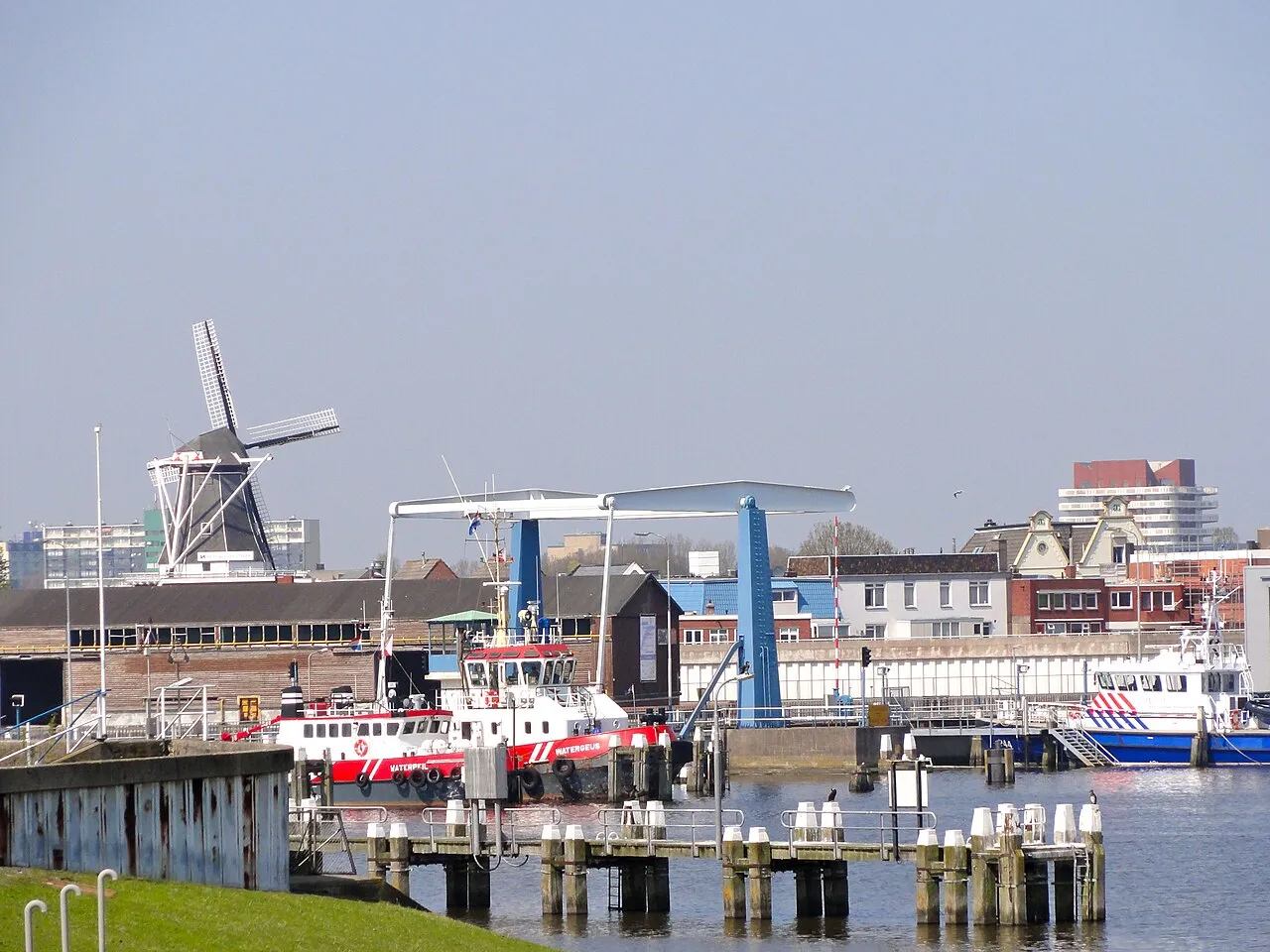
Delfzijl is a town. Location: Eemsdelta Municipality, Province of Groningen. Population: 28,649. Elevation: 0 m.
Delfzijl (Dutch: [dɛl(ə)fˈsɛil] ; Gronings: Delfziel [dɛlfˈsil]) is a city and former municipality (which now belongs to the municipality of Eemsdelta) with a population of 25,651 in the province of Groningen in the northeast of the Netherlands. Delfzijl was a sluice between the Delf and the Ems, which became fortified settlement in the 16th century. The fortifications were removed in the late 19th century.
Source: Wikipedia · CC BY-SA 4.0
Photos of Delfzijl
-

Hardscarf · CC BY-SA 4.0 -

m66roepers from Nederland · CC BY 2.0 -

Hardscarf · CC BY-SA 4.0 -

C messier · CC BY-SA 4.0 -

Wutsje · CC BY-SA 3.0


Travel notes for Delfzijl
From Wikivoyage
Delfzijl is a pleasant harbour city on the northern coast of the Netherlands. It's in the north-eastern part of Groningen Province and is home to some 20,000 people. It's not a major tourist destination, except when once every 5 years the town in turned into the bustling decor for DelfSail, a major maritime event attracting almost a million visitors who come to admire ships from all around the world. In other years, a much smaller but still fun event is held, called the Havendagen or Harbour days.
Understand+
The city has a large industrial area, a busy port, a tiny beach and a few attractions to entertain the (mostly accidental) visitors. The place is not recommended for a longer stay, but has plenty of shops, a few hotels and a well stocked public library with internet facilities.
Delfzijl gained national notoriety in 2005 and 2006 because of political turmoil caused by its bickering local politicians. One of the last mayors to leave town in a hurry (Ms. Marritje Appel), bitterly denounced the city as "Sicily of the North".
During the local elections of 2006 30% of all voters in the city of Delfzijl submitted an "abstain vote".
Tourist Information Office (VVV), J. v.d. Kornputplein 1a, ☏ +31 596-618104, vvvdelfzijl@topvangroningen.nl.
Get in+
There's a train connection from Groningen, which leaves every half-hour (€6.80, 37 minutes). It stops at Delfzijl's central station and at Delfzijl-West. The trains are operated by Arriva.
1 Delfzijl railway station, Johan van den Kornputplein 1. (updated Feb 2022)
2 Delfzijl West railway station, Hogelandsterweg 1. (updated Feb 2022)
There are also bus connections to and from Winschoten, Uithuizen, Appingedam, Groningen (city) and many hamlets and villages in the area.
Good provincial roads lead to all directions:
N360 direction Groningen
N362 direction Winschoten
N997 direction Losdorp
N992 direction Woldendorp
The N33 leads to Eemshaven and (in the other direction) to Assen.
As a harbour town, Delfzijl is well reachable via water if you have your own boat. The main water ways are the large Eemskanaal and the smaller Damsterdiep, which is almost exclusively used for private boats. There's a yacht harbour called "Het Dok" in the so-called "Oude Eemskanaal".
In summer, there are daily ferry crossings (also for cars) to the German island of Borkum and the German town of Ditzum.
Source: Wikivoyage · CC BY-SA 4.0 · abridged
Twin towns and sister cities of Delfzijl
- Zelzate· Belgium
Source: Wikidata. Only places with a page on this site are shown.
Climate of Delfzijl
Best months for sightseeingBest months for sightseeing: June–August.
This month · November
A cold month
Day 9° · Night 3° · Rain 78 mm
- Hottest month
- August (day 22°)
- Coldest month
- February (night 0°)
- Wettest month
- November (78 mm)
- Driest month
- February (44 mm)
Bars: average monthly low and high temperature. Below: precipitation. Monthly averages for 1970–2000 at about 18 km resolution, adjusted for elevation. Highlighted months are mild and relatively dry. Source: WorldClim 2.1 (CC BY 4.0).
Show values as a table
| Month | Jan | Feb | Mar | Apr | May | Jun | Jul | Aug | Sep | Oct | Nov | Dec |
|---|---|---|---|---|---|---|---|---|---|---|---|---|
| Average high (°C) | 4° | 5° | 8° | 12° | 17° | 19° | 21° | 22° | 18° | 13° | 9° | 6° |
| Average low (°C) | 0° | 0° | 2° | 4° | 8° | 10° | 13° | 13° | 10° | 7° | 3° | 1° |
| Precipitation (mm) | 65 | 44 | 60 | 44 | 54 | 75 | 75 | 65 | 73 | 72 | 78 | 73 |
How to get to Delfzijl
The nearest airport is Groningen Airport Eelde (GRQ), 33 km to the southwest as the crow flies. The nearest large city is Groningen, 26 km to the southwest.
Airports
- Groningen Airport Eelde (GRQ) Groningen 33 kmsouthwest
- Sea-Airport Cuxhaven/Nordholz / Nordholz Naval Airbase (FCN) Wurster Nordseeküste 125 kmnortheast
- Bremen Airport (BRE) Bremen 129 kmeast
Nearby large cities
- Groningen Population: 244.8K 26 kmsouthwest
- Leeuwarden Population: 124.5K 75 kmwest
- Oldenburg Population: 159.2K 89 kmeast
- Zwolle Population: 129.8K 107 kmsouthwest
- Bremerhaven Population: 118.6K 113 kmeast
Straight-line distances; road distances are longer. Airport data: OurAirports.
Day trips from Delfzijl
Within 100 km: 100 historic and cultural sites, 412 natural sites, 317 lakes, rivers and coasts.
0–25 km27 places
- Uphuser Meer Lake 24 kmE
- Mahlbusen Lake 8 kmE
- Naturschutzgebiet Leyhörn Natural site 23 kmNE
- Wolder Tief River 22 kmNE
25–60 km232 places
- East Frisian Islands Island 56 kmNE
- Norderney Island 48 kmNE
- Borkum Island 32 kmNW
- Baltrum Island 55 kmNE
60–100 km570 places
- Insel Spiekeroog Island 71 kmNE
- Strand Harlesiel Beach 73 kmNE
- Friesenstrand Beach 92 kmE
- Nordstrand Beach 73 kmNE
Straight-line distances.
Nearby attractions & nature
Everything nearby-
Bohrinsel Island, Lower Saxony7.7 km N
-
Mahlbusen Lake, Emden7.8 km E
-
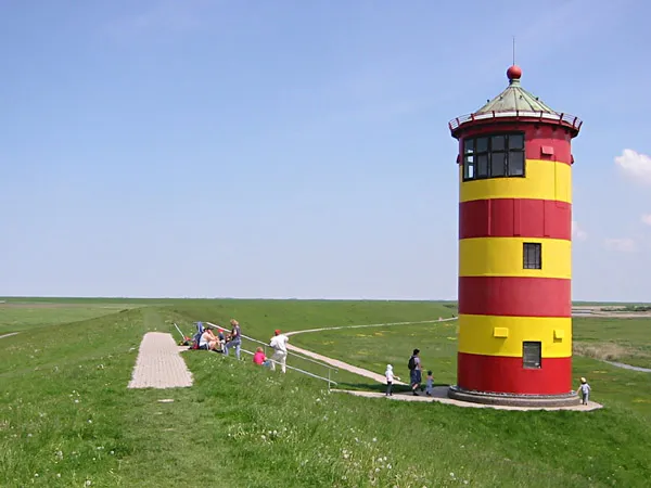 Pilsum Lighthouse Landmark, Krummhörn21 km NE
-
Campen's Lighthouse Landmark, Krummhörn11 km NE
-
Leitfeueranstalt Campen Landmark, Krummhörn11 km NE
-
Amtsgericht Emden Attraction, Emden19 km E
-
Fernmeldeturm Emden Landmark, Emden20 km E
-
Canumer Tief River, Lower Saxony17 km NE
Sources & licences
Data last updated: · 2 independent sources