Jipsinghuizen
Located in Westerwolde Municipality, Province of Groningen Coordinates: 52°58′42″ N 7°09′00″ E

- Elevation
- 4 m
- above sea level
- Local time
- UTC+01:00
- Europe/Amsterdam · UTC+01:00
- Airports
- GRQ Groningen Airport Eelde41 km
- FMO Münster Osnabrück Airport101 km
About Jipsinghuizen
Jipsinghuizen is a village. Location: Westerwolde Municipality, Province of Groningen. Elevation: 4 m.
Jipsinghuizen (Dutch pronunciation: [ˌjɪpsɪŋˈɦœyzə(n)]; Gronings: Jipsenhoezen [ˌjɪpsn̩ˈɦuːzn̩]) is a hamlet in the Dutch province of Groningen. It is a part of the municipality of Westerwolde, and lies about 28 km northeast of Emmen. The statistical area "Jipsinghuizen", which also can include the surrounding countryside, has a population of around 150. Jipsinghuizen used to be part of the municipality of Vlagtwedde, but merged into Westerwolde in 2017.
Source: Wikipedia · CC BY-SA 4.0
Photos of Jipsinghuizen
-

Characea · CC0 -

Wikimedia Commons · CC0 -

Nationaal Archief · CC0 -

Nationaal Archief · CC0 -

A. J. van der Wal · CC BY-SA 4.0


Climate of Jipsinghuizen
Best months for sightseeingBest months for sightseeing: June–August.
This month · November
A cold month
Day 8° · Night 3° · Rain 68 mm
- Hottest month
- August (day 22°)
- Coldest month
- February (night -1°)
- Wettest month
- June (76 mm)
- Driest month
- April (44 mm)
Bars: average monthly low and high temperature. Below: precipitation. Monthly averages for 1970–2000 at about 18 km resolution, adjusted for elevation. Highlighted months are mild and relatively dry. Source: WorldClim 2.1 (CC BY 4.0).
Show values as a table
| Month | Jan | Feb | Mar | Apr | May | Jun | Jul | Aug | Sep | Oct | Nov | Dec |
|---|---|---|---|---|---|---|---|---|---|---|---|---|
| Average high (°C) | 4° | 5° | 9° | 13° | 18° | 20° | 22° | 22° | 18° | 14° | 8° | 6° |
| Average low (°C) | -1° | -1° | 1° | 3° | 7° | 10° | 12° | 12° | 9° | 6° | 3° | 1° |
| Precipitation (mm) | 64 | 45 | 61 | 44 | 53 | 76 | 76 | 59 | 65 | 69 | 68 | 72 |
How to get to Jipsinghuizen
The nearest airport is Groningen Airport Eelde (GRQ), 41 km to the west as the crow flies. The nearest large city is Groningen, 47 km to the northwest.
Airports
- Groningen Airport Eelde (GRQ) Groningen 41 kmwest
- Münster Osnabrück Airport (FMO) Greven 101 kmsouth
- Bremen Airport (BRE) Bremen 110 kmeast
Nearby large cities
- Groningen Population: 244.8K 47 kmnorthwest
- Oldenburg Population: 159.2K 74 kmeast
- Enschede Population: 153.7K 86 kmsouth
- Zwolle Population: 129.8K 88 kmsouthwest
- Leeuwarden Population: 124.5K 93 kmwest
Straight-line distances; road distances are longer. Airport data: OurAirports.
Day trips from Jipsinghuizen
Within 100 km: 138 historic and cultural sites, 751 natural sites, 493 lakes, rivers and coasts.
0–25 km49 places
- Sandpoel Lake 21 kmSE
- Waldsee Lake 16 kmNE
- Dankernsee Lake 21 kmS
- Heeder See Lake 8 kmE
25–60 km433 places
- Hatzumer Sand Island 39 kmN
- Wolfmeer Lake 42 kmNE
- Uphuser Meer Lake 45 kmN
- Twekmeer Lake 46 kmNE
60–100 km900 places
- East Frisian Islands Island 86 kmN
- Norderney Island 82 kmN
- Borkum Island 74 kmNW
- Insel Spiekeroog Island 95 kmN
Straight-line distances.
Nearby attractions & nature
Everything nearby-
Bourtange Fortress Historic site, Westerwolde Municipality4.2 km NE
-
Bourtange Fortress Museum Museum, Westerwolde Municipality4.3 km NE
-
Rechtemoor Natural site, Heede5.4 km E
-
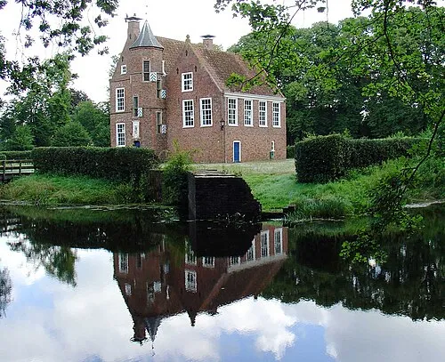 Wedderborg Historic site, Westerwolde Municipality11 km NW
-
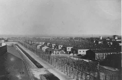 Early Camp Neusustrum Historic site, Sustrum11 km SE
-
Heeder See Lake, Heede8.4 km E
Other cities and towns in Westerwolde Municipality
-
 Vlagtwedde Village, Westerwolde Municipality6.1 km NW
-
Harpel Village, Westerwolde Municipality4.7 km NW
-
Ellersinghuizen Village, Westerwolde Municipality5.2 km NW
-
Weite Village, Westerwolde Municipality5.2 km N
-
Pallert Village, Westerwolde Municipality4 km NE
-
 Veelerveen Village, Westerwolde Municipality8.8 km N
Sources & licences
Data last updated: · 2 independent sources