Papenveer
Located in Nieuwkoop Municipality, South Holland Coordinates: 52°11′06″ N 4°43′30″ E

- Population
- 1,135
- 1.1K
- Elevation
- -2 m
- above sea level
- Local time
- UTC+01:00
- Europe/Amsterdam · UTC+01:00
- Airports
- AMS Amsterdam Airport Schiphol14 km
- RTM Rotterdam The Hague Airport32 km
About Papenveer
Papenveer is a village. Location: Nieuwkoop Municipality, South Holland. Population: 1,135. Elevation: -2 m.
Papenveer is a small village in the Dutch province of South Holland. It is located in the municipality of Nieuwkoop, 2 km north of Ter Aar. The name "Papenveer" means "Catholics' ferry". When the Catholic Church in Korteraar closed in 1822, churchgoers had to cross the river De Aar to go to the church in Langeraar. A ferry was opened that was free for Catholics; everyone else had to pay. The village of Papenveer grew around this ferry.
Source: Wikipedia · CC BY-SA 4.0
Photos of Papenveer
-

HenkvD · CC BY-SA 4.0 -

Gerard Dukker · CC BY-SA 4.0 -

Vogelpark Avifauna Ziko van Dijk · CC BY-SA 4.0


Climate of Papenveer
Best months for sightseeingBest months for sightseeing: June–August.
This month · November
A cold month
Day 9° · Night 4° · Rain 94 mm
- Hottest month
- August (day 22°)
- Coldest month
- February (night 0°)
- Wettest month
- November (94 mm)
- Driest month
- April (46 mm)
Bars: average monthly low and high temperature. Below: precipitation. Monthly averages for 1970–2000 at about 18 km resolution, adjusted for elevation. Highlighted months are mild and relatively dry. Source: WorldClim 2.1 (CC BY 4.0).
Show values as a table
| Month | Jan | Feb | Mar | Apr | May | Jun | Jul | Aug | Sep | Oct | Nov | Dec |
|---|---|---|---|---|---|---|---|---|---|---|---|---|
| Average high (°C) | 6° | 6° | 9° | 12° | 17° | 19° | 21° | 22° | 18° | 14° | 9° | 7° |
| Average low (°C) | 1° | 0° | 2° | 4° | 8° | 10° | 12° | 12° | 10° | 7° | 4° | 2° |
| Precipitation (mm) | 70 | 50 | 64 | 46 | 51 | 70 | 69 | 64 | 84 | 89 | 94 | 82 |
How to get to Papenveer
The nearest airport is Amsterdam Airport Schiphol (AMS), 14 km to the north as the crow flies. The nearest large city is Hoofddorp, 13 km to the north.
Airports
- Amsterdam Airport Schiphol (AMS) Amsterdam 14 kmnorth
- Rotterdam The Hague Airport (RTM) Rotterdam 32 kmsouthwest
- Eindhoven Airport (EIN) Eindhoven 93 kmsoutheast
Nearby large cities
- Hoofddorp Population: 132.7K 13 kmnorth
- Leiden Population: 119.7K 16 kmwest
- Zoetermeer Population: 115.8K 21 kmsouthwest
- Haarlem Population: 162.5K 23 kmnorth
- Amsterdam Population: 741.6K 24 kmnortheast
Straight-line distances; road distances are longer. Airport data: OurAirports.
Day trips from Papenveer
Within 100 km: 154 historic and cultural sites, 114 natural sites, 51 lakes, rivers and coasts.
0–25 km58 places
- Obrechtkerk Attraction 22 kmNE
- Noorderkerk Attraction 24 kmNE
- Westerkerk Attraction 24 kmNE
- Mozes en Aäronkerk Attraction 24 kmNE
25–60 km64 places
- IJsselmonde Island 38 kmS
- Habana Beach Beach 37 kmW
- Badstrand Rockanje Beach 58 kmSW
- Eiland van Brienenoord Island 34 kmS
60–100 km197 places
- Putjensberg Mountain 90 kmE
- Putse Moer Lake 91 kmS
- Stappensven Lake 89 kmS
- Wolvenbos Natural site 96 kmS
Straight-line distances.
Nearby attractions & nature
Everything nearby-
Vogelpark Avifauna Attraction, Gemeente Alphen aan den Rijn7.3 km SW
-
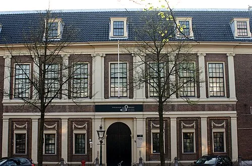 Rijksmuseum van Oudheden Museum, Leiden Municipality17 km W
-
Olympic Stadium Landmark, Gemeente Amsterdam20 km NE
-
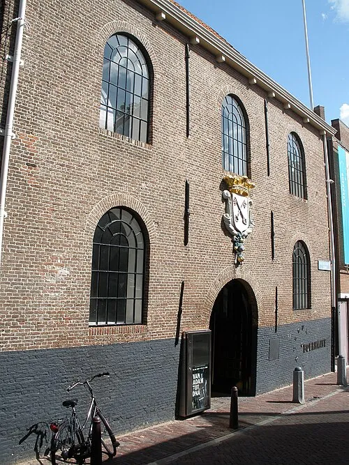 Museum Boerhaave Museum, Leiden Municipality16 km W
-
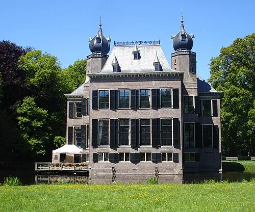 Oud Poelgeest Historic site, Oegstgeest Municipality16 km W
-
 Van Gogh Museum Museum, Gemeente Amsterdam22 km NE
Other cities and towns in Nieuwkoop Municipality
-
 Vrouwenakker Village, Nieuwkoop Municipality6.2 km NE
-
Zuideinde Village, Nieuwkoop Municipality6.4 km SE
-
Noordse Dorp Village, Nieuwkoop Municipality8 km E
-
 Woerdense Verlaat Village, Nieuwkoop Municipality10 km E
-
Achttienhoven Village, Nieuwkoop Municipality10 km SE
-
 Noorden Village, Nieuwkoop Municipality7.2 km E
Sources & licences
Data last updated: · 2 independent sources