South Holland
Local name: Zuid-Holland
Located in The Netherlands Coordinates: 52°00′00″ N 4°40′00″ E
- Population
- 3,804,906
- 3.8M
- Elevation
- -7 m
- above sea level
- Local time
- UTC+01:00
- Europe/Amsterdam · UTC+01:00
- Places inside
- 51
- listed under South Holland
About South Holland
South Holland is a region. Location: The Netherlands. Population: 3,804,906.
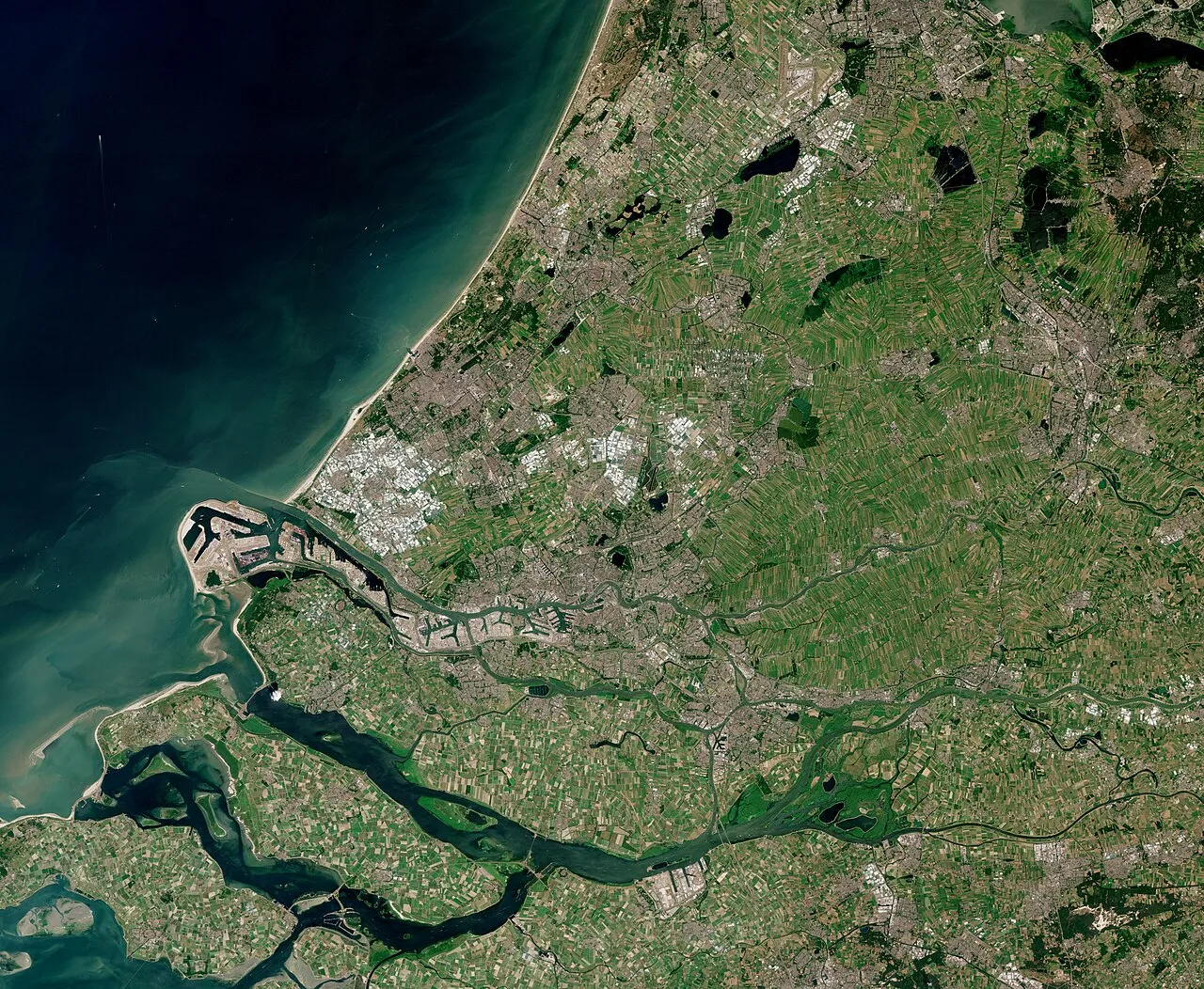
South Holland (Dutch: Zuid-Holland [ˌzœyt ˈɦɔlɑnt] ) is a province of the Netherlands with a population of over 3.8 million as of January 2023 and a population density of about 1,410/km2 (3,700/sq mi), making it the country's most populous province and one of the world's most densely populated areas. Situated on the North Sea in the west of the Netherlands, South Holland covers an area of 3,308 km2 (1,277 sq mi), of which 609 km2 (235 sq mi) is water.
Read more on Wikipedia Text: Wikipedia contributors · CC BY-SA 4.0 · shortened
At a glance
- Built
- 1840
- Area
- 3,418 km²
Source: Wikidata
In comparison
- Listed here: District: 50, Island: 1
Places in South Holland
51 places-
Rotterdam Municipality District651.2K
-
Gemeente Den Haag District532.6K
-
IJsselmonde Island423K
-
Gemeente Zoetermeer District125.3K
-
Leiden Municipality District124.3K
-
Dordrecht Municipality District118.4K
-
Gemeente Alphen aan den Rijn District112.6K
-
Westland Municipality District111.4K
-
Delft Municipality District102.3K
-
Nissewaard District85.4K
-
Schiedam Municipality District79.3K
-
Gemeente Vlaardingen District73.9K
-
Leidschendam-Voorburg Municipality District76.4K
-
Voorne aan Zee District73.9K
-
Gemeente Gouda District72.7K
-
Gemeente Capelle aan den IJssel District67.3K
-
Katwijk Municipalty District65.9K
-
Gemeente Lansingerland District63.4K
-
Krimpenerwaard District55.6K
-
Pijnacker-Nootdorp Municipality District55.7K
-
Rijswijk Municipality District55.2K
-
Gemeente Goeree-Overflakkee District50.6K
-
Barendrecht Municipality District48.6K
-
Ridderkerk Municipality District46.7K
-
Gemeente Zuidplas District45.1K
-
Gemeente Zwijndrecht District44.8K
-
Gemeente Noordwijk District44.1K
-
Gemeente Teylingen District37.8K
-
Gemeente Gorinchem District36.3K
-
Bodegraven-Reeuwijk District35.3K
-
Maassluis Municipality District33.6K
-
Papendrecht Municipality District32.2K
-
Gemeente Waddinxveen District30.5K
-
Gemeente Hendrik-Ido-Ambacht District30.7K
-
Gemeente Krimpen aan den IJssel District29.4K
-
Nieuwkoop Municipality District29.2K
-
Gemeente Wassenaar District26.9K
-
Kaag en Braassem Municipality District27.5K
-
Leiderdorp Municipality District27.2K
-
Albrandswaard Municipality District25.8K
-
Gemeente Voorschoten District25.6K
-
Sliedrecht Municipality District25.6K
-
Oegstgeest Municipality District25.1K
-
Lisse Municipality District23K
-
Gemeente Hillegom District22.2K
-
Alblasserdam Municipality District20.1K
-
Midden-Delfland Municipality District19.4K
-
Gemeente Hardinxveld-Giessendam District18K
-
Gemeente Zoeterwoude District8.8K
-
Hoeksche Waard District
-
Molenlanden District
Largest cities and towns
-
Rotterdam City, Rotterdam Municipality868.1K
-
The Hague City, Gemeente Den Haag474.3K
-
Leiden City, Leiden Municipality119.7K
-
Voorburg Town, Leidschendam-Voorburg Municipality38K
-
Ypenburg Town, Gemeente Den Haag30K
-
Alphen aan den Rijn Town, Gemeente Alphen aan den Rijn70.3K
-
Schiedam Town, Schiedam Municipality75.4K
-
Vlaardingen Town, Gemeente Vlaardingen73.8K
Nature and heritage in South Holland
-
Erasmusbrug Landmark, Rotterdam Municipality
-
Euromast Landmark, Rotterdam Municipality
-
Willemsbrug Landmark, Rotterdam Municipality
-
Natuurhistorisch Museum Rotterdam Museum, Rotterdam Municipality
-
Diergaarde Blijdorp Attraction, Rotterdam Municipality
-
Van Brienenoordbrug Landmark, Rotterdam Municipality
Sources & licences
Data last updated: · 2 independent sources