Gemeente Capelle aan den IJssel
Local name: Capelle aan den IJssel
Located in South Holland, The Netherlands Coordinates: 51°56′08″ N 4°34′41″ E

- Population
- 67,319
- 67.3K
- Elevation
- -2 m
- above sea level
- Local time
- UTC+01:00
- Europe/Amsterdam · UTC+01:00
- Places inside
- 2
- listed under Gemeente Capelle aan den IJssel
- Airports
- RTM Rotterdam The Hague Airport10 km
- AMS Amsterdam Airport Schiphol43 km
About Gemeente Capelle aan den IJssel
Gemeente Capelle aan den IJssel is a district. Location: South Holland, The Netherlands. Population: 67,319.
Capelle aan den IJssel (Dutch pronunciation: [kaːˈpɛlə ʔaːn dən ˈɛisəl] or [- də ˈʔɛi-]; transl. "Capelle on the IJssel") is a large town and municipality in the western Netherlands, in the province of South Holland. The municipality had a population of 67,319 in 2021, and covers an area of 15.40 km2 (5.95 sq mi), of which 1.26 km2 (0.49 sq mi) is water. It is situated on the eastern edge of Rotterdam, on the Hollandse IJssel river.
Source: Wikipedia · CC BY-SA 4.0
Photos of Gemeente Capelle aan den IJssel
-
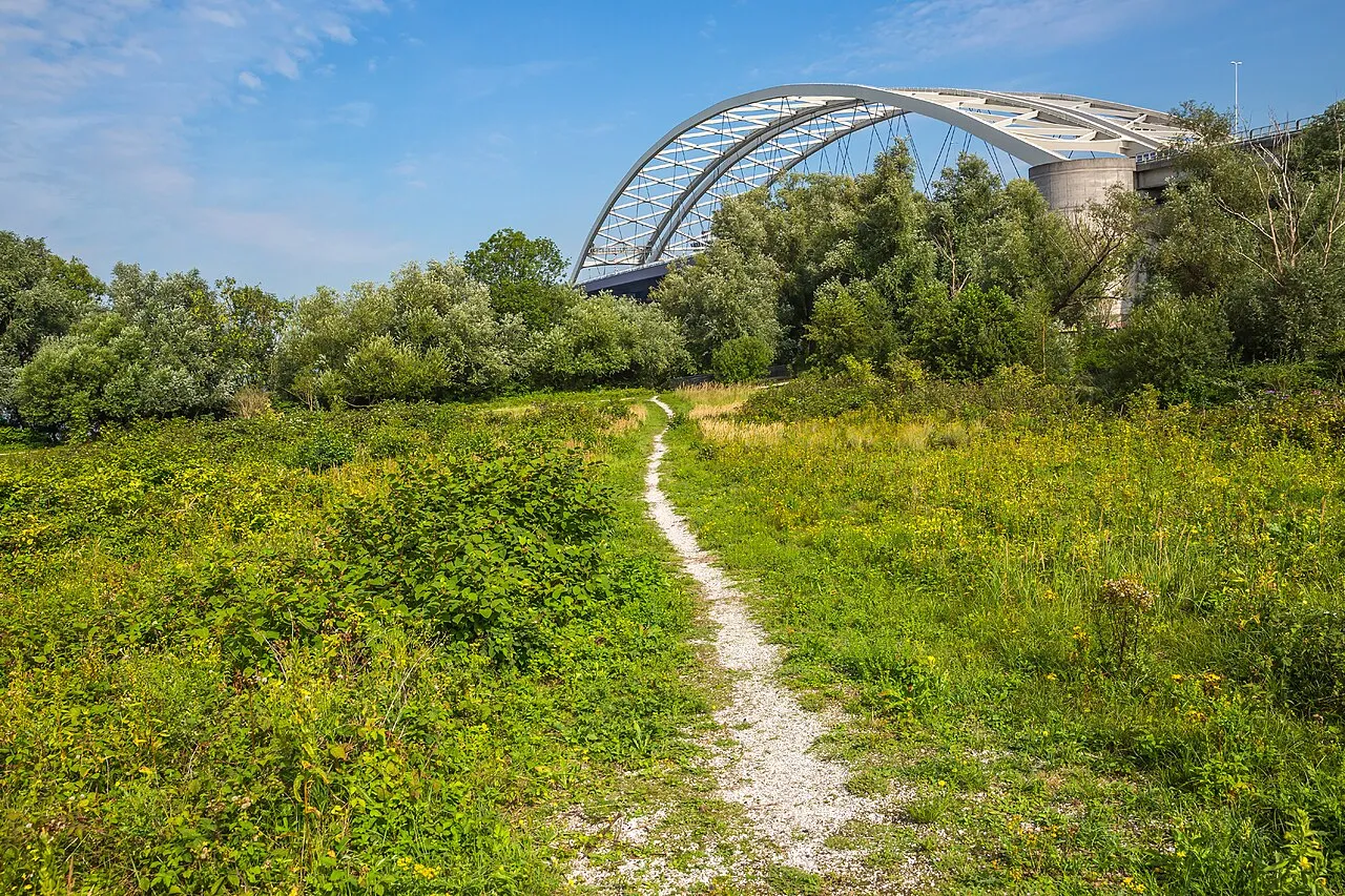
Eiland van Brienenoord GraphyArchy · CC BY-SA 4.0 -
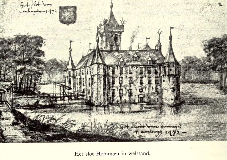
Slot Honingen Unknown author Unknown author · Public domain -
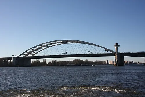
Van Brienenoordbrug Sneeuwvlakte · CC BY-SA 4.0 -
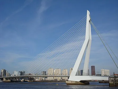
Erasmusbrug F.Eveleens · CC BY 3.0 -
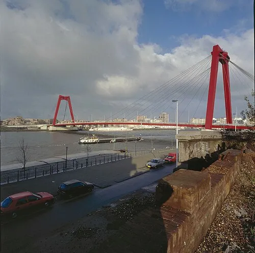
Willemsbrug Gerard Dukker · CC BY-SA 4.0


Travel notes for Gemeente Capelle aan den IJssel
From Wikivoyage
Capelle aan den IJssel (or Capelle for short) is a city along the Hollandsche IJssel river, that to the east and north is bordered by Rotterdam.
Understand+
Capelle was founded in the 12th century, and fortified with a castle, Slot Capelle, in the fourteenth century. Of the castle, only the 'dief- en duifhuisje' (thief- and pigeon house) of the castle remains. To its north used to lie a swamp that was drained to become the Prins-Alexanderpolder, named after the then-crown prince Alexander of Nassau (1851-1884) who died before he could succeed his father, Willem III. Both Capelle and Prins Alexander grew explosively after the Second World War as demand for housing was surging.
Get in+
Through the north of the region, the A20 highway runs from the Rotterdam ringway to Gouda, connecting near the Alexandrium mall with exit 16. The ringway also serves Capelle from the A16, where exit 25 feeds into the N210/S107, which connects to Kralingen in the west and Capelle in the east.
Metro lines A , B and C all run through and terminate in this district. Furthermore, the water ferries 20 and 21 call at Rivium, a business park in the far west of Capelle. This water ferry port is connected to the metro through a self-driving bus, though you will have to walk half a kilometre from the ferry port to the end of the bus line. Taking the metro directly from either Rotterdam Alexander or Rotterdam Centraal train stations is far less cumbersome.
Source: Wikivoyage · CC BY-SA 4.0 · abridged
Places bordering Gemeente Capelle aan den IJssel
- Gemeente Krimpen aan den IJssel
Population of Gemeente Capelle aan den IJssel over time
| 1960 | 12,115 | |
|---|---|---|
| 1971 | 29,008 | |
| 1980 | 43,544 | |
| 1990 | 58,307 | |
| 2000 | 65,018 | |
| 2010 | 66,104 | |
| 2016 | 66,514 | |
| 2017 | 66,421 | |
| 2018 | 66,854 | |
| 2019 | 66,818 | |
| 2020 | 67,122 | |
| 2021 | 67,319 |
Censuses and official estimates; source: Wikidata.
Climate of Gemeente Capelle aan den IJssel
Best months for sightseeingBest months for sightseeing: June–August.
This month · November
A cold month
Day 10° · Night 4° · Rain 93 mm
- Hottest month
- August (day 22°)
- Coldest month
- February (night 0°)
- Wettest month
- November (93 mm)
- Driest month
- April (49 mm)
Bars: average monthly low and high temperature. Below: precipitation. Monthly averages for 1970–2000 at about 18 km resolution, adjusted for elevation. Highlighted months are mild and relatively dry. Source: WorldClim 2.1 (CC BY 4.0).
Show values as a table
| Month | Jan | Feb | Mar | Apr | May | Jun | Jul | Aug | Sep | Oct | Nov | Dec |
|---|---|---|---|---|---|---|---|---|---|---|---|---|
| Average high (°C) | 6° | 6° | 9° | 13° | 17° | 20° | 22° | 22° | 19° | 14° | 10° | 7° |
| Average low (°C) | 1° | 0° | 2° | 4° | 8° | 11° | 13° | 12° | 10° | 7° | 4° | 2° |
| Precipitation (mm) | 71 | 54 | 70 | 49 | 55 | 74 | 76 | 64 | 82 | 88 | 93 | 82 |
How to get to Gemeente Capelle aan den IJssel
The nearest airport is Rotterdam The Hague Airport (RTM), 10 km to the west as the crow flies. The nearest large city is Rotterdam, 7 km to the west.
Airports
- Rotterdam The Hague Airport (RTM) Rotterdam 10 kmwest
- Amsterdam Airport Schiphol (AMS) Amsterdam 43 kmnorth
- Eindhoven Airport (EIN) Eindhoven 77 kmsoutheast
Nearby large cities
- Rotterdam Population: 868.1K 7 kmwest
- Zoetermeer Population: 115.8K 15 kmnorthwest
- Dordrecht Population: 119.3K 15 kmsoutheast
- The Hague Population: 474.3K 25 kmnorthwest
- Leiden Population: 119.7K 25 kmnorth
Straight-line distances; road distances are longer. Airport data: OurAirports.
Day trips from Gemeente Capelle aan den IJssel
Within 100 km: 203 historic and cultural sites, 154 natural sites, 217 lakes, rivers and coasts.
0–25 km16 places
- IJsselmonde Island 9 kmSW
- Eiland van Brienenoord Island 5 kmSW
- Vogelpark Avifauna Attraction 23 kmN
- Den Haag Concentration Camp Historic site 24 kmNW
25–60 km130 places
- Stappensven Lake 59 kmS
- Hassel Bos Natural site 58 kmS
- Gouverneurs Bos Natural site 58 kmS
- Essen Duinen Natural site 52 kmS
60–100 km428 places
- Het Eiland Island 91 kmSW
- Putse Moer Lake 62 kmS
- Kleine Weel Lake 78 kmS
- Grote Weel Lake 78 kmS
Straight-line distances.
Places in Gemeente Capelle aan den IJssel
2 places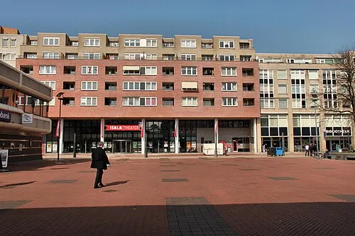
Capelle aan den IJssel
Population: 65.3K
Capelle-West
Population: 2.4K
Nearby attractions & nature
Everything nearby-
Van Brienenoordbrug Landmark, Rotterdam Municipality4.3 km SW
-
Willemsbrug Landmark, Rotterdam Municipality6 km W
-
Slot Honingen Historic site, Rotterdam Municipality4.6 km W
-
Erasmusbrug Landmark, Rotterdam Municipality6.9 km SW
-
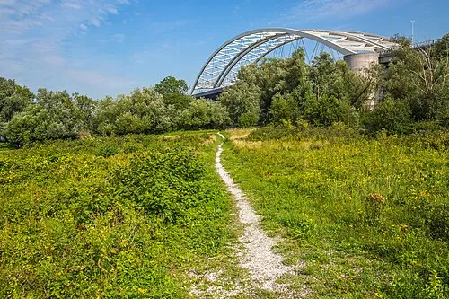 Eiland van Brienenoord Island, Rotterdam Municipality4.8 km SW
-
IJsselmonde Island, South Holland8.8 km SW
Other regions in South Holland
-
 Gemeente Krimpen aan den IJssel District, South Holland2.4 km S
-
 Gemeente Den Haag District, South Holland25 km NW
-
 Ridderkerk Municipality District, South Holland7.5 km S
-
 Barendrecht Municipality District, South Holland10 km S
-
 Schiedam Municipality District, South Holland13 km W
-
 Gemeente Hendrik-Ido-Ambacht District, South Holland11 km S
Sources & licences
Data last updated: · 2 independent sources