Schiedam Municipality
Located in South Holland, The Netherlands Coordinates: 51°55′35″ N 4°23′12″ E
- Population
- 79,279
- 79.3K
- Elevation
- -2 m
- above sea level
- Local time
- UTC+01:00
- Europe/Amsterdam · UTC+01:00
- Places inside
- 5
- listed under Schiedam Municipality
- Airports
- RTM Rotterdam The Hague Airport5 km
- AMS Amsterdam Airport Schiphol50 km
About Schiedam Municipality
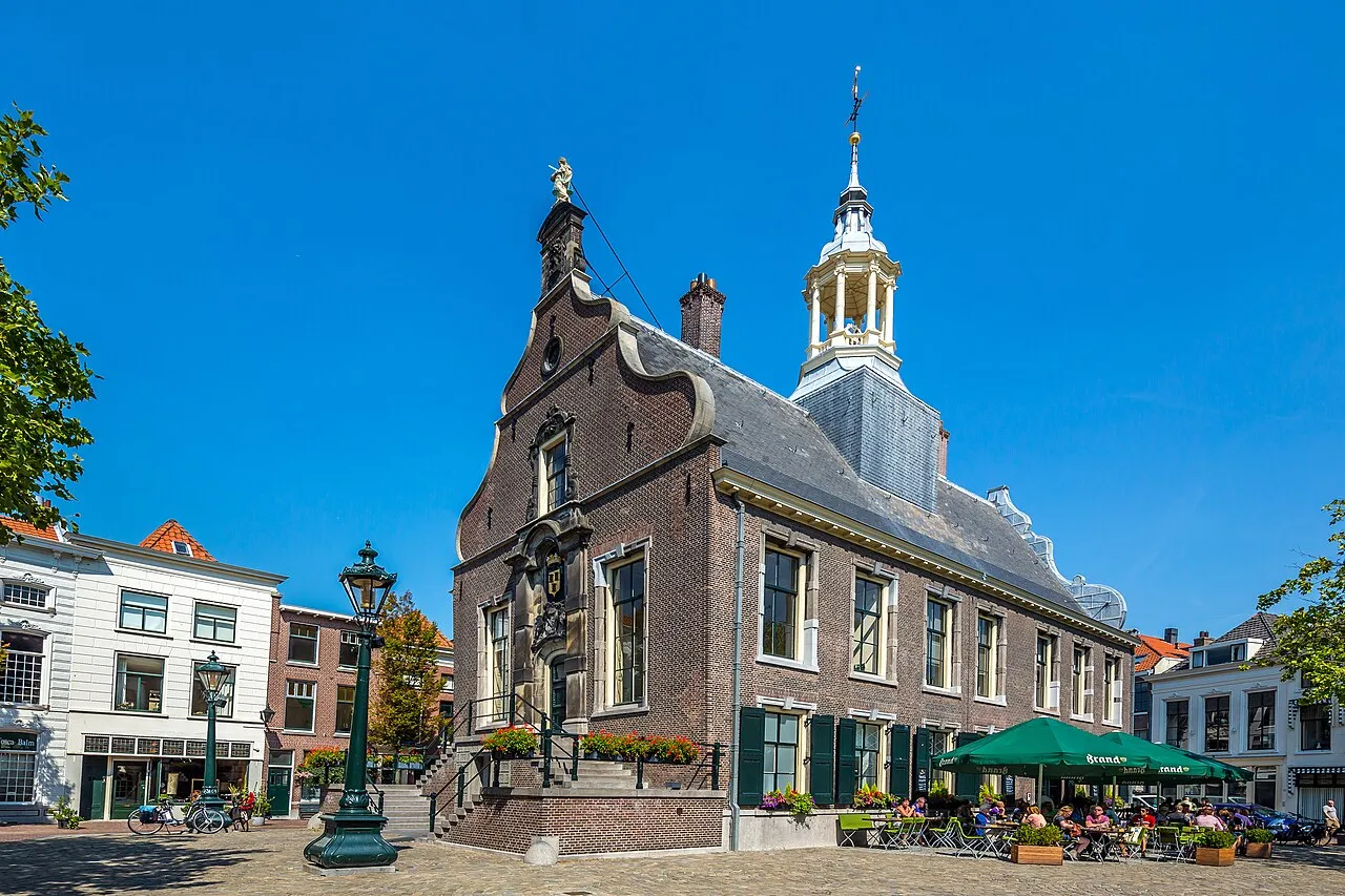
Schiedam Municipality is a district. Location: South Holland, The Netherlands. Population: 79,279.
Schiedam (Dutch pronunciation: [sxiˈdɑm] ) is a town and municipality in the west of the Netherlands. It is located in the Rotterdam–The Hague metropolitan area, west of the city Rotterdam, east of the town Vlaardingen, and south of the city Delft. In the south, Schiedam is also connected to the village of Pernis via the Benelux tunnel. The town's historical center is ringed with canals and contains the tallest windmill in the world.
Source: Wikipedia · CC BY-SA 4.0
Travel notes for Schiedam Municipality
From Wikivoyage
Schiedam is a city and municipality in the province of South-Holland in the Netherlands and is part of the Rotterdam metropolitan area. The city is best known for Jenever (gin), its historical centre and the tallest old windmills in the world.
Understand+
I-Punt S'Dam (Tourist information (VVV)), Lange Kerkstraat 39, ☏ +31 10-4733000, info@sdam.nl. Mon closed; Tue-Sun 11:00-16:00. (updated Jun 2022)
City of Schiedam website
Get in+
By plane:
The nearest airport is Rotterdam The Hague Airport with flights from selected cities in Europe. See the Rotterdam page.
For onward travel with public transport use RET bus line 33. Travel to Schiedam requires at least one transfer in Rotterdam. Plan your journey via the nationwide planner 9292.
The train (operated by NS) between Rotterdam Centraal and Schiedam Centrum gives you in many cases the fastest total travel time of about 35 minutes, but for the train you either need a separate train ticket or an OV-Chipkaart with sufficient balance (20 euro).
You can save the hassle and some money by traveling with RET only. Depending on your final destination in Schiedam you can take bus 33 to Rotterdam Centraal and then tram line 21 or 24, or take bus 33 the opposite direction to Meijersplein/Airport metro station, change to metro line E (direction Slinge) and change at Beurs station to metro A, B or C (see below).
As it's 10 km to the centre of Schiedam a taxi can be a fast but more expensive alternative.
If you arrive at Amsterdam Schiphol Airport you can take a direct intercity service to Schiedam Centrum operated by NS. One way ticket, 2nd class costs €13.60 (2023) (plus €1 if bought from ticket machine).
By train:
Schiedam Centrum station is well served by national rail (Nederlandse Spoorwegen [1]), with direct connections to Delft, The Hague, Leiden, Amsterdam Schiphol Airport, Amsterdam, Rotterdam, Dordrecht, Roosendaal, Middelburg and Vlissingen.
For international trains arriving at Rotterdam Centraal Station, Schiedam Centrum is a 5-minute train ride from there.
By metro:
Source: Wikivoyage · CC BY-SA 4.0 · abridged
Places bordering Schiedam Municipality
- Gemeente Vlaardingen
Population of Schiedam Municipality over time
| 1960 | 80,632 | |
|---|---|---|
| 1971 | 82,967 | |
| 1980 | 74,233 | |
| 1990 | 70,207 | |
| 2000 | 76,102 | |
| 2010 | 75,718 | |
| 2016 | 77,051 | |
| 2017 | 77,838 | |
| 2018 | 77,907 | |
| 2019 | 77,999 | |
| 2020 | 78,730 | |
| 2021 | 79,279 |
Censuses and official estimates; source: Wikidata.
Climate of Schiedam Municipality
Best months for sightseeingBest months for sightseeing: June–August.
This month · November
A cold month
Day 10° · Night 4° · Rain 96 mm
- Hottest month
- August (day 22°)
- Coldest month
- February (night 1°)
- Wettest month
- November (96 mm)
- Driest month
- April (48 mm)
Bars: average monthly low and high temperature. Below: precipitation. Monthly averages for 1970–2000 at about 18 km resolution, adjusted for elevation. Highlighted months are mild and relatively dry. Source: WorldClim 2.1 (CC BY 4.0).
Show values as a table
| Month | Jan | Feb | Mar | Apr | May | Jun | Jul | Aug | Sep | Oct | Nov | Dec |
|---|---|---|---|---|---|---|---|---|---|---|---|---|
| Average high (°C) | 6° | 6° | 9° | 12° | 17° | 20° | 22° | 22° | 19° | 14° | 10° | 7° |
| Average low (°C) | 1° | 1° | 3° | 4° | 8° | 11° | 13° | 13° | 11° | 7° | 4° | 2° |
| Precipitation (mm) | 71 | 53 | 69 | 48 | 53 | 72 | 77 | 64 | 86 | 92 | 96 | 82 |
How to get to Schiedam Municipality
The nearest airport is Rotterdam The Hague Airport (RTM), 5 km to the northeast as the crow flies. The nearest large city is Rotterdam, 6 km to the east.
Airports
- Rotterdam The Hague Airport (RTM) Rotterdam 5 kmnortheast
- Amsterdam Airport Schiphol (AMS) Amsterdam 50 kmnortheast
- Antwerp International Airport (Deurne) (ANR) Antwerp 82 kmsouth
Nearby large cities
- Rotterdam Population: 868.1K 6 kmeast
- Zoetermeer Population: 115.8K 16 kmnortheast
- The Hague Population: 474.3K 18 kmnorth
- Dordrecht Population: 119.3K 24 kmsoutheast
- Leiden Population: 119.7K 27 kmnorth
Straight-line distances; road distances are longer. Airport data: OurAirports.
Day trips from Schiedam Municipality
Within 100 km: 197 historic and cultural sites, 98 natural sites, 220 lakes, rivers and coasts.
0–25 km22 places
- IJsselmonde Island 11 kmSE
- Habana Beach Beach 20 kmNW
- Badstrand Rockanje Beach 24 kmW
- Eiland van Brienenoord Island 11 kmE
25–60 km66 places
- Stappensven Lake 58 kmS
- Essen Duinen Natural site 52 kmS
- De Zoom - Kalmthoutse Heide Natural site 59 kmS
- Zoom River 48 kmS
60–100 km427 places
- Knokke-Strand Beach 99 kmSW
- Het Eiland Island 85 kmS
- Putse Moer Lake 61 kmS
- Kleine Weel Lake 73 kmS
Straight-line distances.
Places in Schiedam Municipality
5 placesBar: population relative to the most populous place in this list.
Cities & villages2
Heritage & sights1
- Stedelijk Museum Schiedam · Museum
Nearby attractions & nature
Everything nearby-
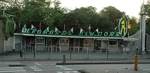 Diergaarde Blijdorp Attraction, Rotterdam Municipality4.5 km E
-
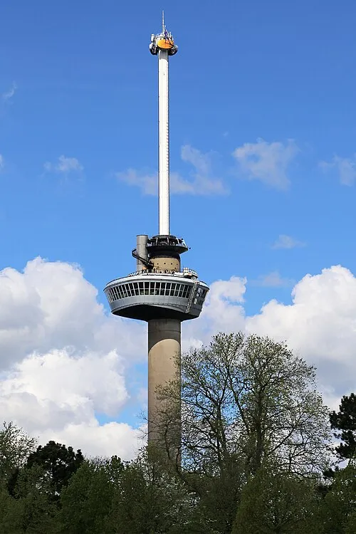 Euromast Landmark, Rotterdam Municipality6 km SE
-
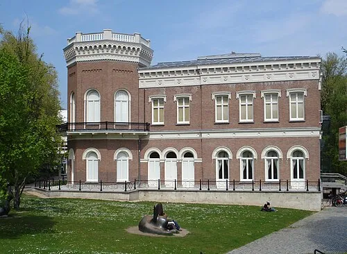 Natuurhistorisch Museum Rotterdam Museum, Rotterdam Municipality6.2 km E
-
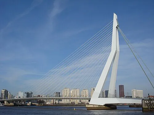 Erasmusbrug Landmark, Rotterdam Municipality7.2 km E
-
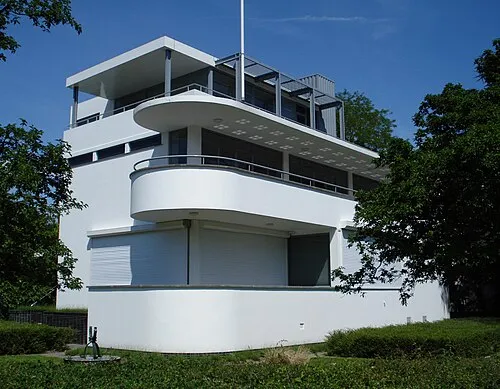 Chabot Museum Museum, Rotterdam Municipality6 km E
-
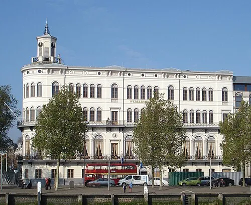 Wereldmuseum Rotterdam Museum, Rotterdam Municipality6.8 km E
Sources & licences
Data last updated: · 2 independent sources