- Population
- 1,315
- 1.3K
- Elevation
- 0 m
- above sea level
- Local time
- UTC+01:00
- Europe/Amsterdam · UTC+01:00
- Airports
- OST Ostend-Bruges International Airport54 km
- ANR Antwerp International Airport (Deurne)76 km
About Zoutelande
Zoutelande is a village. Location: Veere Municipality, Zeeland. Population: 1,315. Elevation: 0 m.
Zoutelande (Zeelandic: Zóetelande) is a village in the southwestern Netherlands. It is located in the municipality of Veere, Zeeland, between Dishoek and Westkapelle on the former island Walcheren. On 1 January 2005 it had 1,556 inhabitants. Originally, Zoutelande was mainly an agricultural village. The village's character changed slowly into a tourist resort as the demand for beach recreation rose from about the middle of the 19th century.
Source: Wikipedia · CC BY-SA 4.0
Climate of Zoutelande
Best months for sightseeingBest months for sightseeing: June–September.
This month · November
A cold month
Day 10° · Night 6° · Rain 81 mm
- Hottest month
- August (day 21°)
- Coldest month
- February (night 2°)
- Wettest month
- October (82 mm)
- Driest month
- April (41 mm)
Bars: average monthly low and high temperature. Below: precipitation. Monthly averages for 1970–2000 at about 18 km resolution, adjusted for elevation. Highlighted months are mild and relatively dry. Source: WorldClim 2.1 (CC BY 4.0).
Show values as a table
| Month | Jan | Feb | Mar | Apr | May | Jun | Jul | Aug | Sep | Oct | Nov | Dec |
|---|---|---|---|---|---|---|---|---|---|---|---|---|
| Average high (°C) | 6° | 6° | 9° | 11° | 15° | 18° | 20° | 21° | 18° | 14° | 10° | 7° |
| Average low (°C) | 2° | 2° | 4° | 6° | 9° | 12° | 14° | 15° | 13° | 9° | 6° | 3° |
| Precipitation (mm) | 60 | 45 | 54 | 41 | 47 | 61 | 65 | 55 | 75 | 82 | 81 | 71 |
Other places to visit in this season: June July August September
How to get to Zoutelande
The nearest airport is Ostend-Bruges International Airport (OST), 54 km to the southwest as the crow flies. The nearest large city is Bruges, 37 km to the southwest.
Airports
- Ostend-Bruges International Airport (OST) Oostende 54 kmsouthwest
- Antwerp International Airport (Deurne) (ANR) Antwerp 76 kmsoutheast
- Rotterdam The Hague Airport (RTM) Rotterdam 83 kmnortheast
Nearby large cities
- Bruges Population: 118.5K 37 kmsouthwest
- Ghent Population: 265.1K 53 kmsouth
- Antwerp Population: 529.2K 71 kmsoutheast
- Rotterdam Population: 868.1K 83 kmnortheast
- The Hague Population: 474.3K 85 kmnortheast
Straight-line distances; road distances are longer. Airport data: OurAirports.
Day trips from Zoutelande
Within 100 km: 170 historic and cultural sites, 133 natural sites, 610 lakes, rivers and coasts.
0–25 km9 places
- Knokke-Strand Beach 21 kmSW
- Molenkreek River 25 kmS
- Albertstrand Beach 22 kmSW
- Aloha Beach Beach 12 kmNE
25–60 km137 places
- Klein Strand Oostende Beach 49 kmSW
- Het Eiland Island 45 kmSE
- Kleine Weel Lake 54 kmSE
- Grote Weel Lake 55 kmSE
60–100 km767 places
- IJsselmonde Island 82 kmNE
- Putse Moer Lake 67 kmE
- Stappensven Lake 67 kmE
- Hofstademeer Lake 92 kmSE
Straight-line distances.
Nearby attractions & nature
Everything nearby-
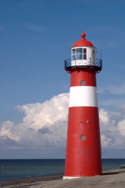 Noorderhoofd Landmark, Veere Municipality5.4 km NW
-
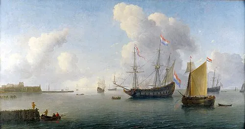 Fort Rammekens Historic site, Gemeente Vlissingen13 km SE
-
Soelekerkplaat Mountain, Veere Municipality15 km E
-
Aloha Beach Beach, Veere Municipality12 km NE
-
Aardbeieneiland Island, Gemeente Middelburg15 km E
-
Zandkreekplaat Island, Gemeente Goes17 km E
Sources & licences
Data last updated: · 2 independent sources