- Elevation
- 856 m
- above sea level
- Local time
- UTC+03:00
- Europe/Istanbul · UTC+03:00
- Airports
- ESB Esenboğa International Airport23 km
- KFS Kastamonu Airport171 km
About Varlık
Varlık is a neighbourhood. Location: Yenimahalle, Ankara Province. The best months to visit are May–June, September–October. The nearest airport is Esenboğa International Airport (23 km). Nearby sights include Hanefi Camii and Ulu Camii.
Climate of Varlık
Best months for sightseeingBest months for sightseeing: May–June, September–October.
This month · November
Outside the best season
Day 12° · Night 1° · Rain 32 mm
Better nearby cities in November
- Tarsus · 383 km southeast22°
- Mersin · 384 km southeast22°
- Alanya · 387 km south21°
- Hottest month
- July (day 30°)
- Coldest month
- January (night -4°)
- Wettest month
- May (55 mm)
- Driest month
- August (10 mm)
Bars: average monthly low and high temperature. Below: precipitation. Monthly averages for 1970–2000 at about 18 km resolution, adjusted for elevation. Highlighted months are mild and relatively dry. Source: WorldClim 2.1 (CC BY 4.0).
Show values as a table
| Month | Jan | Feb | Mar | Apr | May | Jun | Jul | Aug | Sep | Oct | Nov | Dec |
|---|---|---|---|---|---|---|---|---|---|---|---|---|
| Average high (°C) | 4° | 6° | 11° | 17° | 22° | 27° | 30° | 30° | 26° | 20° | 12° | 6° |
| Average low (°C) | -4° | -3° | 0° | 5° | 9° | 13° | 16° | 16° | 11° | 7° | 1° | -2° |
| Precipitation (mm) | 46 | 37 | 37 | 45 | 55 | 33 | 14 | 10 | 15 | 29 | 32 | 47 |
Other places to visit in this season: May June September October
How to get to Varlık
The nearest airport is Esenboğa International Airport (ESB), 23 km to the northeast as the crow flies. The nearest large city is Ankara, 5 km to the south.
Airports
- Esenboğa International Airport (ESB) Ankara 23 kmnortheast
- Kastamonu Airport (KFS) Kastamonu 171 kmnortheast
- Zonguldak Çaycuma Airport (ONQ) Zonguldak 183 kmnorth
Nearby large cities
- Ankara Population: 3.5M 5 kmsouth
- Çankaya Population: 792.2K 5 kmsoutheast
- Gölbaşı Population: 165.2K 19 kmsouth
- Kirikkale Population: 187K 59 kmeast
- Bolu Population: 184.7K 135 kmnorthwest
Straight-line distances; road distances are longer. Airport data: OurAirports.
Day trips from Varlık
Within 100 km: 70 historic and cultural sites, 791 natural sites, 214 lakes, rivers and coasts.
0–25 km198 places
- Lake Mogan Lake 22 kmS
- Yunus Emre Göleti Lake 21 kmW
- Lake Eymir Lake 15 kmS
- Kızılca Göleti Lake 21 kmN
25–60 km513 places
- Taşlıca Barajı Lake 50 kmN
- Pazar Barajı Lake 41 kmN
- Aşağı Karaören Barajı Lake 39 kmN
- Asartepe Barajı Lake 42 kmNW
60–100 km364 places
- Büklükale Historic site 66 kmSE
- İnandıktepe Historic site 76 kmNE
- Ilıca Barajı Lake 78 kmSW
- Eğrekkaya Barajı Lake 60 kmN
Straight-line distances.
Nearby attractions & nature
Everything nearby-
Hanefi Camii Attraction, Altındağ1.3 km SE
-
Ulu Camii Attraction, Yenimahalle1.6 km W
-
Yeşilyurt Camii Attraction, Keçiören1.6 km N
-
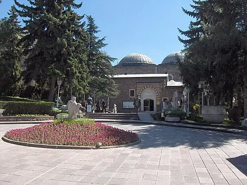 Museum of Anatolian Civilizations Museum, Altındağ3.5 km SE
-
Gümüşdere Camii Attraction, Keçiören1.9 km E
-
Sahrayı Cedit Camii Attraction, Keçiören1.9 km NW
Sources & licences
Data last updated: