Palandöken
Located in Erzurum Province, Turkey Coordinates: 39°51′20″ N 41°16′47″ E
- Population
- 161,482
- 161.5K
- Elevation
- 2,366 m
- above sea level
- Local time
- UTC+03:00
- Europe/Istanbul · UTC+03:00
- Places inside
- 49
- listed under Palandöken
About Palandöken
Palandöken is a district. Location: Erzurum Province, Turkey. Population: 161,482.
In comparison
- 9 sights and natural places within 10 km Sultanseki Tepesi, Büyükejder Tepesi
- Listed here: Village: 28, Mountain: 15, City: 2, River: 2
Places in Palandöken
49 places-
Çeperli Village125
-
Alibezirgan Village84
-
Akyıldırım Dağı Mountain
-
Aziziye Village
-
Başgöze Pınarı Natural site
-
Börekli Village
-
Büyükejder Tepesi Mountain
-
Büyükgüney Tepeleri Mountain
-
Büyükhöyük Tepesi Mountain
-
Çavuşoğlukomu Village
-
Çiçekli Tepesi Mountain
-
Çır Suyu River
-
Dereboğaz Village
-
Eğerli Dağı Mountain
-
Eğerlidağ Tepesi Mountain
-
Erzurum Bucağı Municipality
-
Güllüköy Village
-
Güzelyurt Village
-
Hancığaz Village
-
Haytanınkomu Village
-
Karakaya Tepesi Mountain
-
Kayşanlı Dere River
-
Kayşanlı Komu Village
-
Keklikkomu Village
-
Konaklı Village
-
Köroğlu Tepesi Mountain
-
Kümbet Village
-
Maksudun Yurdu Village
-
Nenehatun Village
-
Paklı Tepe Mountain
-
Palandöken City
-
Şehitler Village
-
Sığırlı Village
-
Sultanseki Tepesi Mountain
-
Tanbura Village
-
Taşlıgüney Village
-
Tekederesi Village
-
Tepeköy Village
-
Toparlak Village
-
Turnagölü Tepesi Mountain
-
Tuzcu Village
-
Uzunahmet Village
-
Yağmurcuk Village
-
Yakutiye City
-
Yaylanıngüney Tepesi Mountain
-
Yerlidağ Tepesi Mountain
-
Yıkılgan Village
-
Yıldırım Dağı Mountain
-
Yukarı Yenice Village
Nearby attractions & nature
Everything nearby-
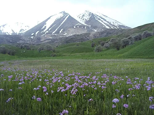 Karasu - Aras Dağları Mountain, Erzurum Province3.2 km SE
-
Palandöken Dağları Mountain, Erzurum Province8.4 km S
-
Erzurum Kalesi Historic site, Yakutiye5.8 km N
-
Karagöl Dağları Mountain, Erzurum Province17 km S
-
Top Tepe Mountain, Tekman İlçesi12 km S
-
Molla Tepesi Mountain, Tekman İlçesi12 km SE
Sources & licences
Data last updated: