Erzurum Kalesi
Located in Yakutiye, Erzurum Province Coordinates: 39°54′29″ N 41°16′47″ E
- Local time
- UTC+03:00
- Europe/Istanbul · UTC+03:00
- Elevation
- 1,921 m
- above sea level
- Airports
- ERZ Erzurum International Airport11 km
- BGG Bingöl Airport130 km
About Erzurum Kalesi
Erzurum Kalesi is a historic site. Location: Yakutiye, Erzurum Province. The best months to visit are June–September. The nearest airport is Erzurum International Airport (11 km). Nearby sights include Sultanseki Tepesi and Akyıldırım Dağı.
Climate of Erzurum Kalesi
Best months for sightseeingBest months for sightseeing: June–September.
This month · November
A cold month
Day 5° · Night -5° · Rain 42 mm
Better nearby cities in November
- Cizre · 297 km south20°
- Kızıltepe · 309 km south19°
- Silopi · 314 km south20°
- Hottest month
- August (day 27°)
- Coldest month
- January (night -14°)
- Wettest month
- May (74 mm)
- Driest month
- August (18 mm)
Bars: average monthly low and high temperature. Below: precipitation. Monthly averages for 1970–2000 at about 18 km resolution, adjusted for elevation. Highlighted months are mild and relatively dry. Source: WorldClim 2.1 (CC BY 4.0).
Show values as a table
| Month | Jan | Feb | Mar | Apr | May | Jun | Jul | Aug | Sep | Oct | Nov | Dec |
|---|---|---|---|---|---|---|---|---|---|---|---|---|
| Average high (°C) | -5° | -3° | 1° | 10° | 16° | 21° | 26° | 27° | 22° | 14° | 5° | -2° |
| Average low (°C) | -14° | -13° | -7° | -1° | 4° | 7° | 11° | 10° | 6° | 1° | -5° | -10° |
| Precipitation (mm) | 30 | 33 | 41 | 64 | 74 | 47 | 24 | 18 | 23 | 50 | 42 | 32 |
Other places to visit in this season: June July August September
How to get to Erzurum Kalesi
The nearest airport is Erzurum International Airport (ERZ), 11 km to the northwest as the crow flies. The nearest large city is Erzurum, 1 km to the west.
Airports
- Erzurum International Airport (ERZ) Erzurum 11 kmnorthwest
- Bingöl Airport (BGG) Bingöl 130 kmsouthwest
- Muş Airport (MSR) Muş 133 kmsouth
Nearby large cities
- Erzurum Population: 767.8K 1 kmwest
- Bingoel Population: 128.9K 132 kmsouthwest
- Rize Population: 119.8K 139 kmnorthwest
- Ağrı Population: 124.5K 152 kmeast
- Erzincan Population: 150.7K 154 kmwest
Straight-line distances; road distances are longer. Airport data: OurAirports.
Day trips from Erzurum Kalesi
Within 100 km: 9 historic and cultural sites, 934 natural sites, 467 lakes, rivers and coasts.
0–25 km51 places
- Yıldırım Dağı Mountain 22 kmS
- Karakaya Tepesi Mountain 17 kmS
- Yayla Tepesi Mountain 16 kmN
- Oluklu Dağ Mountain 17 kmNE
25–60 km847 places
- Taşlı Göl Lake 50 kmSW
- Büyük Göl Lake 50 kmSW
- Medek Gölleri Lake 52 kmSW
- Dipsiz Gölü Lake 49 kmSW
60–100 km512 places
- Seki Gölü Lake 77 kmS
- Lake Akdoğan Lake 94 kmSE
- Tortum Gölü Lake 86 kmN
- Bahri Gölü Lake 68 kmS
Straight-line distances.
Nearby attractions & nature
Everything nearby-
Sultanseki Tepesi Mountain, Palandöken6.4 km S
-
Akyıldırım Dağı Mountain, Palandöken7.6 km E
-
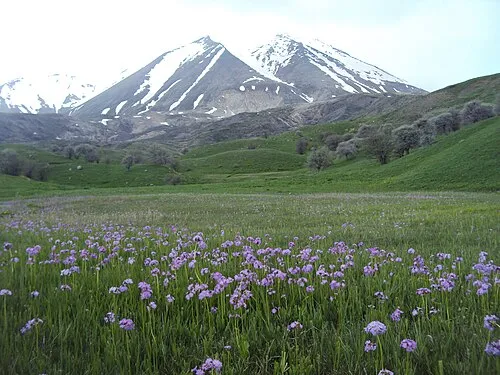 Karasu - Aras Dağları Mountain, Erzurum Province8.5 km S
-
Büyükejder Tepesi Mountain, Palandöken8.5 km S
-
Yıldırım Dağı Mountain, Palandöken8.9 km S
-
Eğerli Dağı Mountain, Palandöken9.4 km S
-
Eğerlidağ Tepesi Mountain, Palandöken9.5 km S
-
Erzurum longwave broadcasting mast Landmark, Aziziye18 km NW
Nearest towns and villages
-
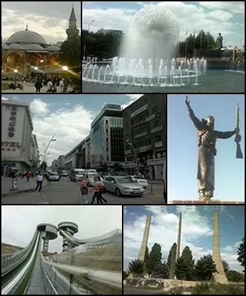 Erzurum City, Erzurum Province0.2 km W
-
Kazımkarabekir City, Yakutiye0.9 km N
-
Kazımkarabekir Bucağı Municipality, Erzurum Province0.9 km N
-
Yakutiye City, Palandöken1.4 km SW
Sources & licences
Data last updated: