Saint Sargis Church
Located in Digor İlçesi, Kars Province Coordinates: 40°22′51″ N 43°22′36″ E
- Local time
- UTC+03:00
- Europe/Istanbul · UTC+03:00
- Elevation
- 1,808 m
- above sea level
- Airports
- KSY Kars Airport30 km
- LWN Shirak International Airport58 km
About Saint Sargis Church
Saint Sargis Church is a historic site. Location: Digor İlçesi, Kars Province. The best months to visit are June–September. The nearest airport is Kars Airport (30 km). Nearby sights include Khtskonk monastery and Saint John the Baptist Church.
Climate of Saint Sargis Church
Best months for sightseeingBest months for sightseeing: June–September.
This month · November
A cold month
Day 7° · Night -3° · Rain 31 mm
Better nearby cities in November
- Cizre · 355 km south20°
- Silopi · 358 km south20°
- Hottest month
- August (day 27°)
- Coldest month
- January (night -13°)
- Wettest month
- May (84 mm)
- Driest month
- January (21 mm)
Bars: average monthly low and high temperature. Below: precipitation. Monthly averages for 1970–2000 at about 18 km resolution, adjusted for elevation. Highlighted months are mild and relatively dry. Source: WorldClim 2.1 (CC BY 4.0).
Show values as a table
| Month | Jan | Feb | Mar | Apr | May | Jun | Jul | Aug | Sep | Oct | Nov | Dec |
|---|---|---|---|---|---|---|---|---|---|---|---|---|
| Average high (°C) | -3° | -2° | 3° | 11° | 16° | 21° | 26° | 27° | 23° | 15° | 7° | 0° |
| Average low (°C) | -13° | -12° | -7° | 0° | 4° | 7° | 11° | 11° | 7° | 1° | -3° | -9° |
| Precipitation (mm) | 21 | 27 | 29 | 52 | 84 | 68 | 42 | 34 | 28 | 41 | 31 | 25 |
Other places to visit in this season: June July August September
How to get to Saint Sargis Church
The nearest airport is Kars Airport (KSY), 30 km to the northwest as the crow flies. For international flights: Shirak International Airport (LWN) (58 km). The nearest large city is Iğdır, 76 km to the southeast.
Airports
- Kars Airport (KSY) Kars 30 kmnorthwest
- Shirak International Airport (LWN) Gyumri 58 kmnortheast
- Iğdır Airport (IGD) Iğdır 62 kmsoutheast
Nearby large cities
- Iğdır Population: 101.7K 76 kmsoutheast
- Ağrı Population: 124.5K 79 kmsouth
- Erzurum Population: 767.8K 186 kmwest
- Van Population: 525K 209 kmsouth
- Rize Population: 119.8K 252 kmwest
Straight-line distances; road distances are longer. Airport data: OurAirports.
Day trips from Saint Sargis Church
Within 100 km: 59 historic and cultural sites, 232 natural sites, 240 lakes, rivers and coasts.
0–25 km64 places
- Ani Historic site 22 kmNE
- Gelört Gölü Lake 22 kmNW
- Çalı Gölü Lake 19 kmNW
- Yayla Dağı Mountain 25 kmNW
25–60 km178 places
- Turna Gölü Lake 28 kmW
- Papak Gölü Lake 52 kmSW
- Mustafa Gölü Lake 33 kmN
- Mişk Gölü Lake 32 kmN
60–100 km289 places
- Ufak Adası Island 91 kmN
- Kaçak Adası Island 91 kmN
- Büyük Ada Island 78 kmN
- Rus Adası Island 77 kmN
Straight-line distances.
Nearby attractions & nature
Everything nearby-
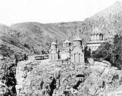 Khtskonk monastery Historic site, Digor İlçesi0.1 km E
-
Saint John the Baptist Church Historic site, Digor İlçesi<0.1 km S
-
Holy Mother of God Church Historic site, Digor İlçesi<0.1 km S
-
Saint Stephen the Protomartyr Church Historic site, Digor İlçesi<0.1 km E
-
Saint Gregory the Illuminator Church Historic site, Digor İlçesi0.2 km E
-
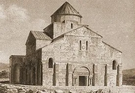 Tekor Cathedral Historic site, Digor İlçesi3.4 km E
-
Kabaktepe Dağı Mountain, Digor İlçesi6.2 km NE
-
Koturdağı Tepesi Mountain, Digor İlçesi8.1 km W
Nearest towns and villages
More sights in Digor İlçesi
-
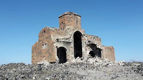 Cathedral of Mren Historic site, Digor İlçesi29 km SE
-
Ketan Historic site, Digor İlçesi22 km E
-
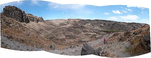 Bagaran Historic site, Digor İlçesi30 km SE
-
Saint Gevorg Church Historic site, Digor İlçesi30 km SE
Sources & licences
Data last updated: