- Population
- 146,521
- 146.5K
- Elevation
- 121 m
- above sea level
- Local time
- UTC+00:00
- Europe/London · UTC+00:00
- Airports
- MAN Manchester Airport47 km
- LPL Liverpool John Lennon Airport52 km
About Blackburn
Blackburn is a city. Location: Blackburn with Darwen, England. Population: 146,521. Elevation: 121 m.
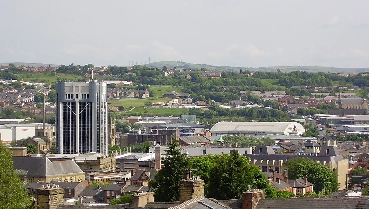
Blackburn ( ) is an industrial town and the administrative centre of the Blackburn with Darwen borough, in Lancashire, England. The town lies north of the West Pennine Moors on the southern edge of the Ribble Valley, 8 miles (13 km) east of Preston and 21 miles (34 km) north-north-west of Manchester. Blackburn is at the centre of the wider unitary authority area along with the town of Darwen. It is the second-largest town in Lancashire, after Blackpool.
Source: Wikipedia · CC BY-SA 4.0
Photos of Blackburn
-

Ian Greig · CC BY-SA 2.0 -

Ian Greig · CC BY-SA 2.0 -

Robert Wade · CC BY-SA 2.0 -

Robert Wade · CC BY-SA 2.0 -

Robert Wade · CC BY-SA 2.0


Travel notes for Blackburn
From Wikivoyage
Blackburn (population 155,000 in 2021, with Darwen) is a large town in Lancashire in North West England.
The town has some attractive public buildings and parks, but it is mostly known for its contribution to the cotton weaving industry and for its successful premiership football team, Blackburn Rovers. Due to the town's association with cotton, it was a natural choice for early immigrants from cotton producing countries, such as Pakistan and India, to settle. Consequently, Blackburn is a great place to sample South Asian cuisine. After years of industrial decline, the town is undergoing a 'quiet' renaissance with fast rising property prices.
Understand+
The name Blackburn is derived from the river Blakewater, which runs through the centre of town. Famous visitors to Blackburn include Condoleezza Rice, HM Queen Elizabeth II, and Mahatma Gandhi.
Visit Blackburn tourist information
Get in+
By train:
1 Blackburn station
By plane:
Blackburn is served by Manchester Airport and Liverpool John Lennon airport, each of which is approximately 1½ hr away.
Source: Wikivoyage · CC BY-SA 4.0 · abridged
Climate of Blackburn
Best months for sightseeingBest months for sightseeing: June–August.
This month · November
A wet month
Day 9° · Night 4° · Rain 143 mm
- Hottest month
- July (day 19°)
- Coldest month
- January (night 1°)
- Wettest month
- November (143 mm)
- Driest month
- May (71 mm)
Bars: average monthly low and high temperature. Below: precipitation. Monthly averages for 1970–2000 at about 18 km resolution, adjusted for elevation. Highlighted months are mild and relatively dry. Source: WorldClim 2.1 (CC BY 4.0).
Show values as a table
| Month | Jan | Feb | Mar | Apr | May | Jun | Jul | Aug | Sep | Oct | Nov | Dec |
|---|---|---|---|---|---|---|---|---|---|---|---|---|
| Average high (°C) | 6° | 6° | 9° | 11° | 15° | 17° | 19° | 19° | 16° | 13° | 9° | 7° |
| Average low (°C) | 1° | 1° | 2° | 4° | 7° | 9° | 12° | 11° | 9° | 7° | 4° | 2° |
| Precipitation (mm) | 131 | 83 | 107 | 75 | 71 | 86 | 87 | 109 | 113 | 138 | 143 | 141 |
How to get to Blackburn
The nearest airport is Manchester Airport (MAN), 47 km to the south as the crow flies. The nearest large city is Preston, 15 km to the west.
Airports
- Manchester Airport (MAN) Manchester, Greater Manchester 47 kmsouth
- Liverpool John Lennon Airport (LPL) Liverpool 52 kmsouthwest
- Leeds Bradford Airport (LBA) Leeds, West Yorkshire 56 kmeast
Nearby large cities
- Preston Population: 313.3K 15 kmwest
- Burnley Population: 149.4K 17 kmeast
- Bolton Population: 141.3K 19 kmsouth
- Wigan Population: 175.4K 25 kmsouthwest
- Salford Population: 129.8K 32 kmsoutheast
Straight-line distances; road distances are longer. Airport data: OurAirports.
Day trips from Blackburn
Within 100 km: 656 historic and cultural sites, 1,770 natural sites, 248 lakes, rivers and coasts.
0–25 km163 places
- The Island Island 11 kmS
- Pickup Bank Reservoir Lake 7 kmSE
- Anglezarke Reservoir Lake 10 kmSW
- Winter Hill (boundary) Mountain 14 kmS
25–60 km654 places
- Great Britain Island 42 kmNE
- Formby Beach Beach 45 kmSW
- Ainsdale Beach Beach 41 kmW
- St Anne's Beach Beach 36 kmW
60–100 km1,857 places
- High Moor Mountain 67 kmNW
- Thurstaston Beach Beach 63 kmSW
- Roanhead Beach Beach 68 kmNW
- The Island Island 77 kmNE
Straight-line distances.
Blackburn and similar cities
Side by side with cities of similar size in the same country: population, elevation and climate.
| Measure | Blackburn | Cambridge | Blackpool | Basildon |
|---|---|---|---|---|
| Population | 146.5K | 145.7K | 145K | 144.9K |
| Elevation | 121 m | 12 m | 21 m | 31 m |
| Summer day (hottest month) | 19° | 22° | 19° | 22° |
| Winter night (coldest month) | 1° | 1° | 2° | 1° |
| Annual rainfall | 1,284 mm | 551 mm | 961 mm | 587 mm |
| Best months | Jun–Aug | Jun–Aug | Jun–Sep | Jun–Aug |
| Distance | — | 245 km | 38 km | 314 km |
Climate values are 1970–2000 monthly averages; straight-line distance.
Nearby attractions & nature
Everything nearby-
Revidge Mountain, Blackburn with Darwen1.3 km NW
-
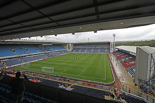 Ewood Park Landmark, Blackburn with Darwen2.4 km S
-
Billinge Hill Mountain, Blackburn with Darwen2.5 km W
-
Bog Bank Mountain, Blackburn with Darwen3.9 km S
-
Height House Hill Mountain, Hyndburn District3.8 km NE
-
Mellor Moor Mountain, Mellor3.9 km NW
-
Stanley Hill Mountain, Mellor4.2 km NW
-
Wilpshire Moor Mountain, Wilpshire4.7 km NE
Sources & licences
Data last updated: · 2 independent sources