Bournemouth, Christchurch and Poole
Located in England, United Kingdom Coordinates: 50°43′53″ N 1°54′25″ W
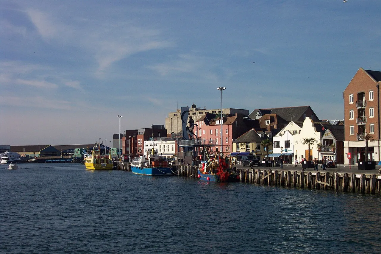
- Population
- 395,784
- 395.8K
- Elevation
- 30 m
- above sea level
- Local time
- UTC+00:00
- Europe/London · UTC+00:00
- Places inside
- 45
- listed under Bournemouth, Christchurch and Poole
- Airports
- BOH Bournemouth Airport7 km
- SOU Southampton Airport46 km
About Bournemouth, Christchurch and Poole
Bournemouth, Christchurch and Poole is a district. Location: England, United Kingdom. Population: 395,784. The best months to visit are June–August. The nearest airport is Bournemouth Airport (7 km). Nearby sights include Meyrick Park and Dean Park Cricket Ground.
Photos of Bournemouth, Christchurch and Poole
-
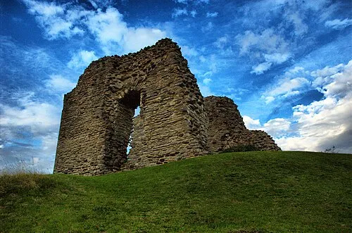
Christchurch Castle Ulli1105 · CC BY 3.0 -
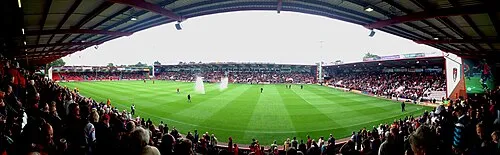
Dean Court Matthew Jackson · CC BY-SA 3.0


Climate of Bournemouth, Christchurch and Poole
Best months for sightseeingBest months for sightseeing: June–August.
This month · November
A cold month
Day 11° · Night 4° · Rain 89 mm
- Hottest month
- July (day 22°)
- Coldest month
- February (night 2°)
- Wettest month
- December (98 mm)
- Driest month
- July (39 mm)
Bars: average monthly low and high temperature. Below: precipitation. Monthly averages for 1970–2000 at about 18 km resolution, adjusted for elevation. Highlighted months are mild and relatively dry. Source: WorldClim 2.1 (CC BY 4.0).
Show values as a table
| Month | Jan | Feb | Mar | Apr | May | Jun | Jul | Aug | Sep | Oct | Nov | Dec |
|---|---|---|---|---|---|---|---|---|---|---|---|---|
| Average high (°C) | 8° | 8° | 10° | 13° | 16° | 19° | 22° | 22° | 19° | 15° | 11° | 9° |
| Average low (°C) | 2° | 2° | 3° | 4° | 7° | 10° | 12° | 12° | 10° | 7° | 4° | 3° |
| Precipitation (mm) | 90 | 64 | 64 | 51 | 49 | 54 | 39 | 53 | 70 | 84 | 89 | 98 |
How to get to Bournemouth, Christchurch and Poole
The nearest airport is Bournemouth Airport (BOH), 7 km to the northeast as the crow flies. For international flights: Bristol Airport (BRS) (92 km). The nearest large city is Bournemouth, 2 km to the southeast.
Airports
- Bournemouth Airport (BOH) Bournemouth 7 kmnortheast
- Southampton Airport (SOU) Southampton 46 kmnortheast
- Bristol Airport (BRS) Bristol 92 kmnorthwest
Nearby large cities
- Bournemouth Population: 163.6K 2 kmsoutheast
- Poole Population: 151.5K 6 kmwest
- Southampton Population: 269.8K 40 kmnortheast
- Portsmouth Population: 208.1K 58 kmeast
- Bath Population: 101.6K 78 kmnorthwest
Straight-line distances; road distances are longer. Airport data: OurAirports.
Day trips from Bournemouth, Christchurch and Poole
Within 100 km: 289 historic and cultural sites, 648 natural sites, 102 lakes, rivers and coasts.
0–25 km101 places
- Brownsea Island Island 6 kmSW
- Avon Beach Beach 12 kmE
- Studland Beach Beach 8 kmS
- Round Island Island 9 kmSW
25–60 km384 places
- Portsea Island Natural site 60 kmE
- Isle of Wight Island 44 kmE
- Chesil Beach Beach 48 kmW
- Calshot Beach Beach 43 kmE
60–100 km554 places
- Charmouth Beach Beach 70 kmW
- Climping Beach Beach 94 kmE
- Pagham Beach Beach 83 kmE
- Thorney Island Island 70 kmE
Straight-line distances.
Places in Bournemouth, Christchurch and Poole
45 places
Poole
Population: 151.5K
Christchurch District
Population: 49.5K

Boscombe
Population: 20.7K
Southbourne
Population: 19K
Wimborne Minster
Population: 15.6K

Canford Heath
Population: 14.4K
- 7 Branksome 13.6K
- 8 Hamworthy 13.1K
- 9 Wallisdown 10.3K
- 10 Broadstone 10.3K
- 11 Kinson 10.2K
- 12 Parkstone 9.6K
- 13 Canford Cliffs 8.6K
- 14 Oakley 2.4K
Bar: population relative to the most populous place in this list.
Cities & villages19
- Ashley Cross · Village
- Bearwood · Village
- Canford Magna · Village
- Charminster · Neighbourhood
- Hillbourne · Neighbourhood
- Holdenhurst · Neighbourhood
- Iford · Neighbourhood
- Lower Hamworthy · Neighbourhood
- Merley · Village
- Moordown · Village
- Northbourne · Neighbourhood
- Nuffield Industrial Estate · Neighbourhood
- Oakdale · Neighbourhood
- Stanley Green · Neighbourhood
- Tuckton · Neighbourhood
- Waterloo · Neighbourhood
- Westbourne · Neighbourhood
- Wick · Village
- Winton · Neighbourhood
Mountains & nature8
- Christchurch Rverlands Car Park · Natural site
- Corfe Hills · Mountain
- Hengistbury Head · Natural site
- Pocket Park · Natural site
- Poole Bay · Natural site
- Sandbanks Peninsula · Natural site
- Seafield Gardens · Natural site
- Warren Hill · Mountain
Lakes, rivers & coasts1
- Upton Lake · Lake
Heritage & sights3
- Bournemouth International Centre · Attraction
- Fern Berrow Mediumwave Transmitter, Mast East · Landmark
- Fern Berrow Mediumwave Transmitter, Mast West · Landmark
Nature and heritage in Bournemouth, Christchurch and Poole
Nearby attractions & nature
Everything nearby-
Meyrick Park Natural site, England1.6 km E
-
Dean Park Cricket Ground Natural site, England2.6 km E
-
Fernheath Playing Fields Natural site, England2.7 km N
-
Queens Park Natural site, England4.4 km E
-
Kings Park Natural site, England5.2 km E
-
Shelley Park Natural site, England5.3 km E
Sources & licences
Data last updated: