Broadstone
Located in Bournemouth, Christchurch and Poole, England Coordinates: 50°45′26″ N 1°59′39″ W
- Population
- 10,289
- 10.3K
- Elevation
- 47 m
- above sea level
- Local time
- UTC+00:00
- Europe/London · UTC+00:00
- Airports
- BOH Bournemouth Airport11 km
- SOU Southampton Airport50 km
About Broadstone
Broadstone is a town. Location: Bournemouth, Christchurch and Poole, England. Population: 10,289. Elevation: 47 m.
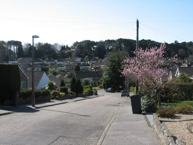
Broadstone is a town and civil parish and electoral ward of the Bournemouth, Christchurch and Poole district, in the ceremonial county of Dorset, England. It is located three miles (five kilometres) from Hamworthy railway station and seven miles (eleven kilometres) from Bournemouth Airport. The ward had a population of 10,289 at the 2021 census. Since 1840, Broadstone has grown from a small farm to a suburb of 10,000 people.
Source: Wikipedia · CC BY-SA 4.0
Photos of Broadstone
-

Peter Kazmierczak · CC BY-SA 2.0 -

David Tarrant · CC BY-SA 2.0 -

Ian Kirk from Broadstone, Dorset, UK · CC BY 2.0


Climate of Broadstone
Best months for sightseeingBest months for sightseeing: June–August.
This month · November
A cold month
Day 11° · Night 4° · Rain 89 mm
- Hottest month
- July (day 22°)
- Coldest month
- February (night 2°)
- Wettest month
- December (98 mm)
- Driest month
- July (39 mm)
Bars: average monthly low and high temperature. Below: precipitation. Monthly averages for 1970–2000 at about 18 km resolution, adjusted for elevation. Highlighted months are mild and relatively dry. Source: WorldClim 2.1 (CC BY 4.0).
Show values as a table
| Month | Jan | Feb | Mar | Apr | May | Jun | Jul | Aug | Sep | Oct | Nov | Dec |
|---|---|---|---|---|---|---|---|---|---|---|---|---|
| Average high (°C) | 8° | 8° | 10° | 13° | 16° | 19° | 22° | 22° | 19° | 15° | 11° | 9° |
| Average low (°C) | 2° | 2° | 3° | 4° | 7° | 10° | 12° | 12° | 10° | 7° | 4° | 3° |
| Precipitation (mm) | 90 | 64 | 64 | 51 | 49 | 54 | 39 | 53 | 70 | 84 | 89 | 98 |
How to get to Broadstone
The nearest airport is Bournemouth Airport (BOH), 11 km to the east as the crow flies. For international flights: Bristol Airport (BRS) (86 km). The nearest large city is Poole, 5 km to the south.
Airports
- Bournemouth Airport (BOH) Bournemouth 11 kmeast
- Southampton Airport (SOU) Southampton 50 kmnortheast
- Bristol Airport (BRS) Bristol 86 kmnorthwest
Nearby large cities
- Poole Population: 151.5K 5 kmsouth
- Bournemouth Population: 163.6K 9 kmsoutheast
- Southampton Population: 269.8K 45 kmeast
- Portsmouth Population: 208.1K 64 kmeast
- Bath Population: 101.6K 73 kmnorth
Straight-line distances; road distances are longer. Airport data: OurAirports.
Day trips from Broadstone
Within 100 km: 295 historic and cultural sites, 685 natural sites, 107 lakes, rivers and coasts.
0–25 km114 places
- Brownsea Island Island 7 kmS
- Avon Beach Beach 19 kmE
- Studland Beach Beach 11 kmS
- Man O'War Beach Beach 25 kmSW
25–60 km364 places
- Isle of Wight Island 51 kmE
- Chesil Beach Beach 43 kmW
- Calshot Beach Beach 49 kmE
- Ventnor Beach Beach 58 kmE
60–100 km609 places
- Portsea Island Natural site 66 kmE
- Charmouth Beach Beach 64 kmW
- Kilve Beach Beach 99 kmNW
- Pagham Beach Beach 89 kmE
Straight-line distances.
Nearby attractions & nature
Everything nearby-
Pocket Park Natural site, Bournemouth, Christchurch and Poole0.4 km SE
-
Corfe Hills Mountain, Bournemouth, Christchurch and Poole1.5 km NW
-
Upton Heath Mountain, Corfe Mullen2.2 km W
-
Holes Bay Natural site, England3.1 km S
-
Upton Lake Lake, Bournemouth, Christchurch and Poole4 km S
-
Wimborne Mound Historic site, Wimborne Minster4.2 km N
-
Brownsea Island Island, Dorset7.5 km S
-
Otter Island Island, Lytchett Minster and Upton5.1 km SW
Other cities and towns in Bournemouth, Christchurch and Poole
-
Parkstone Town, Bournemouth, Christchurch and Poole4.6 km SE
-
Christchurch District Municipality, Bournemouth, Christchurch and Poole15 km E
-
 Christchurch Town, Christchurch District15 km E
-
Bournemouth City, Christchurch District9.1 km SE
Sources & licences
Data last updated: · 2 independent sources