
- Elevation
- 53 m
- above sea level
- Local time
- UTC+00:00
- Europe/London · UTC+00:00
- Airports
- LGW London Gatwick Airport34 km
- LHR London Heathrow Airport74 km
About Bevendean
Bevendean is a village. Location: Brighton and Hove, England. Elevation: 53 m.
Bevendean is a district of the city of Brighton and Hove, in East Sussex, England. The estate lies to the north-east of central Brighton, and was largely developed after World War II with a mixture of council housing and private development. A large proportion of the properties are council houses. The area has limited local facilities and there is only one road access route into and out of the area. The manor of Bevendean was recorded in the Domesday Book of 1086. The name is derived from 'Beofa's valley'.
Source: Wikipedia · CC BY-SA 4.0
Photos of Bevendean
-
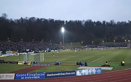
Withdean Stadium Wikimedia Commons · CC BY 2.0

Climate of Bevendean
Best months for sightseeingBest months for sightseeing: June–August.
This month · November
A cold month
Day 11° · Night 4° · Rain 90 mm
- Hottest month
- July (day 21°)
- Coldest month
- February (night 1°)
- Wettest month
- December (95 mm)
- Driest month
- July (42 mm)
Bars: average monthly low and high temperature. Below: precipitation. Monthly averages for 1970–2000 at about 18 km resolution, adjusted for elevation. Highlighted months are mild and relatively dry. Source: WorldClim 2.1 (CC BY 4.0).
Show values as a table
| Month | Jan | Feb | Mar | Apr | May | Jun | Jul | Aug | Sep | Oct | Nov | Dec |
|---|---|---|---|---|---|---|---|---|---|---|---|---|
| Average high (°C) | 8° | 8° | 10° | 12° | 16° | 19° | 21° | 21° | 18° | 15° | 11° | 8° |
| Average low (°C) | 2° | 1° | 3° | 4° | 7° | 10° | 12° | 12° | 10° | 7° | 4° | 3° |
| Precipitation (mm) | 91 | 61 | 63 | 50 | 47 | 57 | 42 | 53 | 70 | 85 | 90 | 95 |
How to get to Bevendean
The nearest airport is London Gatwick Airport (LGW), 34 km to the north as the crow flies. The nearest large city is Brighton, 3 km to the southwest.
Airports
- London Gatwick Airport (LGW) London 34 kmnorth
- London Heathrow Airport (LHR) London 74 kmnorth
- London City Airport (LCY) London 74 kmnorth
Nearby large cities
- Brighton Population: 283.9K 3 kmsouthwest
- Worthing Population: 113.9K 19 kmwest
- Eastbourne Population: 101.7K 29 kmeast
- Crawley Population: 124K 30 kmnorth
- Sutton Population: 187.6K 57 kmnorth
Straight-line distances; road distances are longer. Airport data: OurAirports.
Day trips from Bevendean
Within 100 km: 594 historic and cultural sites, 500 natural sites, 243 lakes, rivers and coasts.
0–25 km76 places
- St Nicholas Church Shoreham Attraction 12 kmW
- The Marlipins Museum Museum 12 kmW
- The Island Island 12 kmSE
- Hawk Island Island 19 kmNE
25–60 km321 places
- Hastings Beach Beach 47 kmE
- Climping Beach Beach 33 kmW
- Pagham Beach Beach 45 kmW
- Thorney Island Island 57 kmW
60–100 km940 places
- Portsea Island Natural site 67 kmW
- Isle of Wight Island 85 kmW
- Isle of Sheppey Island 91 kmNE
- White Hart Lane Landmark 85 kmN
Straight-line distances.
Nearby attractions & nature
Everything nearby-
Hollingbury Castle Mountain, Brighton and Hove1.6 km NW
-
Withdean Stadium Landmark, Brighton and Hove3.5 km W
-
AmEx Stadium Landmark, Brighton and Hove2.8 km NE
-
Bullock Hill Mountain, Brighton and Hove3.7 km E
-
Newmarket Hill Mountain, Kingston Near Lewes3.1 km E
-
Castle Hill Mountain, Kingston Near Lewes4.4 km E
Sources & licences
Data last updated: · 2 independent sources