
- Population
- 9,793
- 9.8K
- Elevation
- 128 m
- above sea level
- Local time
- UTC+00:00
- Europe/London · UTC+00:00
- Airports
- LGW London Gatwick Airport36 km
- LCY London City Airport75 km
About Woodingdean
Woodingdean is a village. Location: Brighton and Hove, England. Population: 9,793. Elevation: 128 m.
Woodingdean is an eastern suburb of the city of Brighton and Hove, East Sussex, separated from the main part of the city by downland and the Brighton Racecourse. The name Woodingdean came from Woodendean (i.e. wooded valley) Farm which was situated in the south end of what is now Ovingdean.
Source: Wikipedia · CC BY-SA 4.0
Photos of Woodingdean
-
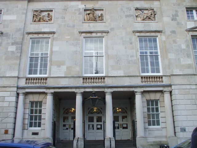
Lewes Crown Court Sussexonian · Public domain -
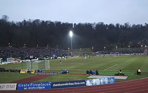
Withdean Stadium Wikimedia Commons · CC BY 2.0


Climate of Woodingdean
Best months for sightseeingBest months for sightseeing: June–August.
This month · November
A cold month
Day 10° · Night 3° · Rain 90 mm
- Hottest month
- July (day 21°)
- Coldest month
- February (night 1°)
- Wettest month
- December (95 mm)
- Driest month
- July (42 mm)
Bars: average monthly low and high temperature. Below: precipitation. Monthly averages for 1970–2000 at about 18 km resolution, adjusted for elevation. Highlighted months are mild and relatively dry. Source: WorldClim 2.1 (CC BY 4.0).
Show values as a table
| Month | Jan | Feb | Mar | Apr | May | Jun | Jul | Aug | Sep | Oct | Nov | Dec |
|---|---|---|---|---|---|---|---|---|---|---|---|---|
| Average high (°C) | 7° | 7° | 10° | 12° | 16° | 18° | 21° | 21° | 18° | 14° | 10° | 8° |
| Average low (°C) | 1° | 1° | 2° | 3° | 6° | 9° | 11° | 11° | 9° | 7° | 3° | 2° |
| Precipitation (mm) | 91 | 61 | 63 | 50 | 47 | 57 | 42 | 53 | 70 | 85 | 90 | 95 |
How to get to Woodingdean
The nearest airport is London Gatwick Airport (LGW), 36 km to the north as the crow flies. The nearest large city is Brighton, 5 km to the west.
Airports
- London Gatwick Airport (LGW) London 36 kmnorth
- London City Airport (LCY) London 75 kmnorth
- London Heathrow Airport (LHR) London 76 kmnorth
Nearby large cities
- Brighton Population: 283.9K 5 kmwest
- Worthing Population: 113.9K 21 kmwest
- Eastbourne Population: 101.7K 26 kmeast
- Crawley Population: 124K 32 kmnorth
- Sutton Population: 187.6K 58 kmnorth
Straight-line distances; road distances are longer. Airport data: OurAirports.
Day trips from Woodingdean
Within 100 km: 589 historic and cultural sites, 493 natural sites, 242 lakes, rivers and coasts.
0–25 km76 places
- St Nicholas Church Shoreham Attraction 15 kmW
- The Marlipins Museum Museum 14 kmW
- The Island Island 10 kmSE
- Hawk Island Island 19 kmN
25–60 km308 places
- Hastings Beach Beach 45 kmE
- Climping Beach Beach 36 kmW
- Pagham Beach Beach 47 kmW
- Thorney Island Island 59 kmW
60–100 km940 places
- Portsea Island Natural site 70 kmW
- Isle of Wight Island 87 kmW
- Isle of Sheppey Island 89 kmNE
- White Hart Lane Landmark 85 kmN
Straight-line distances.
Nearby attractions & nature
Everything nearby-
Bullock Hill Mountain, Brighton and Hove1.2 km E
-
Newmarket Hill Mountain, Kingston Near Lewes1.1 km NE
-
Castle Hill Mountain, Kingston Near Lewes2.4 km NE
-
AmEx Stadium Landmark, Brighton and Hove2.9 km N
-
Hollingbury Castle Mountain, Brighton and Hove4.1 km NW
-
Withdean Stadium Landmark, Brighton and Hove6.2 km W
Sources & licences
Data last updated: · 2 independent sources