- Elevation
- 114 m
- above sea level
- Local time
- UTC+00:00
- Europe/London · UTC+00:00
- Airports
- LTN London Luton Airport49 km
- BHX Birmingham Airport67 km
About Dadford
Dadford is a village. Location: Stowe, Aylesbury Vale. Elevation: 114 m.
Dadford is a hamlet in the parish of Stowe, north Buckinghamshire, England. The hamlet is named Anglo Saxon in origin, meaning, Dodda's Ford in modern English. Although, originally in the parish of Biddlesden, the hamlet was annexed to Stowe in the 17th century to provide extra living accommodation for the servants of the new manor house. The hamlet still exists today, though it remains quite small in size. It has never had a public house but had a shop and post office until the 1980s.
Source: Wikipedia · CC BY-SA 4.0
Climate of Dadford
Best months for sightseeingBest months for sightseeing: June–August.
This month · November
A cold month
Day 10° · Night 4° · Rain 61 mm
- Hottest month
- July (day 22°)
- Coldest month
- February (night 1°)
- Wettest month
- December (63 mm)
- Driest month
- February (43 mm)
Bars: average monthly low and high temperature. Below: precipitation. Monthly averages for 1970–2000 at about 18 km resolution, adjusted for elevation. Highlighted months are mild and relatively dry. Source: WorldClim 2.1 (CC BY 4.0).
Show values as a table
| Month | Jan | Feb | Mar | Apr | May | Jun | Jul | Aug | Sep | Oct | Nov | Dec |
|---|---|---|---|---|---|---|---|---|---|---|---|---|
| Average high (°C) | 7° | 7° | 10° | 12° | 16° | 19° | 22° | 21° | 18° | 14° | 10° | 7° |
| Average low (°C) | 1° | 1° | 2° | 4° | 6° | 9° | 12° | 11° | 9° | 7° | 4° | 2° |
| Precipitation (mm) | 60 | 43 | 53 | 47 | 52 | 56 | 48 | 59 | 59 | 59 | 61 | 63 |
How to get to Dadford
The nearest airport is London Luton Airport (LTN), 49 km to the east as the crow flies. The nearest large city is Milton Keynes, 19 km to the east.
Airports
- London Luton Airport (LTN) Luton, Luton 49 kmeast
- Birmingham Airport (BHX) Birmingham, West Midlands 67 kmnorthwest
- London Heathrow Airport (LHR) London 74 kmsoutheast
Nearby large cities
- Milton Keynes Population: 256.4K 19 kmeast
- Northampton Population: 245.9K 26 kmnortheast
- Oxford Population: 162.1K 36 kmsouthwest
- Bedford Population: 106.9K 40 kmeast
- Luton Population: 225.3K 46 kmsoutheast
Straight-line distances; road distances are longer. Airport data: OurAirports.
Day trips from Dadford
Within 100 km: 924 historic and cultural sites, 626 natural sites, 262 lakes, rivers and coasts.
0–25 km103 places
- China Island Island 22 kmS
- Grotto Island Island 22 kmS
- Monkey Island Island 2 kmSE
- Tongwell Lake Lake 21 kmE
25–60 km433 places
- Andersey Island Island 45 kmS
- Wargrave Island Island 60 kmS
- Rose Isle Island 38 kmS
- Temple Mill Island Island 57 kmS
60–100 km1,276 places
- White Hart Lane Landmark 82 kmSE
- The Lynch Island 61 kmS
- Holm Island Island 75 kmSE
- Sunbury Court Island 83 kmSE
Straight-line distances.
Nearby attractions & nature
Everything nearby-
Monkey Island Island, Stowe1.7 km SE
-
Biddlesden Abbey Historic site, Biddlesden3.8 km NW
-
Buckingham Castle Historic site, Buckingham5.3 km SE
-
Beaumont Castle Historic site, Mixbury7 km SW
-
Lovel Wood Natural site, England5.3 km NE
-
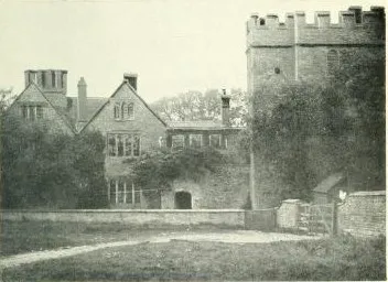 Astwell Castle Historic site, Helmdon8.2 km NW
Sources & licences
Data last updated: · 2 independent sources