Morborne Hill BT Tower
Located in Morborne, Huntingdonshire Coordinates: 52°30′27″ N 0°20′41″ W
- Local time
- UTC+00:00
- Europe/London · UTC+00:00
- Elevation
- 58 m
- above sea level
- Airports
- LTN London Luton Airport70 km
- EMA East Midlands Airport76 km
About Morborne Hill BT Tower
Morborne Hill BT Tower is a landmark. Location: Morborne, Huntingdonshire. The best months to visit are June–August. The nearest airport is London Luton Airport (70 km). Nearby sights include Peterborough Telecommunication Tower and Peterborough Transmitting Station.
Photos of Morborne Hill BT Tower
-
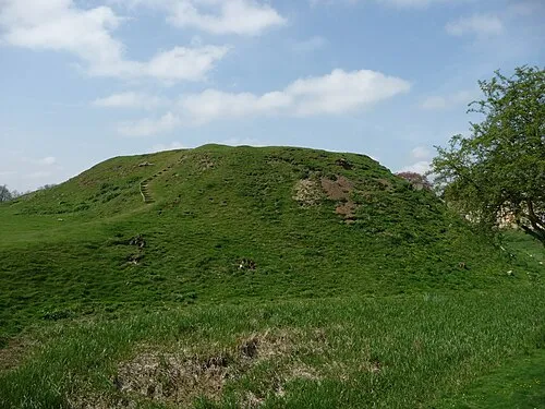
Fotheringhay Castle Iain Simpson · CC BY-SA 2.0

Climate of Morborne Hill BT Tower
Best months for sightseeingBest months for sightseeing: June–August.
This month · November
A cold month
Day 10° · Night 4° · Rain 55 mm
- Hottest month
- July (day 21°)
- Coldest month
- February (night 1°)
- Wettest month
- August (58 mm)
- Driest month
- February (42 mm)
Bars: average monthly low and high temperature. Below: precipitation. Monthly averages for 1970–2000 at about 18 km resolution, adjusted for elevation. Highlighted months are mild and relatively dry. Source: WorldClim 2.1 (CC BY 4.0).
Show values as a table
| Month | Jan | Feb | Mar | Apr | May | Jun | Jul | Aug | Sep | Oct | Nov | Dec |
|---|---|---|---|---|---|---|---|---|---|---|---|---|
| Average high (°C) | 7° | 7° | 10° | 12° | 16° | 19° | 21° | 21° | 18° | 14° | 10° | 7° |
| Average low (°C) | 1° | 1° | 2° | 4° | 6° | 9° | 12° | 12° | 9° | 7° | 4° | 2° |
| Precipitation (mm) | 55 | 42 | 46 | 44 | 48 | 55 | 46 | 58 | 51 | 49 | 55 | 57 |
How to get to Morborne Hill BT Tower
The nearest airport is London Luton Airport (LTN), 70 km to the south as the crow flies. The nearest large city is Peterborough, 10 km to the northeast.
Airports
- London Luton Airport (LTN) Luton, Luton 70 kmsouth
- East Midlands Airport (EMA) Nottingham, Leicestershire 76 kmnorthwest
- London Stansted Airport (STN) London, Essex 80 kmsoutheast
Nearby large cities
- Peterborough Population: 163.4K 10 kmnortheast
- Bedford Population: 106.9K 42 kmsouth
- Cambridge Population: 145.7K 46 kmsoutheast
- Northampton Population: 245.9K 47 kmsouthwest
- Leicester Population: 368.6K 55 kmwest
Straight-line distances; road distances are longer. Airport data: OurAirports.
Day trips from Morborne Hill BT Tower
Within 100 km: 606 historic and cultural sites, 308 natural sites, 128 lakes, rivers and coasts.
0–25 km46 places
- Park Island Island 17 kmN
- The Island Island 24 kmSE
- Prestley Hill Mountain 25 kmW
- Spanhoe Wood Natural site 19 kmW
25–60 km289 places
- Inner Tidal Bank Island 55 kmNE
- Heron Island Island 38 kmSW
- Apple Island Island 42 kmS
- The Islands Island 49 kmW
60–100 km707 places
- Snettisham Beach Beach 67 kmNE
- Scolt Head Island Island 88 kmNE
- Warham Salt Marsh - West Island 99 kmNE
- Lodge Marsh Island 97 kmNE
Straight-line distances.
Nearby attractions & nature
Everything nearby-
Peterborough Telecommunication Tower Landmark, Morborne<0.1 km NW
-
Peterborough Transmitting Station Landmark, Morborne0.1 km E
-
Washingley Hall Farm Historic site, Folksworth and Washingley2.5 km SE
-
Chesterton Mound Historic site, Chesterton3.4 km N
-
Fotheringhay Castle Historic site, Fotheringhay6.5 km W
-
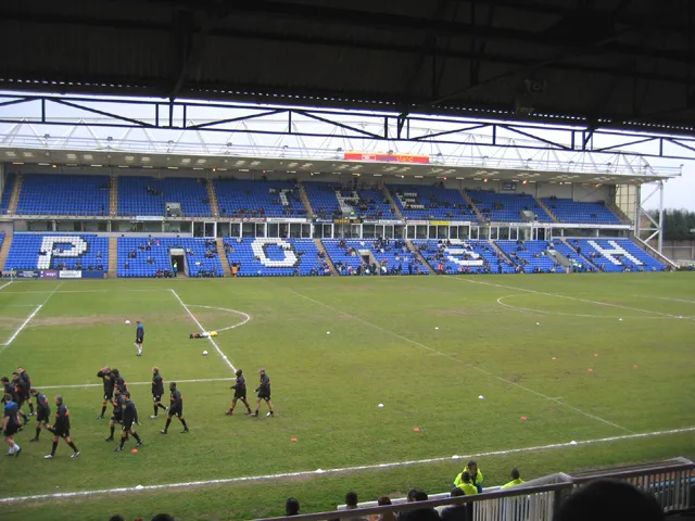 London Road Stadium Landmark, Peterborough9.5 km NE
-
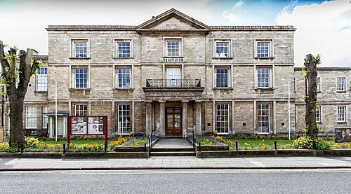 Peterborough Museum and Art Gallery Museum, Peterborough9.8 km NE
-
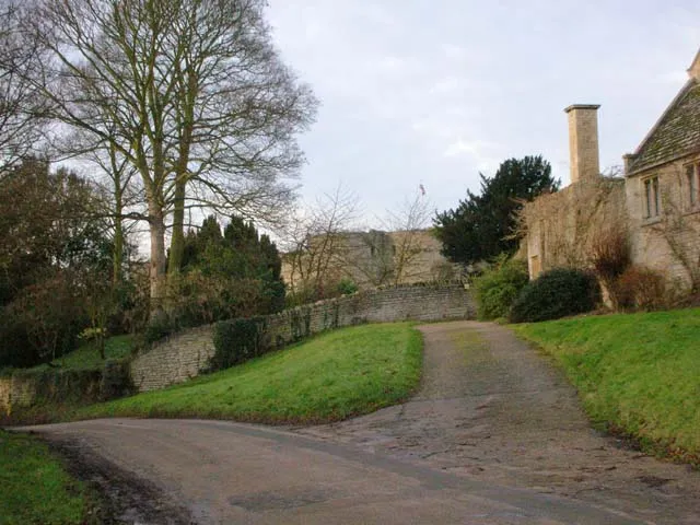 Barnwell Castle Historic site, Barnwell9.7 km SW
Nearest towns and villages
-
Folksworth Village, Folksworth and Washingley2.6 km SE
-
Morborne Village, Morborne1.6 km E
-
Stilton Village, Stilton4.4 km SE
-
Haddon Village, Haddon1.8 km NE
Sources & licences
Data last updated: